Severe Thunderstorm Warning Issued For Parts Of Cullman And Morgan Counties Until 7:15PM
NWS Huntsville has added the “Tornado Possible” tag. Please seek shelter immediately if you are in the path of this storm.

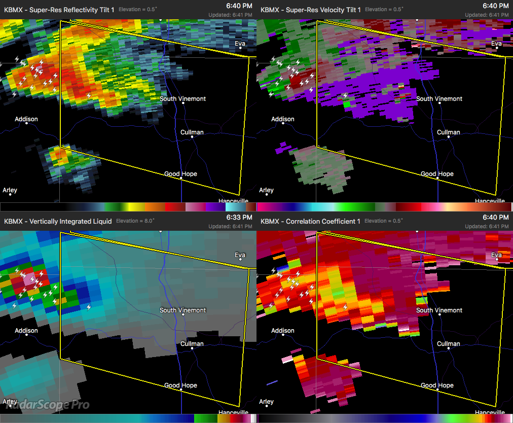
The National Weather Service in Huntsville Alabama has issued a
* Severe Thunderstorm Warning for…
Northwestern Cullman County in north central Alabama…
Southwestern Morgan County in north central Alabama…
* Until 715 PM CDT.
* At 639 PM CDT, a severe thunderstorm was located near Sardis, or 13 miles north of Arley, moving east at 35 mph.
HAZARD…60 to 70 mph wind gusts and quarter size hail.
SOURCE…Radar indicated.
IMPACT…Hail damage to vehicles is expected. Expect wind damage to roofs, siding, and trees.
* Locations impacted include…
Cullman, Good Hope, Baldwin, Vinemont, West Point, Eva, Phelan, Lacon, Logan and Jones Chapel.
Category: ALL POSTS
About the Author (Author Profile)
Subscribe
If you enjoyed this article, subscribe to receive more just like it.


