

Finally, A Quiet Midday Update for Central Alabama, Small Severe Weather Risk for Tennessee Valley Late Tonight
It’s nice to have a quiet weather update to present after a busy week here in the Weather Office.
Don’t get me wrong, I am thankful for summer rains, which totaled over two inches in the past seven days for all but extreme eastern Alabama, but I can do without a rare June EF2 tornado which injured three people.
I am thankful that there are no drought conditions in Alabama as we move into the heart of meteorological summer over the next couple of weeks. The only abnormally dry conditions are over Northeast and Southwest Alabama, including parts of eastern Cullman and Morgan counties, Marshall, Blount, DeKalb, Cherokee, Etowah, northern St. Clair and Calhoun Counties as well as areas north of Mobile.
Showers and storms formed earlier over Northeast Alabama’s higher elevations in an area of deep moisture convergence and maximum instability. The bulk shear where winds strengthen with altitude has now disappeared, so the storms are having trouble holding together.
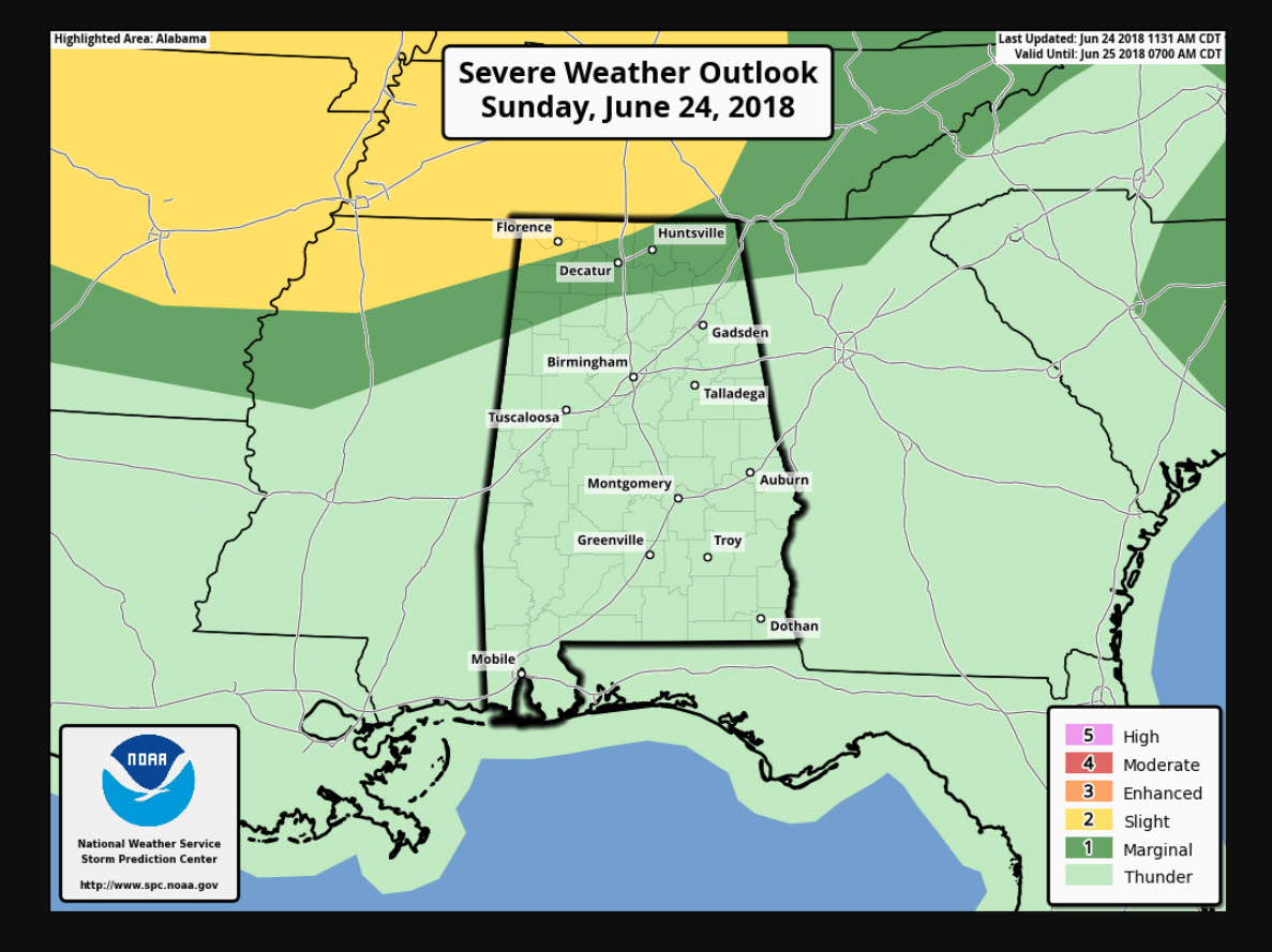
A strong upper-level disturbance is over southern Missouri early this afternoon, producing widespread showers and storms over the Show Me State. As this disturbance travels east tonight, some storms will graze the Tennessee Valley tonight and the SPC has their standard slight risk and a slightly lower risk up for Alabama’s Tennessee Valley counties for late tonight. We will be monitoring these storms.
Skies are partly cloudy across the northern half of Alabama this afternoon, with a nice cumulus field in place. Highs today will warm well into the lower and even middle 90s in spots. Most folks will be between 92-94F. Lows tonight will be between 70-74F.
Rain chances will be going back to the fairly typical summertime setup over the next week as ridging builds over Alabama. The only exceptions will be passing disturbance on Wednesday that will result in showers and storms being a little more common then, and an increase in moisture by Friday into the weekend that will make for greater concentrations of showers and storms.
It will be hot all week, with highs each day between 91-94F. Lows will be between 72-75F.
It looks like our temperatures will stay above normal through much of next week, but rain chances will be in the forecast each day. Could be bad news for fireworks displays, but great news in the drought department.
Category: Alabama's Weather, ALL POSTS
About the Author (Author Profile)
Bill Murray is the President of The Weather Factory. He is the site's official weather historian and a weekend forecaster. He also anchors the site's severe weather coverage. Bill Murray is the proud holder of National Weather Association Digital Seal #0001 @wxhistorianSubscribe
If you enjoyed this article, subscribe to receive more just like it.


