

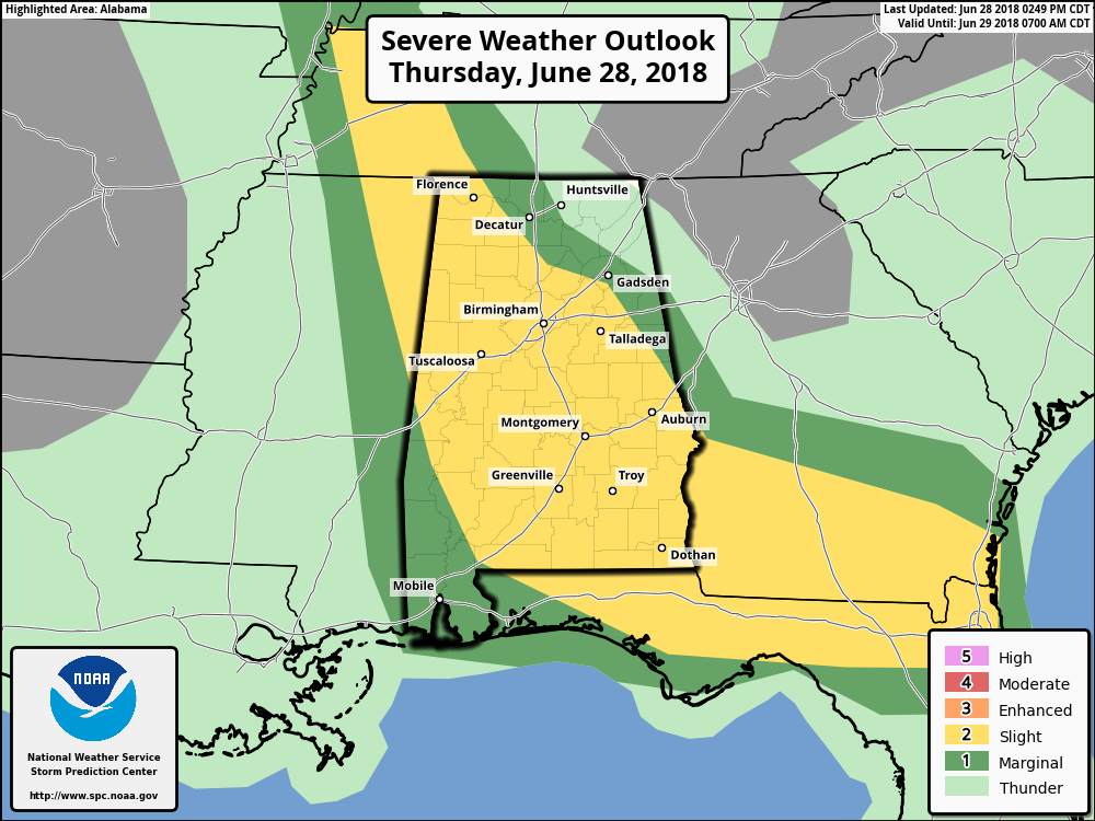
Slight Risk Continues For Most, Threat Over In Northeast AL
The severe thunderstorm threat has ended for the locations that the line of storms have already moved through, especially up in the northeastern corner of the state. With that being said, showers with embedded thunderstorms continue, but this activity is occurring in rain-cooled and more stable air.
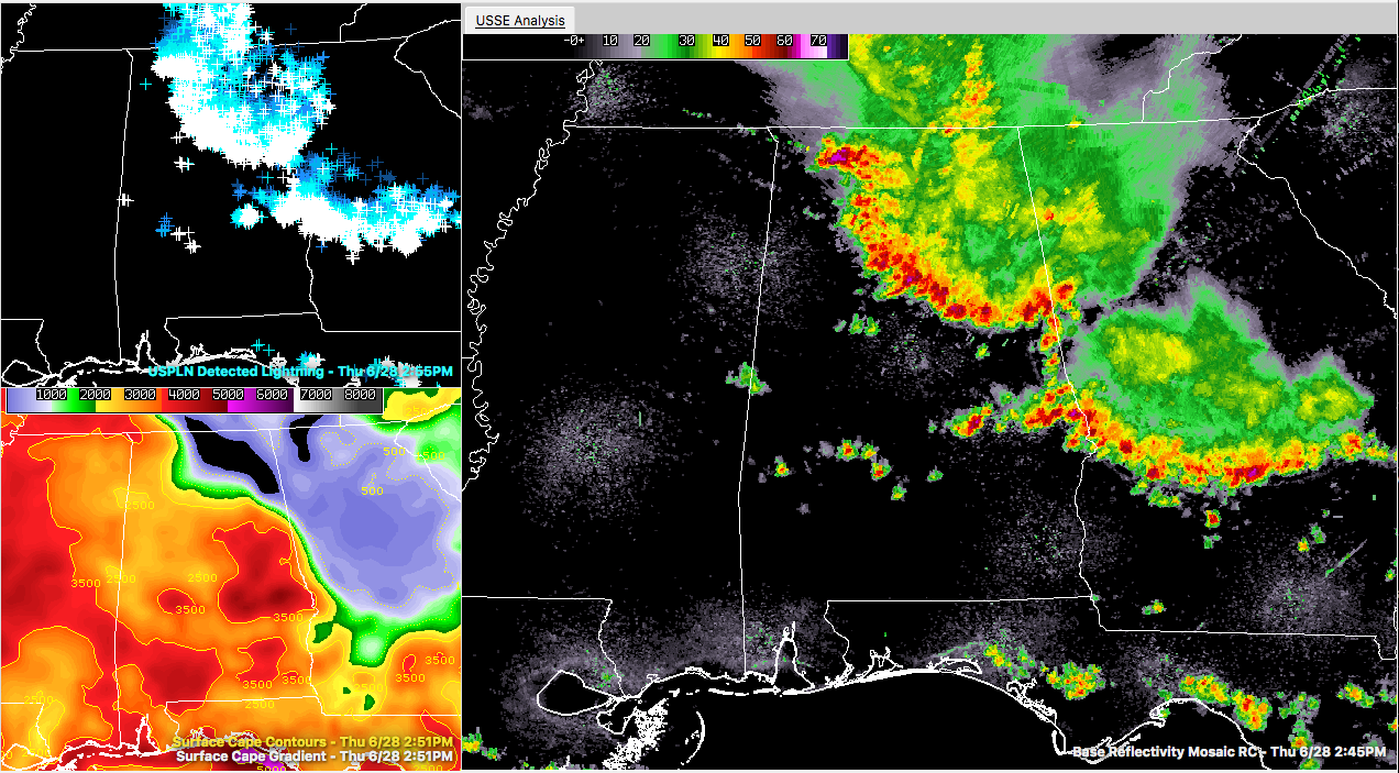
As you can see by the above image, storms are continuing to move southward through parts of North/Central Alabama. The top-left image shows the incredible amount of cloud-to-ground lightning that is occurring every 10 minutes. If this line of storms is approaching your location, get indoors immediately. Lightning can strike more than 10 miles away from the parent storm, so if you can hear thunder, you are at risk to be struck by lightning.
The bottom-left image shows surface instability that is available for these storms to work with. These values (called CAPE) are up in the 2500-4000 J/kg range, meaning that there is plenty of energy available for these storms to continue at their current strength or even strengthen as they move south. That is what we call “untapped air.”
There are so many damage reports coming in at this point, along with the number of warnings and advisories, that I’ll have to wait until later this evening to share those reports with you. Most of the reports are tree and power line damage, but there have been some reports of a few structures being damaged by wind or fallen trees.
The main window for severe storms will continue from now until around 10:00 PM tonight mainly for areas south of a line from Florence to Oneonta to Heflin. The main threat will be damaging winds of 60-70 MPH, with a smaller threat of hail up to 1 inch in diameter. With the entire line, you can expect very heavy rainfall along with dangerous cloud-to-ground lightning.
Stay tuned throughout the day for updates. Any warnings and advisories are immediately published to the blog as they are issued by the NWS.
Category: Alabama's Weather, ALL POSTS
About the Author (Author Profile)
Scott Martin is an operational meteorologist, professional graphic artist, musician, husband, and father. Not only is Scott a member of the National Weather Association, but he is also the Central Alabama Chapter of the NWA president. Scott is also the co-founder of Racecast Weather, which provides forecasts for many racing series across the USA. He also supplies forecasts for the BassMaster Elite Series events including the BassMaster Classic.Subscribe
If you enjoyed this article, subscribe to receive more just like it.


