A Hot and Humid Sunday Afternoon Across Alabama
Showers and storms so far have been concentrated in North Alabama on this July Sunday. But some were starting to show up over Central parts of the state just after noon, most notably in Clay County in East Central Alabama.
Skies are partly cloudy except over the Tennessee Valley where storms have been prominent this morning. Flash flood warnings were in effect for parts of Lawrence, Limestone and Morgan Counties, but have since been canceled.
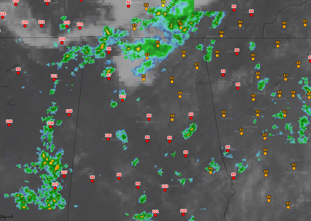
Temperatures are in the 80s and are combining with dewpoints in the middle and upper 70s to produce heat index values between 94-100F. Here are current heat index values:
Heat advisories are in effect for western counties.
Showers and storms will continue to develop through the afternoon. Keep an eye to the sky and to your radar app to spot developing storms.
Storms should be on the increase tomorrow and Tuesday as a frontal system approaches from the northwest. Temperatures will remain hot and humidities will remain high though.
Category: Alabama's Weather, ALL POSTS
About the Author (Author Profile)
Bill Murray is the President of The Weather Factory. He is the site's official weather historian and a weekend forecaster. He also anchors the site's severe weather coverage. Bill Murray is the proud holder of National Weather Association Digital Seal #0001 @wxhistorianSubscribe
If you enjoyed this article, subscribe to receive more just like it.


