

Severe Thunderstorm Watch Issued Until 9:00 AM; Replaces Expired Tornado Watch
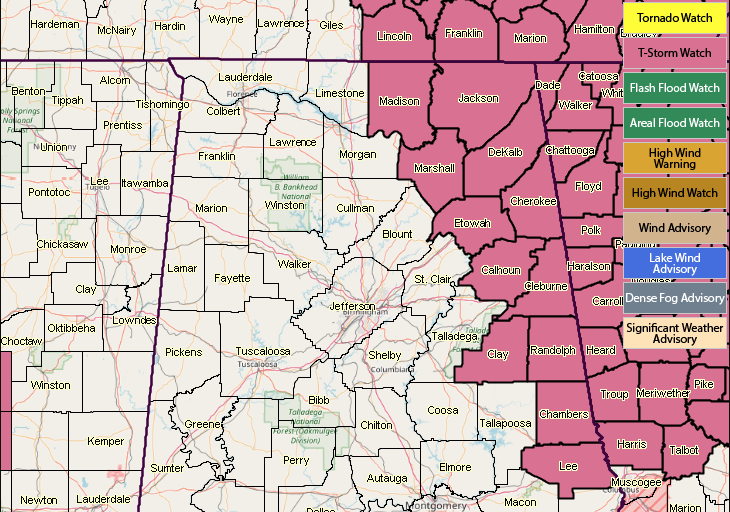
The Storm Prediction Center, in conjunction with NWS Birmingham and NWS Huntsville, has issued a Severe Thunderstorm Watch until 9:00 AM Saturday for these counties in North & Central Alabama: Calhoun, Chambers, Cherokee, Clay, Cleburne, DeKalb, Etowah, Jackson, Lee, Madison, Marshall, and Randolph.
This replaces the Tornado Watch that was issued on Friday evening that expired at 2:00 Saturday.
The main focus from this watch is from a line of storms in Southern Kentucky and Eastern Tennessee, which has the possibility to push southward into Georgia, and brush up against the extreme eastern counties and almost ride down the Alabama/Georgia state line early this morning. Main threat will be damaging winds.
Category: Alabama's Weather, ALL POSTS
About the Author (Author Profile)
Scott Martin is an operational meteorologist, professional graphic artist, musician, husband, and father. Not only is Scott a member of the National Weather Association, but he is also the Central Alabama Chapter of the NWA president. Scott is also the co-founder of Racecast Weather, which provides forecasts for many racing series across the USA. He also supplies forecasts for the BassMaster Elite Series events including the BassMaster Classic.Subscribe
If you enjoyed this article, subscribe to receive more just like it.


