At 2:00 PM: Most Remains Dry, A Few Storms Are Starting To Form
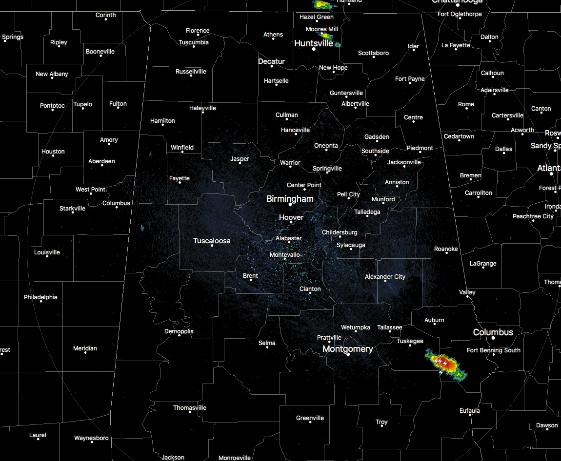
AT 1:45 PM: At this point across North and Central Alabama, most of the area is free from any rain and storms, but we do see a few spots that have fired up over the past few minutes. The strongest storm on the map is down in the southeastern parts of the area over portions of Macon and Russell counties. This storm is moving to the southeast at 25 MPH and will be affecting Hurtsboro, Uchee, Creek Stand, Rutherford, and Hatchechubbe within the next 30 minutes. Wind gusts up to and over 40 MPH will be possible, along with very heavy rain and dangerous cloud-to-ground lightning.
The other rain on the radar is showing up in North Alabama over the Moore’s Mill community in Madison County. At this point, is is a rather small shower with light to moderate rainfall, but we’ll have to watch to see if it pulses up to a stronger storm in the unstable air.
We are still thinking that a few storms will fire up along and east of a boundary that was left over from the morning storms, mainly east of I-65. At this point, the chances of stronger to severe storms will be closest to the Alabama/Georgia state line, with those chances dropping as you move west. Much of the area west of I-65 may only see a few isolated showers or could stay dry.
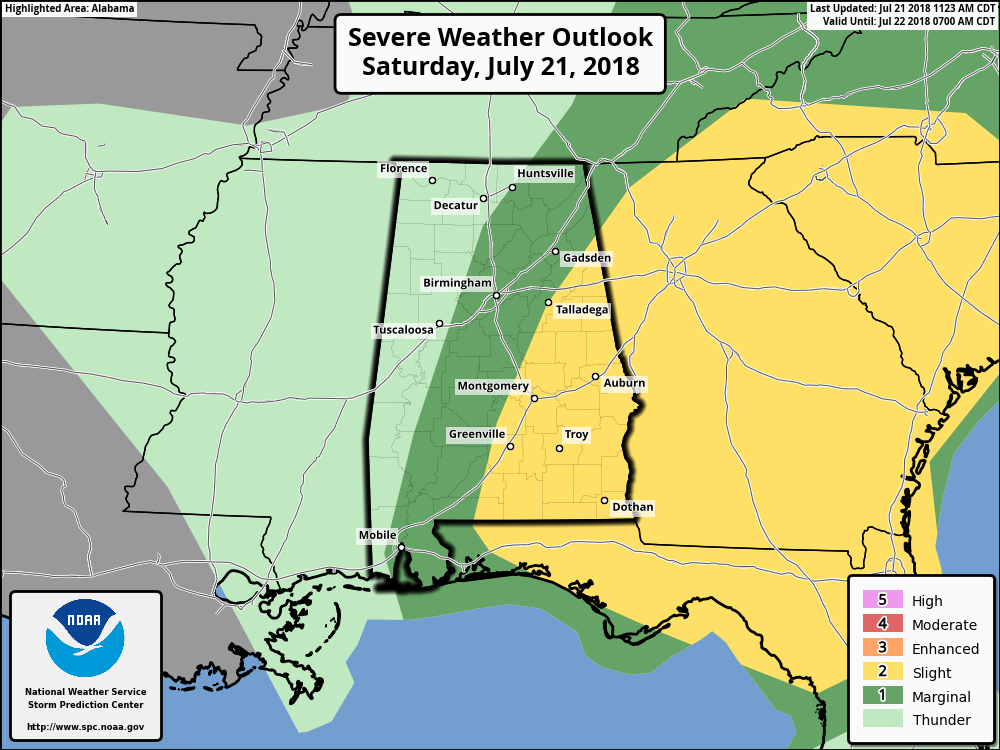
SPC continues to keep much of the eastern half of the state in a Slight Risk for severe storms through the remainder of the day and into tonight, while a good bit of the central part of the area is in a Marginal Risk. The main threat in the slight risk zone will be from damaging winds up to 60 MPH, hail up to 1 inch in diameter, and an isolated tornado or two. The threat in the marginal risk zone will be from isolated damaging wind gusts up to 60 MPH and some smaller hail.
The main time frame for stronger to severe storms will be from now until 8:00 PM tonight. No word from SPC or either of our NWS offices if any watches are being discussed. The atmosphere is primed for stronger to severe storms, but we are only looking at isolated to scattered activity for the day. Much of the area will remain dry, but anywhere a storm develops has the potential to quickly become strong to severe.
Keep checking back on the blog throughout the day for updates.
Category: Alabama's Weather, ALL POSTS
About the Author (Author Profile)
Scott Martin is an operational meteorologist, professional graphic artist, musician, husband, and father. Not only is Scott a member of the National Weather Association, but he is also the Central Alabama Chapter of the NWA president. Scott is also the co-founder of Racecast Weather, which provides forecasts for many racing series across the USA. He also supplies forecasts for the BassMaster Elite Series events including the BassMaster Classic.Subscribe
If you enjoyed this article, subscribe to receive more just like it.


