Plenty Of Sun And Hot: It’s Your Midday Nowcast For Central Alabama
CONDITIONS AT 12:00 PM ACROSS CENTRAL ALABAMA
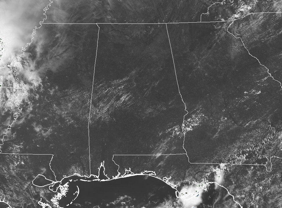
It’s a hot one out there across Central Alabama as we reach the noon hour on the last Saturday of July. We have plenty of sunshine with very little in the way of clouds. Temperatures are currently in the mid-80s to the lower 90s across the area. Birmingham was sitting at 90 degrees, tied as the warm spot with many locations. No rain showing up on radar and we expect for it to stay that way for much of the area throughout the remainder of the day.
WEATHER FOR THE REST OF YOUR SATURDAY
We’ll continue to have mostly sunny skies throughout much of Central Alabama throughout the remainder of the afternoon hours, with only a very slight risk of an isolated shower or storm for locations south of a line stretching from Demopolis to Montgomery to Auburn. Highs will be up in the lower to mid-90s. All of the shower activity will dissipate soon after sunset, or earlier, and we should be left with a fair night. Lows will be in the mid-60s to the lower 70s for most.
NEARLY THE SAME FORECAST FOR SUNDAY

Much of Central Alabama will remain hot and dry ON SUNDAY as we’ll have a good bit of drier air to continue to stay over the area. The only parts of the area that may see any isolated showers or storms will more than likely be south of I-85 and east of I-65. We’ll have a good bit of sunshine with only a few clouds, and highs will be in the lower to mid-90s. Once again, showers will dissipate soon after sunset, and overnight lows will be in the upper 60s to the mid-70s.
AN UPDATE ON THE TROPICS
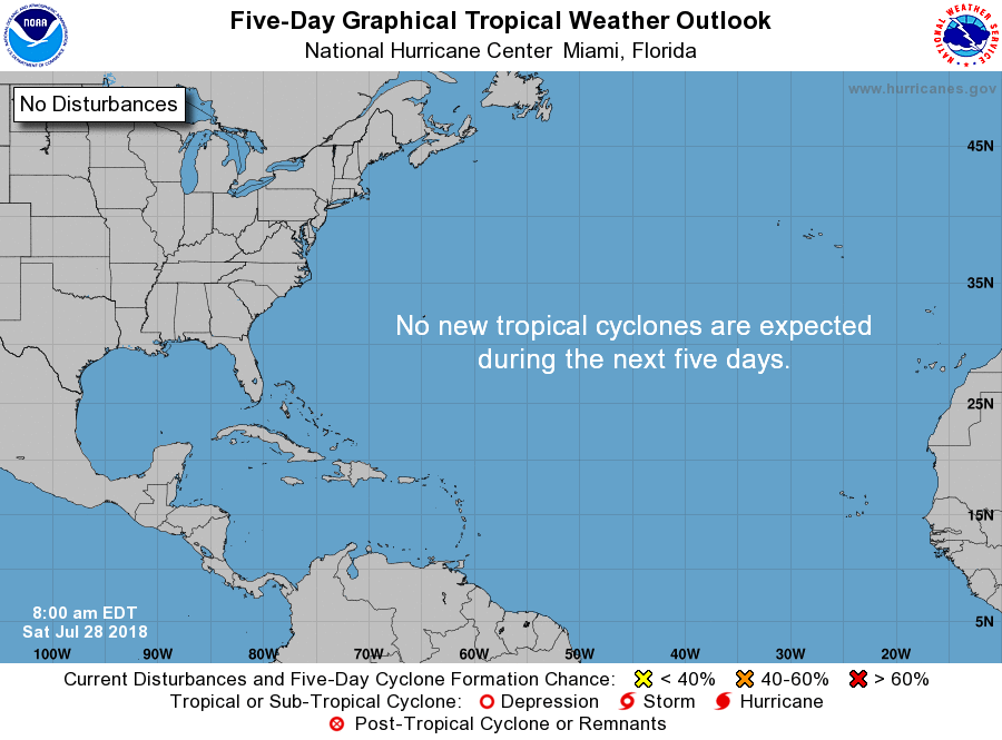
For the next 5 days, the North Atlantic, Caribbean Sea, and the Gulf of Mexico is expected to be free from any tropical development. Out in the eastern North Pacific, Tropical Depression Gilma is heading to the west out to sea. Gilma is expected to weaken and dissipate early next week.
ON THIS DAY IN WEATHER HISTORY
1819 – A small but intense hurricane passed over Bay Saint Louis, MS. The hurricane was considered the worst in fifty years. Few houses were left standing either at Bay Saint Louis or at Pass Christian, and much of the Mississippi coast was desolate following the storm. A U.S. cutter was lost along with its thirty-nine crew members. The storm struck the same area that was hit 150 years later by Hurricane Camille.
1986 – Severe thunderstorms moving out of South Dakota across Iowa produce high winds which derailed eighteen piggyback trailer cars of a westbound freight train near Boone, IA. Sixteen of the cars fell 187 feet into the Des Moines River. The thunderstorms also spawned a number of tornadoes, including one which caused twenty-five to fifty million dollars damage at Sloan, near Sioux City, IA.
BEACH FORECAST CENTER
Get the latest weather and rip current forecasts for the beaches from Fort Morgan to Panama City on our Beach Forecast Center page. There, you can select the forecast of the region that you are interested in.
WE’RE HAVING A RECORD-BREAKING YEAR… ADVERTISE WITH US TODAY!
Don’t miss out! We have enjoyed over 12.7 MILLION page views on AlabamaWx.com since the start of 2018. We can customize a creative, flexible and affordable package that will suit your organization’s needs. Contact Bill Murray at (205) 687-0782.
E-FORECAST
Get the AlabamaWx Weather Blog’s Seven-Day Forecast delivered directly to your inbox by email twice daily. It is the most detailed weather forecast available in Central Alabama. Subscribe here… It’s free!
WEATHERBRAINS
Don’t forget you can listen to our weekly 90 minute netcast anytime on the web at WeatherBrains.com or on iTunes. This is the show all about weather featuring many familiar voices, including the meteorologists at ABC 33/40.
Category: Alabama's Weather, ALL POSTS
About the Author (Author Profile)
Scott Martin is an operational meteorologist, professional graphic artist, musician, husband, and father. Not only is Scott a member of the National Weather Association, but he is also the Central Alabama Chapter of the NWA president. Scott is also the co-founder of Racecast Weather, which provides forecasts for many racing series across the USA. He also supplies forecasts for the BassMaster Elite Series events including the BassMaster Classic.Subscribe
If you enjoyed this article, subscribe to receive more just like it.


