A Hot and Dry Sunday for the Northern Half of Alabama
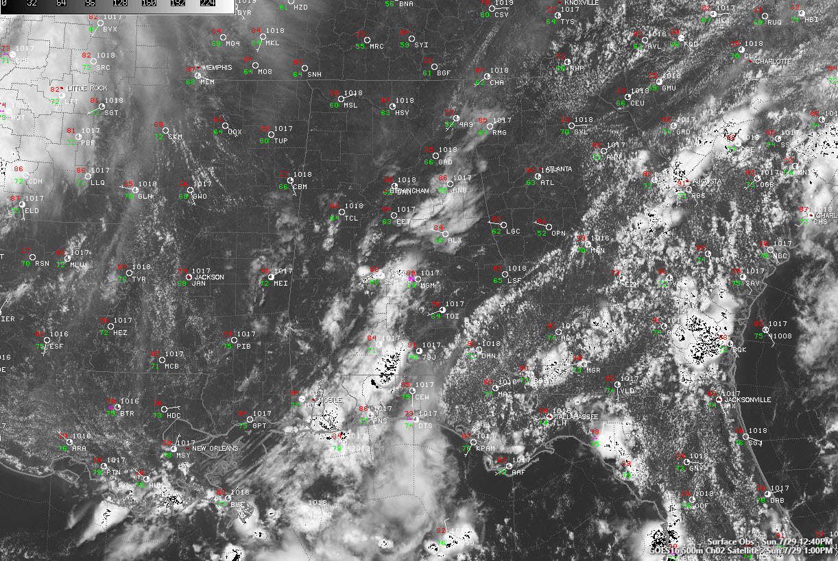
Drier air behind yesterday’s frontal/outflow boundary is producing a hot, dry day across the northern half of Alabama.
Dewpoints have dropped into the lower and middle 60s north of I-20.
Temperatures are warming into the 90s now and will top out between 91-94F this afternoon.
Some storms fired over Central Mississippi this morning thanks to an upper-level disturbance that had some mid-level moisture to work with. It was enhanced by some wave pushing southeastward in the atmosphere, perhaps a gravity wave, that was clearly delineated on GIES satellite data.
Showers and storms will be limited to South Alabama this afternoon and will die this evening. Lows will drop into the upper 60s and lower 70s.
Moisture will surge northward tonight and Monday morning. Meanwhile, a trough will build just to the west of Alabama, putting us in a good position to see increased shower and thunderstorm chances. They will hang on into the overnight hours. The heat will back off a degree or two, but it will still be hot. A passing shortwave may deliver a round of storms late Monday night, and the SPC thinks northwestern sections could see a severe storm or two, but there is a lot of uncertainty in that.
That trough to our west will be digging our way on Tuesday in and we expect widespread showers and storms to be the result. Everyone won’t get heavy rain and the severe weather threat doesn’t look significant, but .5 to 1.5 inches of rain should fall across much of the area. Highs on Tuesday will be limited to the lower and middle 80s.
The trough will begin to weaken by midweek and beyond even as it meanders back and forth across the Lower Mississippi Valley. This means unsettled weather across the Southeast and Alabama. Look for more showers and storms Wednesday through Friday, although they won’t be as widespread as Tuesday. Highs will stay in the 80s the rest of the week.
Category: Alabama's Weather, ALL POSTS
About the Author (Author Profile)
Bill Murray is the President of The Weather Factory. He is the site's official weather historian and a weekend forecaster. He also anchors the site's severe weather coverage. Bill Murray is the proud holder of National Weather Association Digital Seal #0001 @wxhistorianSubscribe
If you enjoyed this article, subscribe to receive more just like it.


