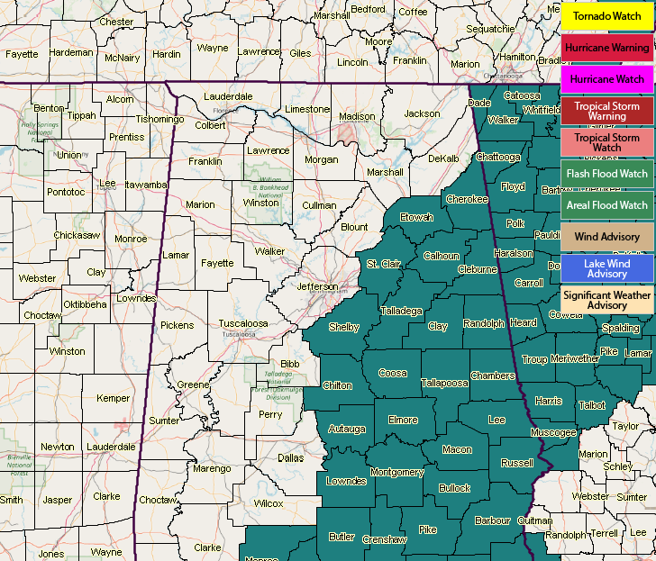
A Few More Counties Have Been Added To The Flash Flood Watch
A steady stream of tropical moisture from the Gulf of Mexico along with a series of upper-level disturbances will combine to bring a prolonged period of off and on stormy weather to Central Alabama. At this time, the parts of Central Alabama that is most likely to get repeated rounds of heavy rain from thunderstorms is in a band from near Montgomery and Troy, and northward to near Anniston and Center.
NWS Birmingham has added Chilton, Etowah, Shelby, and St. Clair counties to the Flash Flood Watch already in effect that expires at 7:00 PM Thursday. The other counties included in the watch are Autauga, Barbour, Bullock, Calhoun, Chambers, Cherokee, Clay, Cleburne, Coosa, Elmore, Lee, Lowndes, Macon, Montgomery, Pike, Randolph, Russell, Talladega, and Tallapoosa.
Category: Alabama's Weather, ALL POSTS
About the Author (Author Profile)
Scott Martin is an operational meteorologist, professional graphic artist, musician, husband, and father. Not only is Scott a member of the National Weather Association, but he is also the Central Alabama Chapter of the NWA president. Scott is also the co-founder of Racecast Weather, which provides forecasts for many racing series across the USA. He also supplies forecasts for the BassMaster Elite Series events including the BassMaster Classic.Subscribe
If you enjoyed this article, subscribe to receive more just like it.


