Morning Showers/Storms

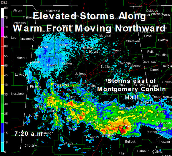
Showers and thundestorms are moving northward through Central Alabama at the leading edge of a warm front and surge of moisture from the Gulf.
There have been a couple of severe thunderstorm warnings in the Montgomery area.
The heaviest storms are over Montgomery and Elmore Counties. Hail is indicated just east of Montgomery. Golf ball size hail was reported in eastern Montgomery at 6:50 a.m.
The line extends back to the west Northwest through Autauga, Dallas, Perry and into Hale and Greene Counties.
Some heavier showers that moved through the Tuscaloosa area are moving into southwestern Jefferson County.
The storms are elevated, which means the instability that is causing them is based above the surface.
Showers and storms will continue along the front as it moves northward through the morning hours.
Temperatures will rise into the 70s across the area this afternoon.
A cold front will appraoach Alabama later today and pass through the state tonight. Ahead of it, surface based storms will develop. There is a chance that some of those could be strong to severe. The main threats will be from hail and damaging winds. The trheat is certainly less than with our last event.
Just keep an eye on the weather as you go through your activities today.
Category: Uncategorized


