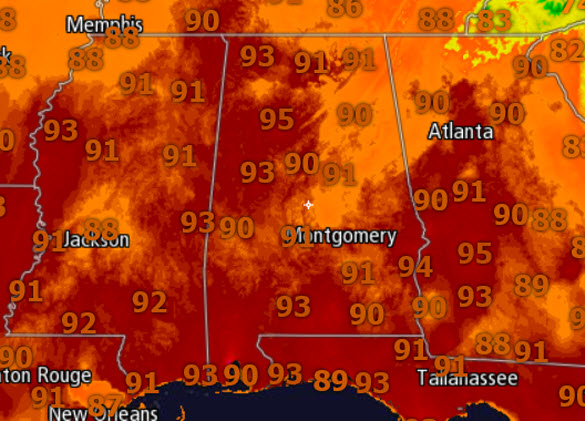
Hot September Saturday
My calendar says mid-September, but the weather is feeling more like mid-July across Alabama today.
We are seeing tons of sunshine, a few fair weather cumulus clouds in the sky, and temperatures well into the 90s which is well-above average for this time of year.
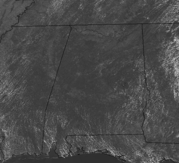
Scanning the radar early this afternoon looking for heat relief in the form of afternoon showers and storms, and I am not seeing any out there. Now that is not to say we won’t see any today, but if we do, they will be very isolated.
FOR TOMORROW: More of the same, as sunshine and mainly dry conditions are expected. Highs will once again surge into the lower 90s. Will there be any afternoon showers? It is a possibility, but I wouldn’t count on them. If we see any, like today, they will be few and far between.
FLORENCE UPDATE: At 1100 AM EDT, the center of Tropical Storm Florence was located near latitude 33.6 North, longitude 79.6 West. Florence is moving slowly toward the west near 2 mph and a slow westward motion is expected to continue through today. A turn toward the west-northwest and northwest is expected on Sunday. Florence is forecast to turn northward through the Ohio Valley by Monday. Radar data and surface observations indicate that maximum sustained winds have decreased to near 45 mph with higher gusts, mainly to the east of the center in heavy rainbands over water. Gradual weakening is forecast while Florence moves farther inland during the next couple of days, and it is expected to weaken to a tropical depression by tonight. Tropical-storm-force winds extend outward up to 150 miles from the center. The estimated minimum central pressure based on nearby surface observations is 995 mb (29.38 inches).
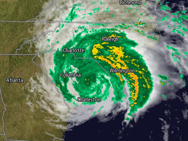
RAINFALL: Florence is expected to produce heavy and excessive rainfall in the following areas…Southern and central portions of North Carolina into far northeast South Carolina…an additional 15 to 20 inches, with storm totals between 30 and 40 inches along the North Carolina coastal areas south of Cape Hatteras. This rainfall will continue to produce catastrophic flash flooding and prolonged significant river flooding. Remainder of northern South Carolina into western North Carolina and southwest Virginia…5 to 10 inches, isolated 15 inches. West-central Virginia into far eastern West Virginia, north of Roanoke and west of Charlottesville, 3 to 6 inches, isolated 8 inches. These rainfall amounts will result in life-threatening flash flooding and river flooding, along with an elevated risk for landslides. A preliminary report from a cooperative observer near Swansboro, North Carolina, indicates that more than 30 inches of rain has fallen so far. In Newport, North Carolina, more than 24 inches of rainfall has been measured.
WIND: Tropical storm conditions will continue today in portions of the warning area along the coast and also over large portions of eastern North Carolina and extreme eastern South Carolina, with tropical-storm-force wind gusts spreading well inland.
TORNADOES: A few tornadoes are possible in southeastern North Carolina northeastern South Carolina today through tonight.
Category: Alabama's Weather, ALL POSTS
About the Author (Author Profile)
Macon, Georgia Television Chief Meteorologist, Birmingham native, and long time Contributor on AlabamaWX. Stormchaser. I did not choose Weather, it chose Me. College Football Fanatic. @Ryan_StinnetSubscribe
If you enjoyed this article, subscribe to receive more just like it.


