

Showers & Storms Firing Up: It’s The Midday Nowcast For Central AL
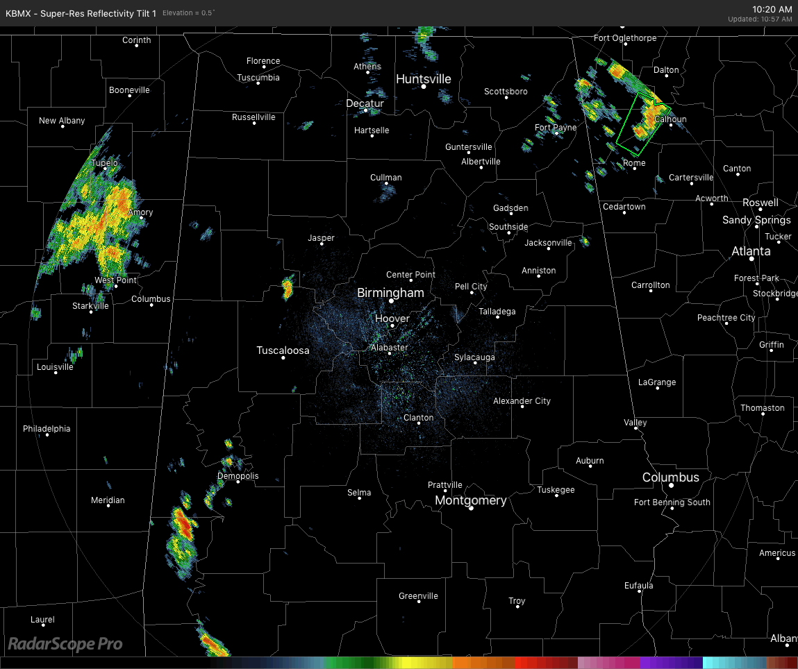
As we have hit the 11:00 am hour in Central Alabama on this first Monday of fall, we have showers and a few embedded thunderstorms forming mainly over the southwestern parts of the area (Greene, Hale, and Sumter counties), with a few more scattered showers over the western parts of Walker and southern parts of Winston county. All of these are moving in a generally north-northeast fashion as we have a southerly flow over the area due to having lower pressure to our east and higher pressure to our west. This flow is allowing plenty of gulf moisture to make those humidity levels rise. We also have a lifting mechanism close by as we have a stalled front just to our north in southern Tennessee.
Temperatures are running in the upper 70s in the north to the upper 80s in the extreme southeastern parts of the area. The warm spot is currently Eufaula at 89 degrees, while the cool spot is 78 at Cullman. Birmingham is currently sitting at 82 degrees.
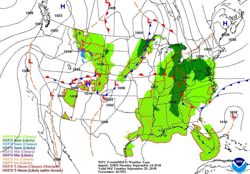
Map valid at 7:00 pm CT this evening.
Showers and thunderstorms will become more likely throughout the area later today as daytime heating will allow for the development of convective activity. No organized severe storms are expected today and the chance of rain for any location throughout Central Alabama will be in the 60-70% range. When it is not raining, skies will be mostly cloudy. Highs will top out in the lower 80s to just at 90 degrees, with the warmest temperatures occurring in the extreme southern locations. For tonight, shower and storm activity will diminish somewhat in the western locations, but there is still an increased chance of storms through a good bit of the late night and overnight hours. Rain chances for any one location will range from 40-60% after sunset until just before sunrise. Overnight lows will be in the lower to mid-70s.
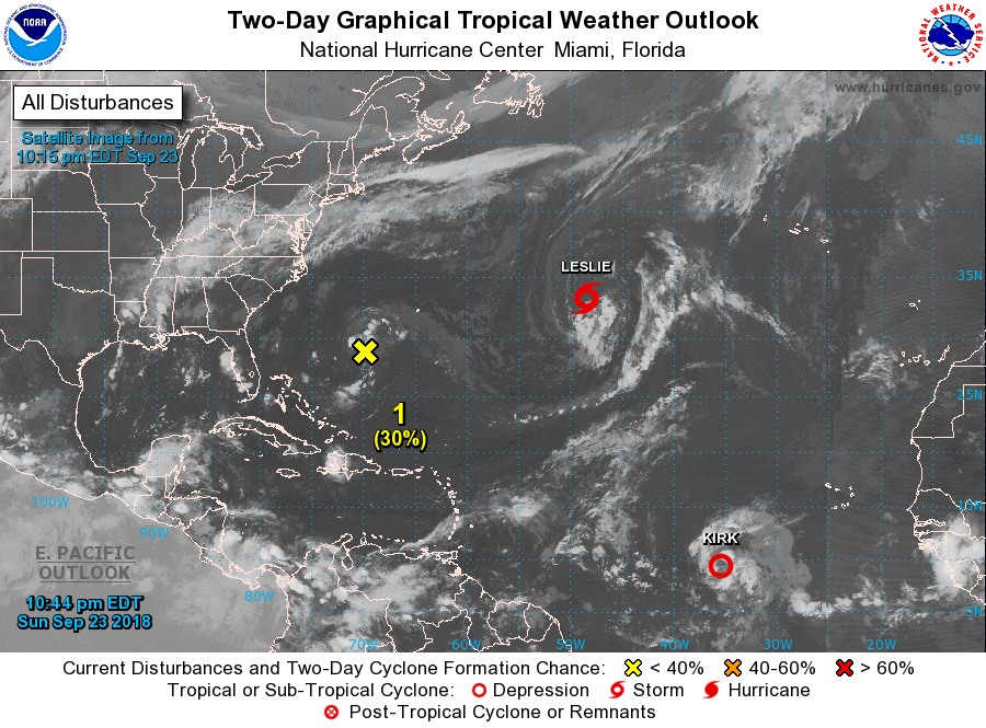
THE TROPICS: Kirk has degenerated into an open wave as it no longer has a closed circulation. Tropical Storm Leslie continues to drift to the east and has not shown any signs of strengthening, and will not be a threat to any land. The only area of concern is a low that is centered to the southwest of of Bermuda as conditions become more conducive for some development over the next day or so. NHC is only giving this disturbance a 40% chance of developing into a depression or storm and should not be a threat to land, but may bring some rainfall to the Outer Banks and the North Carolina coast. Fortunately, the rainfall amounts will not be all that heavy as the QPF is only showing 1.5-2.0 inches throughout the next five days.
ON THIS DAY IN WEATHER HISTORY: 1926 – The temperature at Yellowstone Park dipped to nine degrees below zero. It was the coldest reading of record in the U.S. during September. Severe freezes were widespread over the northwestern U.S. causing great crop destruction. In Washington State, Spokane County experienced their earliest snow of record. Harney Branch Experiment Station in Oregon reported a temperature of 2 degrees above zero to establish a state record for the month of September.
BEACH FORECAST CENTER: Get the latest weather and rip current forecasts for the beaches from Fort Morgan to Panama City on our Beach Forecast Center page. There, you can select the forecast of the region that you are interested in.
CONNECT ON SOCIAL MEDIA: You can find the AlabamaWx Weather Blog on the major social media networks:
Facebook
Twitter
WE’RE HAVING A RECORD-BREAKING YEAR… ADVERTISE WITH US TODAY!: Don’t miss out! We have enjoyed over 15 million page views on AlabamaWx.com since the start of 2018. We can customize a creative, flexible and affordable package that will suit your organization’s needs. Contact Bill Murray at (205) 687-0782.
WEATHERBRAINS: Don’t forget you can listen to our weekly 90 minute netcast anytime on the web at WeatherBrains.com or on iTunes, Stitcher, or Spotify. This is the show all about weather featuring many familiar voices, including the meteorologists at ABC 33/40.
Category: Alabama's Weather, ALL POSTS
About the Author (Author Profile)
Scott Martin is an operational meteorologist, professional graphic artist, musician, husband, and father. Not only is Scott a member of the National Weather Association, but he is also the Central Alabama Chapter of the NWA president. Scott is also the co-founder of Racecast Weather, which provides forecasts for many racing series across the USA. He also supplies forecasts for the BassMaster Elite Series events including the BassMaster Classic.Subscribe
If you enjoyed this article, subscribe to receive more just like it.


