At Midday… Sunny & Very Warm Weather Continues
CONDITIONS AT 11:30 AM
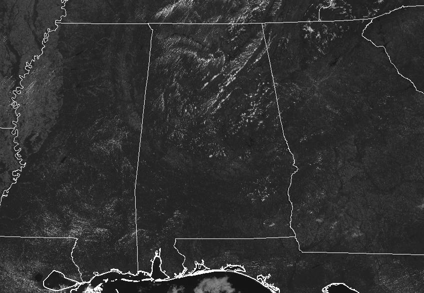
Very little in the way of clouds out there across Central Alabama at midday. Unfortunately, temperatures are already up in the mid-80s to just at 90 degrees, putting us in the “hot” category once again. The hot spot is Montgomery at 90 degrees, while a few locations are tied as the cool spots at 84 degrees. Birmingham was at 86 degrees.
WEATHER FOR THE REST OF YOUR FRIDAY
While nearly all of Central Alabama will stay dry throughout the remainder of the afternoon and into the early evening hours, the chance of rain for any one location is not absolute zero. There will be a very small chance of an isolated shower or two over the northwestern quarter of the area, being close to 20%. The rest of the area will have well less than a 10% chance of an isolated shower. Afternoon highs will be in the upper 80s to the lower 90s, underneath mainly sunny skies. Any shower activity will dissipate at or just after sunset and we’ll have mainly clear skies through the evening and overnight hours. Lows will be in the mid-60s to the lower 70s.
For tonight’s high school football games… while an isolated shower is possible before the sun sets over the northwestern part of Central Alabama, we should have fair conditions throughout the evening. Temperatures will start off in the lower to mid-80s at kickoff and dropping into the 70s by the end of the game.
COLLEGE FOOTBALL FORECASTS
Alabama travels to Fayetteville to take on Arkansas tomorrow morning (11:00 am CDT kickoff). Skies will be occasionally cloudy and a brief passing shower or thunderstorm is possible during the game. Temperatures will rise into the low 80s during the game.
Auburn will be on the road traveling to Starkville to play Mississippi State tomorrow evening (6:30 pm CDT kickoff). Skies will be mostly fair with temperatures falling from the low 80s at kickoff, into the mid 70s by the final whistle.
UAB will take on Louisiana Tech tomorrow evening (6:00 pm CDT kickoff) at Ruston, LA. A few isolated showers are possible during the first half, otherwise mostly fair with temperatures falling from the mid 80s into the 70s by the second half.
THE TROPICS
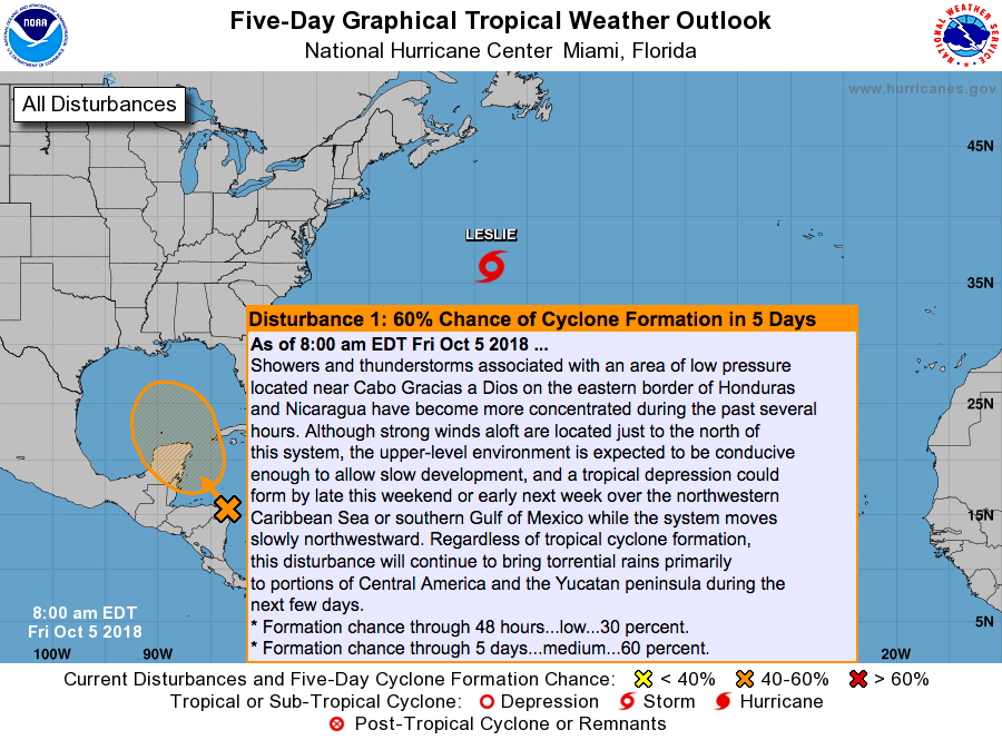
A center of low pressure is over the eastern shores of Honduras and Nicaragua at this point and is expected to continue its slow movement to the northwest and eventually moving into the southern Gulf of Mexico by early next week. We could have a tropical depression or Tropical Storm Michael by Monday. It is still too early to see what happens and where it will go for sure, but we will definitely keep our eyes on it.
BEACH FORECAST CENTER
Get the latest weather and rip current forecasts for the beaches from Fort Morgan to Panama City on our Beach Forecast Center page. There, you can select the forecast of the region that you are interested in.
CONNECT ON SOCIAL MEDIA
You can find the AlabamaWx Weather Blog on the major social media networks:
Facebook
Twitter
YouTube
WE’RE HAVING A RECORD-BREAKING YEAR… ADVERTISE WITH US TODAY!
Don’t miss out! We have enjoyed over 15.2 million page views on AlabamaWx.com since the start of 2018. We can customize a creative, flexible and affordable package that will suit your organization’s needs. Contact Bill Murray at (205) 687-0782.
E-FORECAST
Get the Alabama Wx Weather Blog’s Seven-Day Forecast delivered directly to your inbox by email twice daily. It is the most detailed weather forecast available in Central Alabama. Subscribe here… It’s free!
WEATHERBRAINS
Don’t forget you can listen to our weekly 90 minute netcast anytime on the web at WeatherBrains.com or on iTunes, Stitcher, or Spotify. This is the show all about weather featuring many familiar voices, including the meteorologists at ABC 33/40.
ON THIS DAY IN WEATHER HISTORY
1989 – Showers and thunderstorms associated with Tropical Storm Raymond deluged southeastern Arizona with heavy rain. Up to four and a half inches of rain was reported north of Wilcox. Three- fourths of the streets in the town of Wilcox were left under eighteen inches of water, and damage exceeded a million dollars. Evening thunderstorms developing along a cold front produced severe weather in Oklahoma and the Texas panhandle. Thunderstorms produced high winds which gusted to 80 mph at White Deer TX, and resulted in one death at Pocasset OK. Thunderstorms produced golf ball size hail at Pampa TX and Lefors TX.
Category: Alabama's Weather, ALL POSTS
About the Author (Author Profile)
Scott Martin is an operational meteorologist, professional graphic artist, musician, husband, and father. Not only is Scott a member of the National Weather Association, but he is also the Central Alabama Chapter of the NWA president. Scott is also the co-founder of Racecast Weather, which provides forecasts for many racing series across the USA. He also supplies forecasts for the BassMaster Elite Series events including the BassMaster Classic.Subscribe
If you enjoyed this article, subscribe to receive more just like it.


