Quick Early Morning Notes on the Future Gulf Tropical Storm
No shortage of coverage this morning on what will be Tropical Storm Micheal it appears. Scroll down to read James’ and Scott’s posts as well.
Low pressure is over the southwestern Caribbean this morning, but it is too disorganized to be classified as a tropical depression yet.
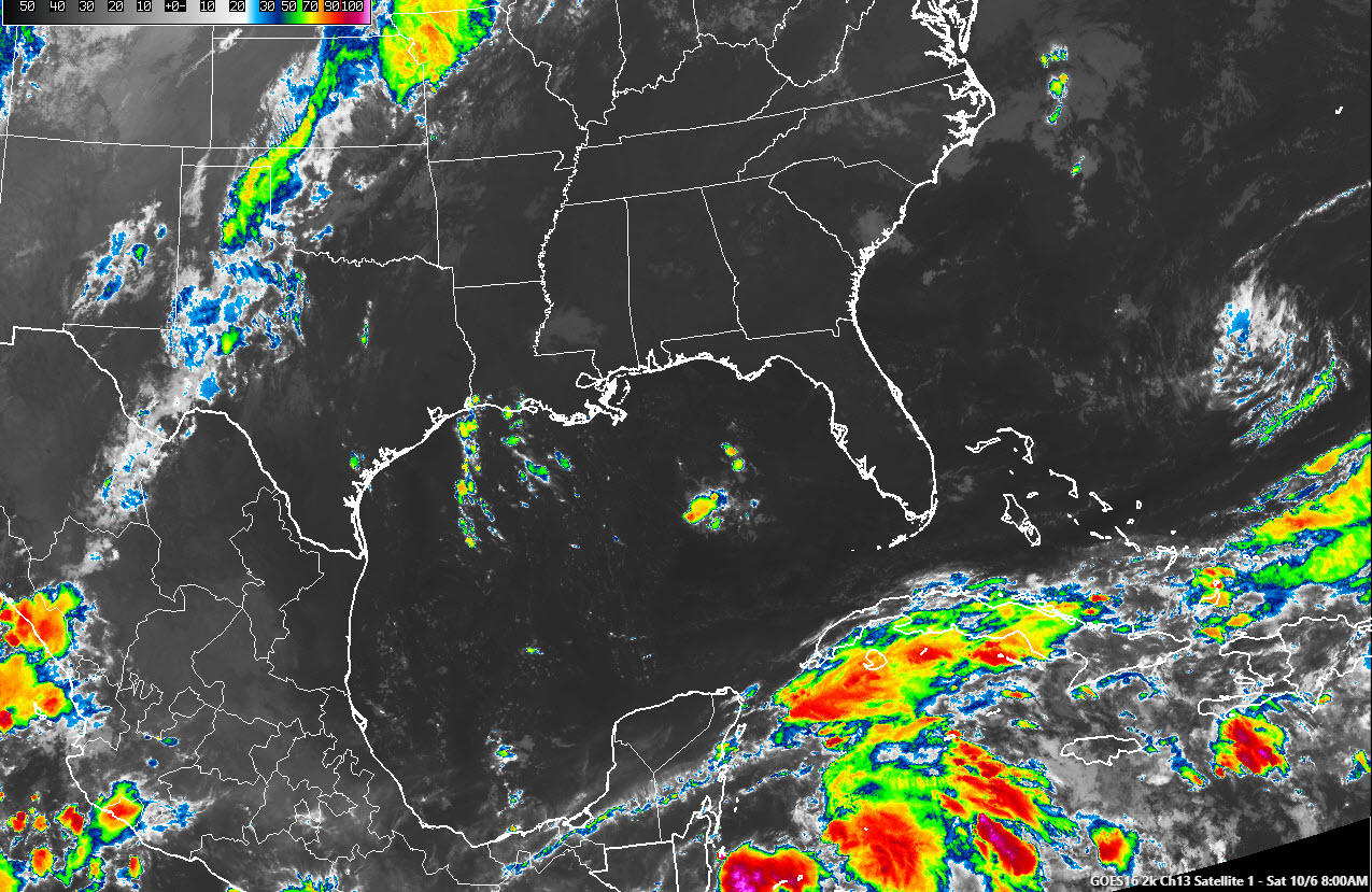
The system is undergoing very strong wind shear and this is expected to continue to assail the system as it moves slowly northward through the western Caribean.
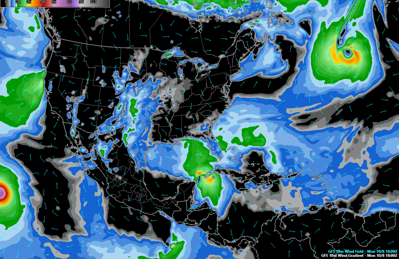
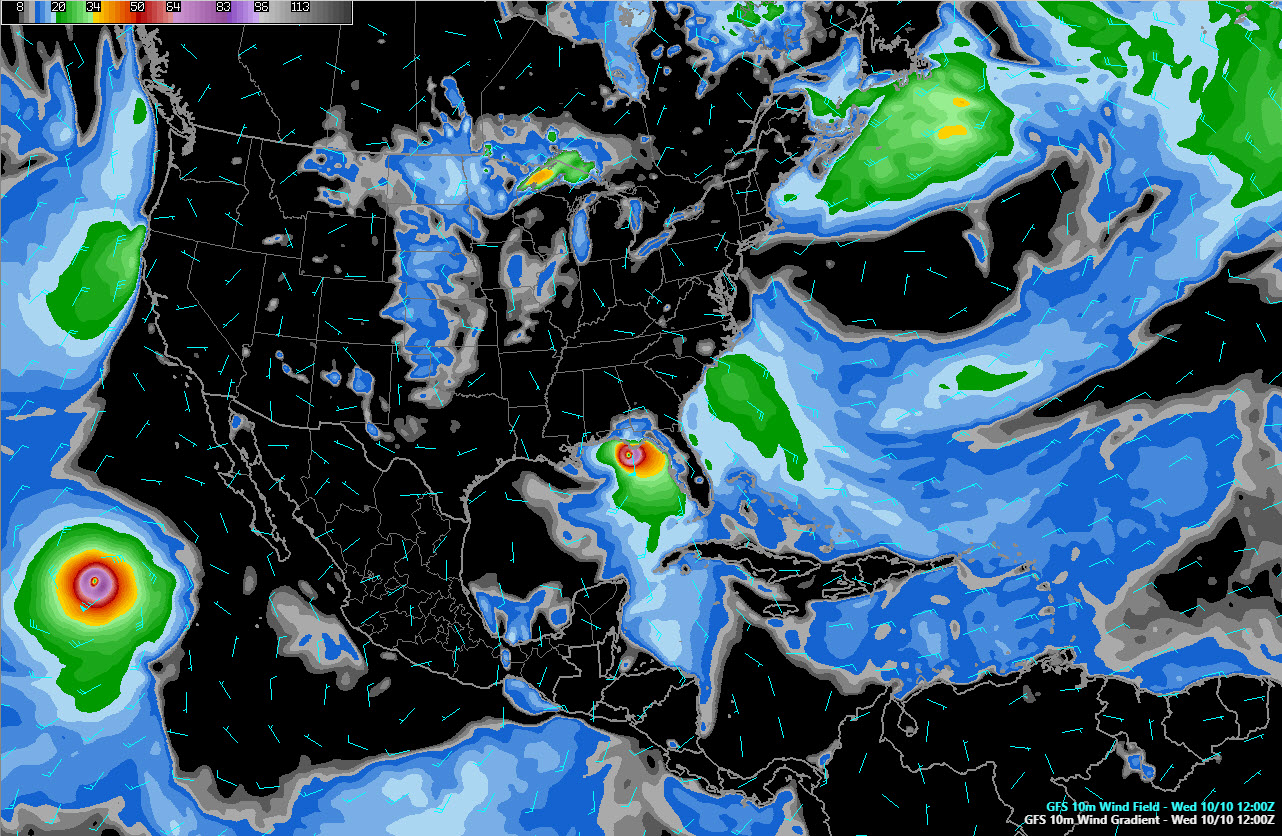
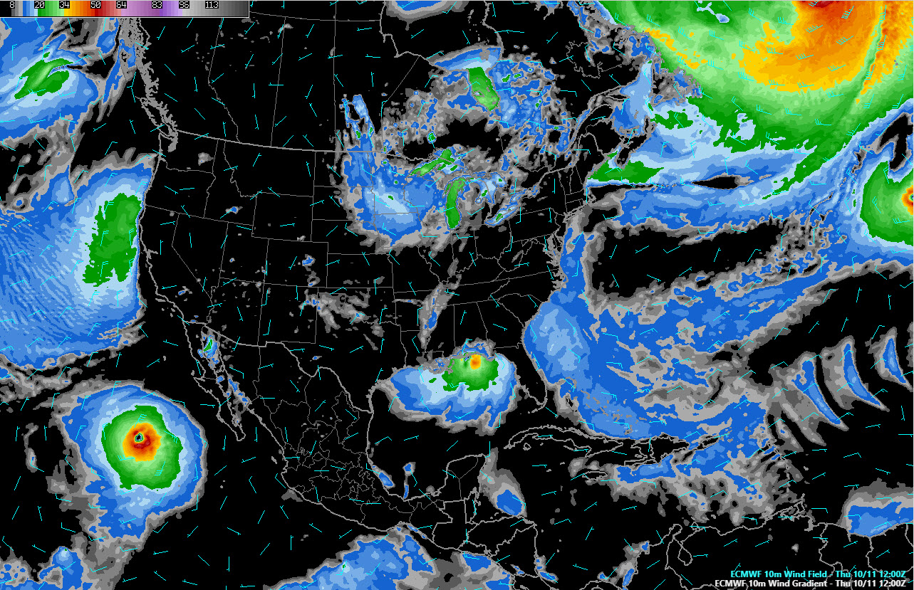
By early Monday morning, the system should be near the Yucatan Peninsula, and the shear will be gradually relaxing, so it should be getting its act together and should be a tropical depression or Tropical Storm Michael. Here is the GFS 10 meter wind depiction for Monday at 7 a.m.
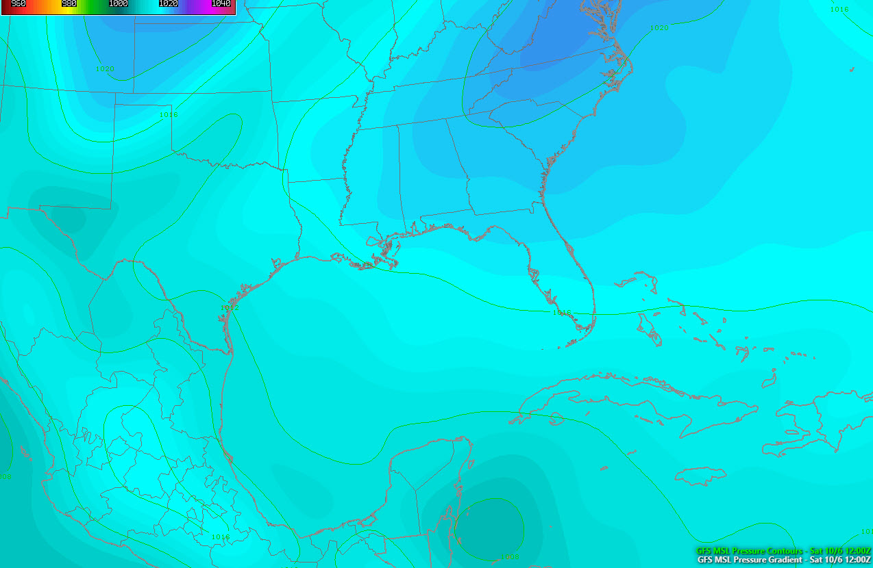
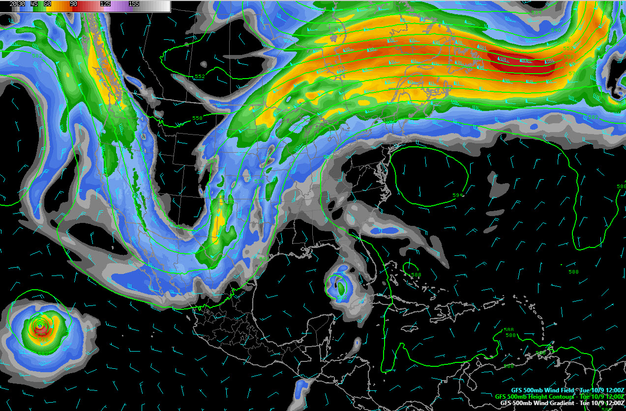
The upper pattern to the north will be in transition and this leads to some uncertainty. Here is what is happening now, with a very strong trough to the west and a stubborn subtropical high to the east.
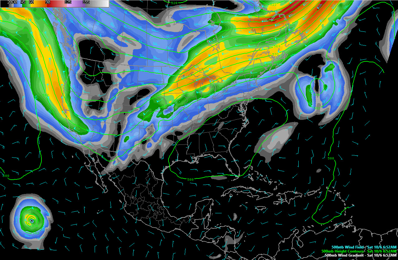
By Tuesday, things should change, with the high relaxing its control over the Southeast and opening a channel for the tropical storm to follow.
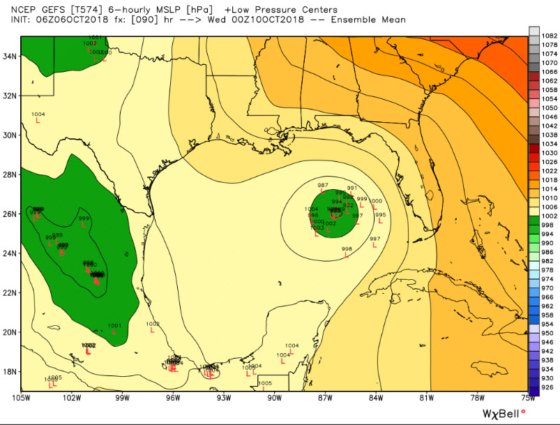
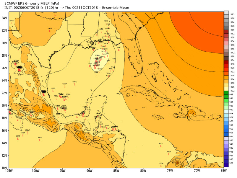
There is some disagreement in track and intensity between the GFS and Euro. Here are the various low locations from the GFS ensemble for Tuesday evening at 7 p.m.:
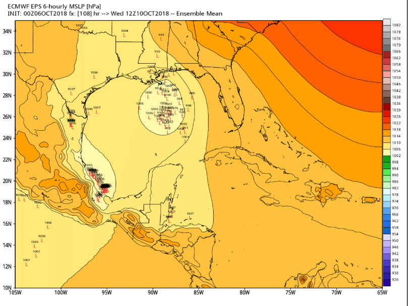
The Euro is slower and further west. Here are the various ensemble low locations Wednesday morning:
So the operational GFS brings a strong tropical storm or minimal hurricane to the Florida Panhandle near Panama City or Apalachicola by Wednesday morning.
The operational Euro is slower and further west, bringing the tropical storm to the coast between Pensacola and Destin Thursday morning.
But the ensemble members are still all over the place, with some of the low locations up into Alabama:
With an evolving pattern and a developing cyclone, we will have to wait to see how the system forms. The Hurricane Hunters are on stand by to fly missions into the system tomorrow.
As far as effects along the beaches of Alabama and Northwest Florida, it looks likely that the rip current threat will be high to extreme through much of the week. The storm looks like it will be fairly small, with the main rain and wind near the center, so impacts will be dependent on the track and we will be able to be specific as the situation unfolds.
For Alabama, again, the track will determine the impacts, but it looks like the heavy rain and wind will be limited to South and Southeast Alabama either Wednesday or Thursday.
Stay tuned.
About the Author (Author Profile)
Bill Murray is the President of The Weather Factory. He is the site's official weather historian and a weekend forecaster. He also anchors the site's severe weather coverage. Bill Murray is the proud holder of National Weather Association Digital Seal #0001 @wxhistorianSubscribe
If you enjoyed this article, subscribe to receive more just like it.


