A 9:20 a.m. Update on Hurricane Michael
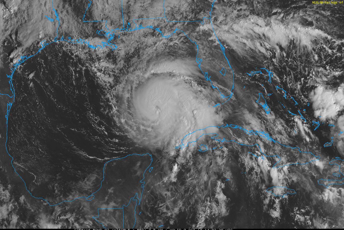
Hurricane Michael looks stronger on satellite this morning with strong convection wrapping around the center in bursts, a possible eye evident and good outflow now noted in nearly every quadrant. Some dry air in intruding at times, perhaps tempering the intensification.
The latest pass through the eye by the Air Force Reserve Hurricane Hunters found a central pressure of 967 millibars. So the central pressure continues to steadily drop. The surface winds were estimated at 105 mph with flight level winds of 104 knots. Discounting this by 10% to estimate surface winds also yields 105 mph. The plane found the eye to be circular with a 30-mile diameter, but it was open to the southwest.
Models are in good agreement that landfall will occur within about 50 miles either side of Panama City Wednesday afternoon as a category three hurricane with top winds of 120 mph. There is a chance that it could be stronger as the storm becomes more organized, outflow continues to increase and it continues to track over warm water.
Most of the storm surge maps being produced right now are based on a track that would carry the center just east of Panama City. I have concern that is a slightly more westerly track is what occurs, the surge heights around Panama City may be higher than show on the maps. Officially, 6-9 feet of storm surge is forecast from the Okaloosa/Walton County line (near Sandestin) to Indian Pass southeast of Panama City and 8-12 feet from Indian Pass to Cedar Key. If the track goes west of Panama City, it would increase surge heights to 8-12 feet from near the landfall point to Port St. Joe.
Storm surge warnings are in effect from the Okaloosa/Walton County line to Anclote River, Florida just north of Tampa Bay. Storm surge watches are in effect back to the Alabama/Florida border and south through the Tampa Bay area.
Surge values are already running 2 feet above normal all along the coast including Destin, Panama City Beach, and Apalachicola.
Tornadoes are possible across the Florida Peninsula and North Florida today. There has already been a tornado warning near Jacksonville
All preparations should be completed by sunset tonight along the Gulf Coast.
Our next update will come at 10:30 a.m. with a new look at impacts. The new full advisory and forecast package will be out just before 10 a.m.
About the Author (Author Profile)
Bill Murray is the President of The Weather Factory. He is the site's official weather historian and a weekend forecaster. He also anchors the site's severe weather coverage. Bill Murray is the proud holder of National Weather Association Digital Seal #0001 @wxhistorianSubscribe
If you enjoyed this article, subscribe to receive more just like it.


