It’s Midday & Not Much Happening In Central Alabama
CONDITIONS ACROSS CENTRAL ALABAMA AT 11:20 AM CDT
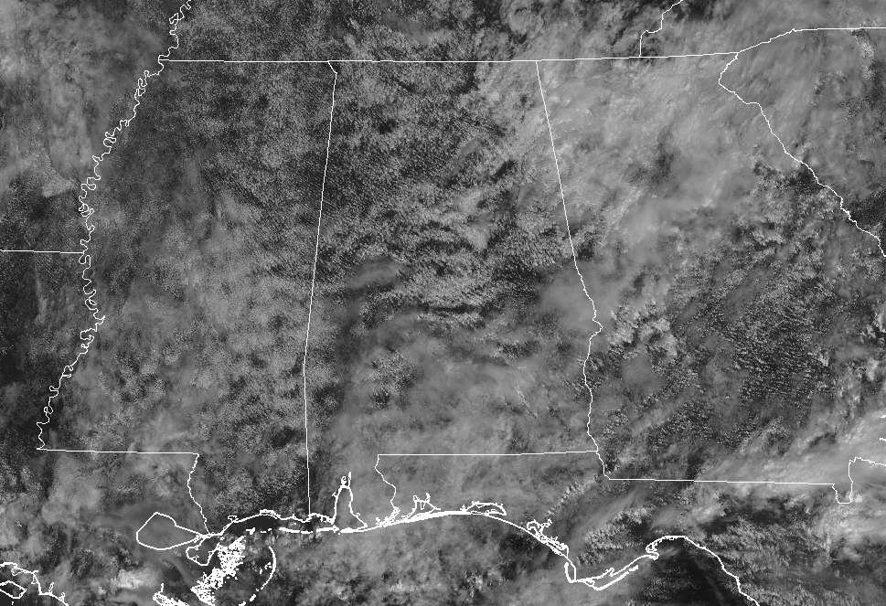
Skies are partly to mostly cloudy throughout Central Alabama, but other than that, it’s relatively quiet at this time. Radar is quiet across the area with the only shower activity that is showing the extreme southern parts of the state. Temperatures are running in the upper 70s to the mid-80s… much cooler than the lower to mid-80s that we were seeing just 24 hours ago.
Our weather for the rest of today will continue to feature partly to mostly cloudy skies and a small risk of isolated to scattered showers and maybe a thunderstorm or two throughout the area, with the higher rain chances being over the southeastern parts of Central Alabama. Afternoon highs will stay in the 80s today, ranging in the mid to upper 80s. We’ll continue to have partly to mostly cloudy skies tonight with a small chance of isolated to scattered showers. Lows will be in the lower to mid-70s.
LATEST ON HURRICANE MICHAEL
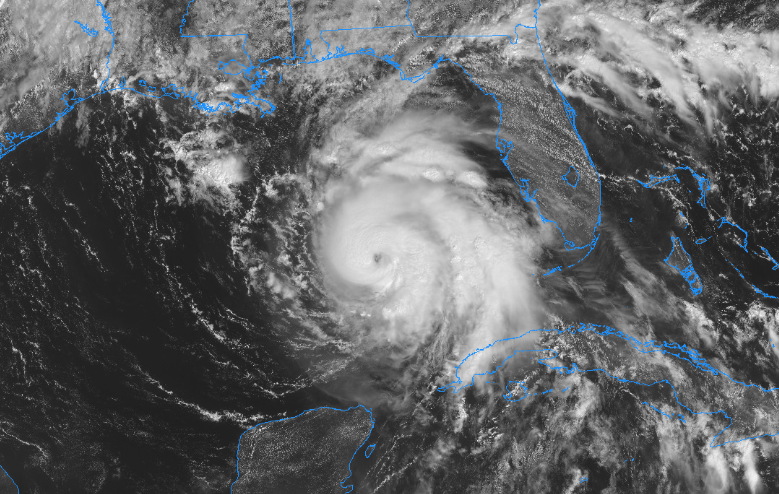
Michael looks to be continuing to strengthen throughout the morning as a visible eye is now clear to see on the visible satellite image. Maximum sustained winds are at 110 MPH, just below category 3 (major hurricane) status. I have a feeling that at the next update, winds will be higher. It is moving to the north at 12 MPH.
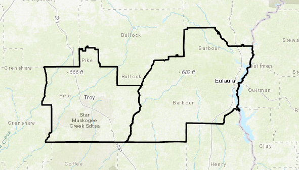
Michael will continue moving to the north before making a curve to the northeast and targeting the Florida Panhandle, with landfall expected sometime during the early afternoon hours on Wednesday. It will likely be a category 3 hurricane but should rapidly weaken as it moves inland. Heavy rains and brief tropical-storm force wind gusts can be expected at this point across the extreme southeastern portions of the area. A Tropical Storm Watch is currently in effect for Pike and Barbour counties until further notice.
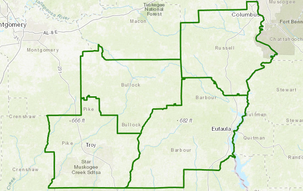
The possibility of locally hazardous flooding could occur in the southeastern parts of the area and a Flash Flood Watch goes into effect starting at 11:00 am CDT on Wednesday and is set to last until 1:00 am CDT Thursday for Barbour. Bullock, Pike, and Russell counties. Localized flooding may prompt a few evacuations as flood waters may have the possibility to enter a few structures in vulnerable spots. Rainfall totals of 3-6 inches is possible across the flash flood watch area.
As far as tornadoes are concerned, we will be well west of the center of Michael, putting us in the calmer side of the storm. We should see little to no impacts across Central Alabama from tornadoes at this time.
We’ll keep you updated throughout the next couple of days on Michael until he clears out of the area.
Category: Alabama's Weather, ALL POSTS
About the Author (Author Profile)
Scott Martin is an operational meteorologist, professional graphic artist, musician, husband, and father. Not only is Scott a member of the National Weather Association, but he is also the Central Alabama Chapter of the NWA president. Scott is also the co-founder of Racecast Weather, which provides forecasts for many racing series across the USA. He also supplies forecasts for the BassMaster Elite Series events including the BassMaster Classic.Subscribe
If you enjoyed this article, subscribe to receive more just like it.


