Michael’s Northern Eye Wall Now Visible On Eglin AFB Radar
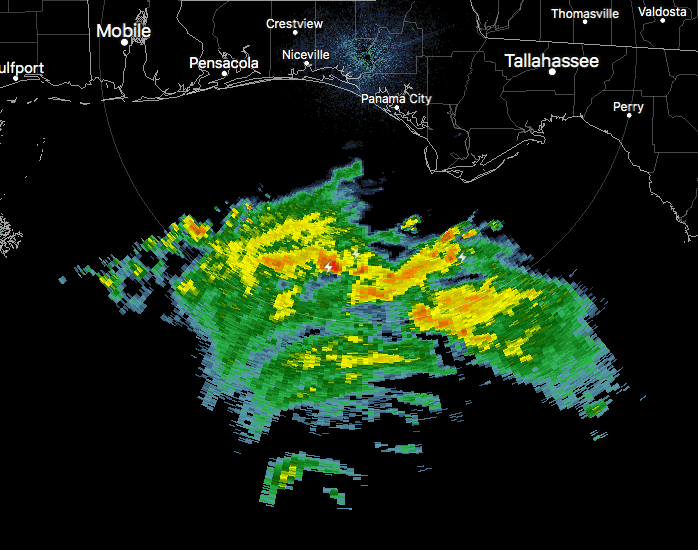
We are now starting to see the northern part of the eyewall on the NWS Radar out of Eglin Air Force Base (KEVX) at this point, and that means that it is only now 210 nautical miles south-southwest of Panama City, and about 193 miles southwest of Apalachicola, as of 8:55 PM.
With it being that close, we are now around 18 hours of the eye of this very dangerous hurricane making landfall somewhere between Laguna Beach to Port St. Joe. My guess at this point may be around the Tyndall Air Force Base.
The turn to the north-northeast and eventually to the northeast should occur within the next few hours. I do believe that we may have a category 4 storm by the next update that will be coming out at 10:00 pm CDT tonight.
About the Author (Author Profile)
Scott Martin is an operational meteorologist, professional graphic artist, musician, husband, and father. Not only is Scott a member of the National Weather Association, but he is also the Central Alabama Chapter of the NWA president. Scott is also the co-founder of Racecast Weather, which provides forecasts for many racing series across the USA. He also supplies forecasts for the BassMaster Elite Series events including the BassMaster Classic.Subscribe
If you enjoyed this article, subscribe to receive more just like it.


