The Latest On Hurricane Michael At 10:00 AM
LATEST ON HURRICANE MICHAEL AT 10:00 AM CDT
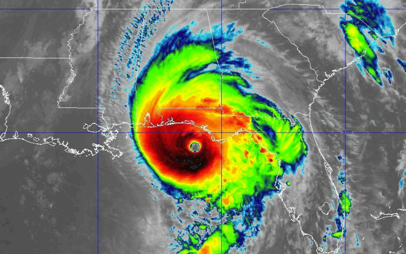
Maximum Sustained Winds: 145 MPH
Minimum Central Pressure: 928 mb
Movement: NNE at 14 MPH
Location: About 60 miles SW of Panama City and about 65 miles WSW of Apalachicola.
A local storm report from St. George Island, FL shows that sustained winds are already at 63 MPH with gusts up to 71 MPH (9:18 am CDT). We still have a few hours before landfall.
ASOS station at Apalachicola is reporting wind gusts up to 56 knots (nearly 65 MPH) as of 9:45 am CDT.
Water is being reported over the roadway on Highway 399 near Pensacola Beach (by social media).
All bridges in Franklin County, FL are now closed (by media).
Nearly 17,000 customers are currently without power throughout the state of Florida, but that number will climb significantly throughout the day.
LATEST KEY MESSAGES FROM NATIONAL HURRICANE CENTER
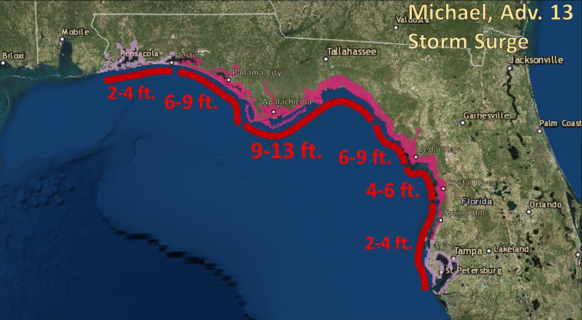
Life-threatening storm surge is likely along portions of the coasts of the Florida Panhandle, Big Bend, and Nature Coast, where a storm surge warning is in effect. The worst storm surge is expected between Tyndall Air Force Base and Keaton Beach, where 9 to 13 feet of inundation is possible.
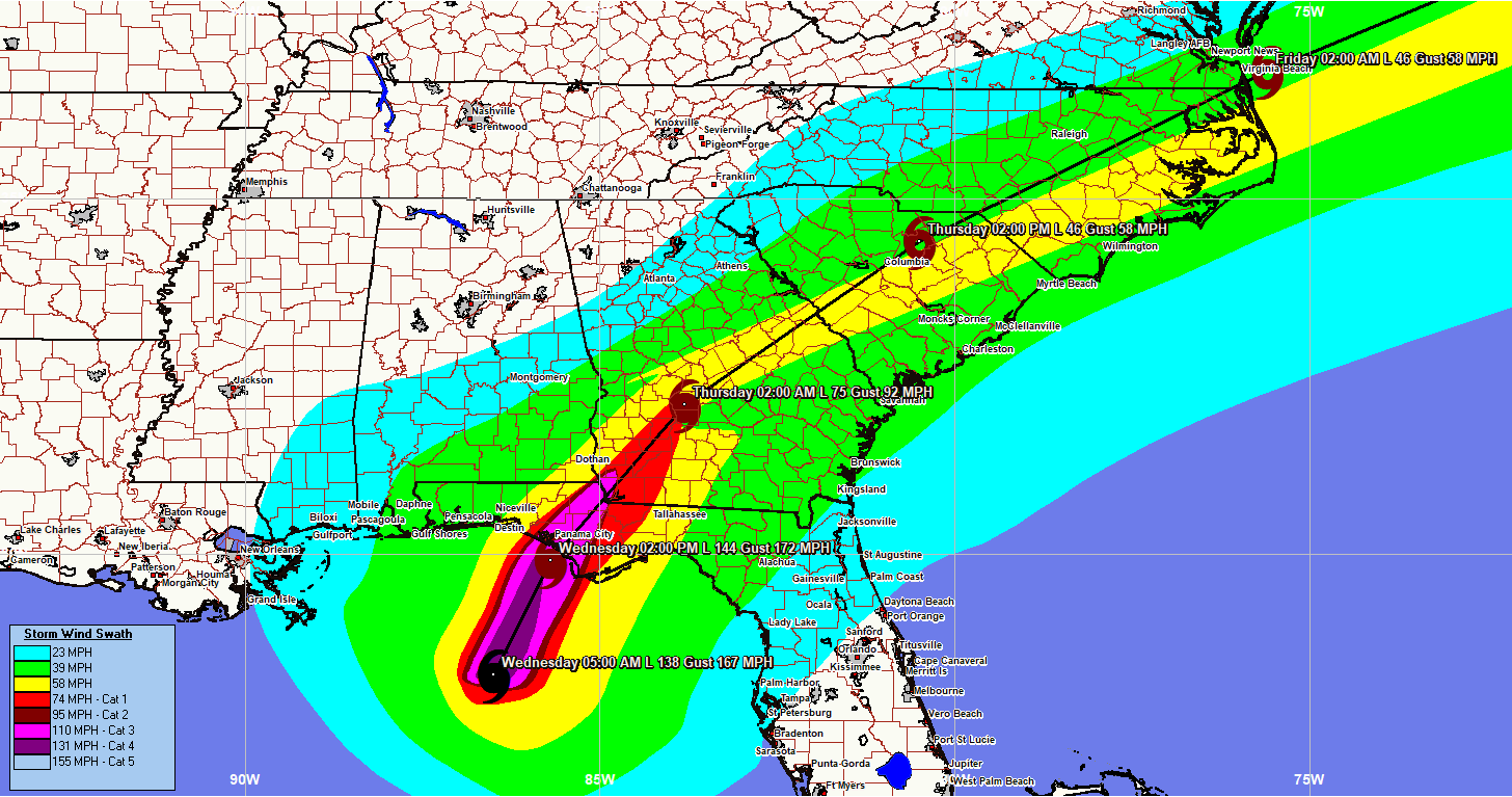
Michael is likely to produce potentially catastrophic wind damage where the core of the hurricane moves onshore in the Florida Panhandle, and everyone in the hurricane warning area should prepare for life-threatening hurricane winds. Dangerous hurricane-force winds will also extend well inland across portions of the Florida Panhandle, southern Georgia, and southeast Alabama as Michael moves inland.
Life-threatening hurricane-force winds will occur well inland across portions of the Florida Panhandle, southeast Alabama, and southwestern Georgia as the core of the hurricane moves inland later today and this evening.
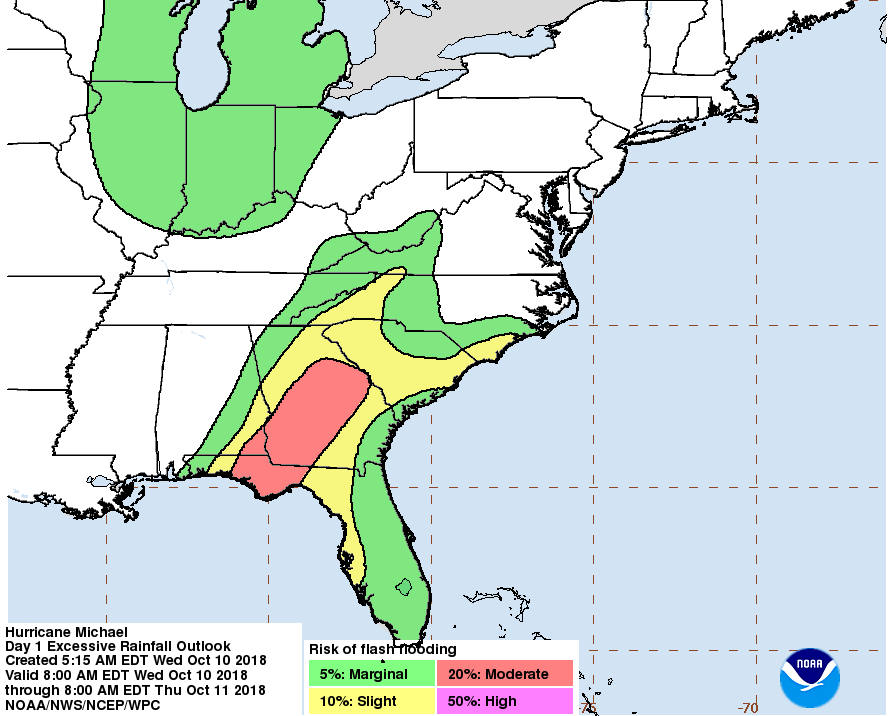
Heavy rainfall from Michael could produce life-threatening flash flooding from the Florida Panhandle and Big Bend region into portions of Georgia, the Carolinas, and southeast Virginia.
Tropical storm conditions will likely affect portions of the southeast U.S. coast from northeast Florida through North Carolina, and tropical storm watches and warnings are in effect for these areas.
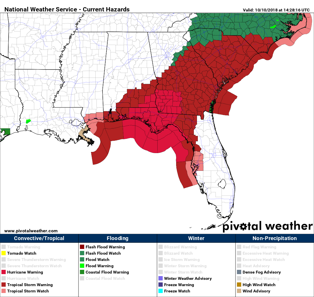
CENTRAL ALABAMA WATCHES & WARNINGS
Tropical Storm Warning
Barbour, Bullock, Pike, Russell
Tropical Storm Watch
Barbour, Pike
Flash Flood Watch
Barbour, Bullock, Pike, Russell
ALABAMA GULF COAST MINOR FLOODING REPORTS
Several roads closed in Orange Beach due to water on roadways, especially near Low Drive and Bay La Launch Avenue. Report from Twitter by Orange Beach Police Department. (9:15 am CDT).
Category: Alabama's Weather, ALL POSTS, Tropical
About the Author (Author Profile)
Scott Martin is an operational meteorologist, professional graphic artist, musician, husband, and father. Not only is Scott a member of the National Weather Association, but he is also the Central Alabama Chapter of the NWA president. Scott is also the co-founder of Racecast Weather, which provides forecasts for many racing series across the USA. He also supplies forecasts for the BassMaster Elite Series events including the BassMaster Classic.Subscribe
If you enjoyed this article, subscribe to receive more just like it.


