

At Midday: Now This Is What Fall Is Supposed To Feel Like
CONDITIONS ACROSS CENTRAL ALABAMA AT 11:30 AM
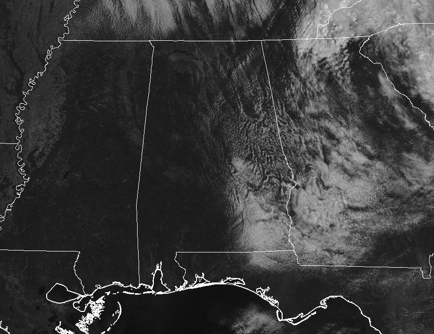
Skies are starting to clear out as what’s left of the cloud cover from Tropical Storm Micael continues to rotate out of here. The western half of the state is now enjoying clear skies while the eastern half have mostly clear conditions in the north to partly to mostly cloudy conditions in the south. Temperatures are currently ranging from the mid-60s to the upper 70s from northwest to southeast, with the warm spot being Auburn at 79 degrees. Birmingham was sitting at 73 degrees, while the cool spot was Haleyville at 66 degrees. We have a nice breeze out there as well, coming out of the northwest at 10-15 MPH.
A REFRESHING DAY FINALLY ACROSS CENTRAL ALABAMA
Skies are clearing out as I type this forecast package, and for the remainder of the day, skies will become clear with plenty of sunshine. We will be dry and much cooler with afternoon highs in the lower 70s in the northwest to the lower 80s in the southeast. Just wait… you are going to love tonight… We’ll have clear skies and very cool temperatures, with lows dipping into… are you ready for this… the mid-40s to the lower 50s. Woohoo! Now that is proper fall weather… just don’t mention pumpkin-spice anything to me.
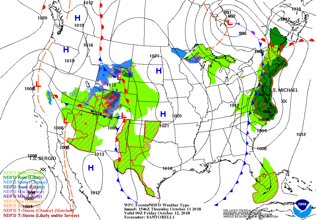
TROPICAL STORM MICHAEL NOW IN THE CAROLINAS
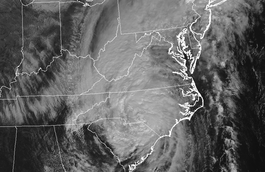
As of earlier this morning, Michael has continued to weaken as it moves northeastward over the Carolinas and the Virginias, but the threat of flooding rainfall is not over. With the ground remaining very saturated from Florence just a few weeks back, it will not take much for flooding to occur. That flooding threat will be the highest over the northern parts of South Carolina, much of North Carolina and Virginia, and up into Maryland, Delaware, and the southern half of New Jersey. Rainfall amounts will be in the 2-6 inch range, with some localized amounts up to 8 inches and higher possible. The good news is Michael will make it off of the coast and out over the Atlantic later this evening and will quickly race off to the northeast.
A GREAT FRIDAY FOLLOWED BY A NICE WEEKEND
I wouldn’t say it’s time to pull out the long sleeve flannel shirts just yet, but you will not have to wait that long to do that. Friday’s weather will be spectacular with plenty of sunshine and highs in the upper 60s to the mid-70s, with lows in the upper 40s to the mid-50. Then we start on a small and short-lived warming trend for the weekend as Saturday will be mainly sunny with highs in the lower to the upper 70s. Sunday will be warmer with highs in the mid-70s to the lower 80s, with a very small chance of an isolated shower or two mainly in the extreme northern parts of Central Alabama.
FRIDAY NIGHT’S HIGH SCHOOL FOOTBALL GAMES
The weather will be clear and cool with temperatures falling from the mid-60s at kickoff into the upper 50s by the final whistle.
SATURDAY’S COLLEGE FOOTBALL GAMES
Auburn hosts Tennessee at Jordan-Hare Stadium (11:00 am CDT kickoff). Skies will be mainly sunny, with temperatures rising from near 70 at kickoff, into the mid-70s by the fourth quarter.
Alabama will host Missouri (6:00 pm CDT kickoff) at Bryant-Denny Stadium. Expect clear skies with temperatures falling from the mid-70s at kickoff into the upper 60s by the end of the game.
UAB will travel to Houston to play Rice Saturday (12:00 pm CDT kickoff). Skies will be partly sunny with temperatures in the lower 80s at kickoff, and mid-80s by the second half.
THE TROPICS REMAIN VERY ACTIVE
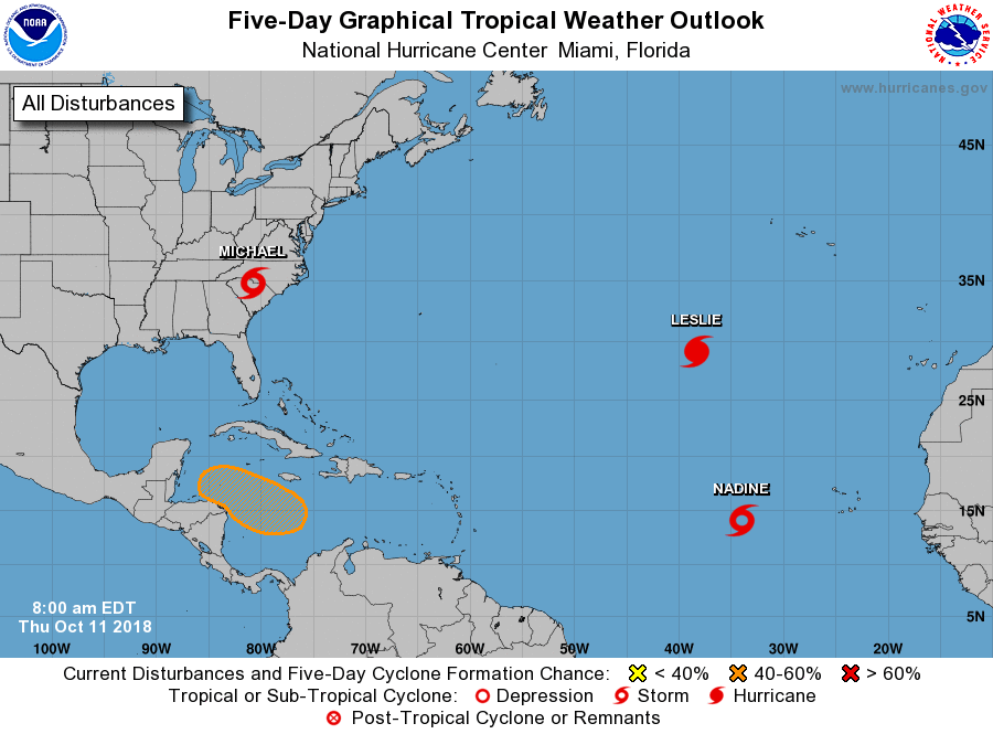
We talked about Tropical Storm Michael earlier, but we do have two other named storms out in the open Atlantic, and an area of interest in the Caribbean Sea. Nadine and Leslie remain out in the far eastern Atlantic and are no threat to land. The National Hurricane Center is giving the disturbance in the Caribbean a medium chance of some development over the next five days. The good news is that it seems it will stay away from the Gulf of Mexico and will be headed for Central America or Mexico.
BEACH FORECAST CENTER
Get the latest weather and rip current forecasts for the beaches from Fort Morgan to Panama City on our Beach Forecast Center page. There, you can select the forecast of the region that you are interested in.
CONNECT ON SOCIAL MEDIA
You can find the AlabamaWx Weather Blog on the major social media networks:
Facebook
Twitter
WE’RE HAVING A RECORD-BREAKING YEAR… ADVERTISE WITH US TODAY!
Don’t miss out! We have enjoyed over 16.2 million page views on AlabamaWx.com since the start of 2018. We can customize a creative, flexible and affordable package that will suit your organization’s needs. Contact Bill Murray at (205) 687-0782.
E-FORECAST
Get the Alabama Wx Weather Blog’s Seven-Day Forecast delivered directly to your inbox by email twice daily. It is the most detailed weather forecast available in Central Alabama. Subscribe here… It’s free!
WEATHERBRAINS:
Don’t forget you can listen to our weekly 90 minute netcast anytime on the web at WeatherBrains.com or on iTunes, Stitcher, or Spotify. This is the show all about weather featuring many familiar voices, including the meteorologists at ABC 33/40.
ON THIS DAY IN WEATHER HISTORY
1954 – A deluge of 6.72 inches of rain in 48 hours flooded the Chicago River, causing ten million dollars damage in the Chicago area.
Category: Alabama's Weather, ALL POSTS
About the Author (Author Profile)
Scott Martin is an operational meteorologist, professional graphic artist, musician, husband, and father. Not only is Scott a member of the National Weather Association, but he is also the Central Alabama Chapter of the NWA president. Scott is also the co-founder of Racecast Weather, which provides forecasts for many racing series across the USA. He also supplies forecasts for the BassMaster Elite Series events including the BassMaster Classic.Subscribe
If you enjoyed this article, subscribe to receive more just like it.


