Showers Affecting Much Of The Northern Half Of Alabama At Midday
CONDITIONS ACROSS CENTRAL ALABAMA AT 11:00 AM
Due to the NWS Birmingham radar (KBMX) being down for maintenance this week until Friday, I will be using a different radar app that is a mosaic of the southeast that will show all of the active radar sites. At this point, all of the shower activity has moved up into the northern parts of Central Alabama and up into a good bit of North Alabama.
Skies are mostly cloudy to cloudy for much of Alabama with mostly clear to sunny skies over the extreme southern and southeastern parts of the state. Temperatures are much cooler for locations behind the cold front, as we see mid-50s to the upper 60s north of the I-59/20 and I-20 corridors and lower 70s to the lower 80s south of that.
WEATHER FOR THE REMAINDER OF YOUR TUESDAY
The cold front will continue to work through the area today and by 7:00 PM this evening it should be located over the southeastern parts of the state. The best chances of rain will be along and north of the I-59/20 and I-20 corridors, around 80-100% from south to north. South of that, rain chances drop off, but there will be a chance of isolated to scattered showers and maybe a thunderstorm or two (20-40%). There will be a big range in afternoon highs due to the cold front, with 60s to the lower 70s in the northwest to the mid-70s to the mid-80s in the southeast. Those rain chances will continue to be highest over the northern-third of the area for tonight, with isolated to scattered showers possible in the south. Overnight lows will bottom out in the lower 50s to the mid-60s.
A FEW LEFTOVER SHOWERS REMAIN FOR YOUR WEDNESDAY
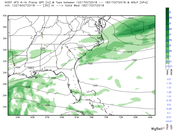
While the cold front will have moved completely through the state, but it will still be close over the western Florida Panhandle and up into southern parts of Georgia. We’ll continue to have a slight chance of a few isolated showers across the area on your “Hump Day.” Those shower chances will be highest over the northern half during the morning hours, but those will transition to the south by the afternoon and evening hours. Afternoon highs will be in the mid-60s to the lower 80s from northwest to southeast. We should be rain free throughout Central Alabama after the sun sets and skies will become partly cloudy for the most part. Overnight lows will be in the 40s and 50s.
HOW ABOUT THE TROPICS
We have a disturbance that could briefly become a tropical depression before it moves onshore in Belize later this evening, but will quickly weaken once it moves inland. The rest of the tropics are relatively quiet at this point. The Atlantic Hurricane Season doesn’t end until November 30th, so we’ll have to continue to keep watch until then.
BEACH FORECAST CENTER
Get the latest weather and rip current forecasts for the beaches from Fort Morgan to Panama City on our Beach Forecast Center page. There, you can select the forecast of the region that you are interested in.
CONNECT ON SOCIAL MEDIA
You can find the AlabamaWx Weather Blog on the major social media networks:
Facebook
Twitter
WE’RE HAVING A RECORD-BREAKING YEAR… ADVERTISE WITH US TODAY!
Don’t miss out! We have enjoyed over 16.3 million page views on AlabamaWx.com since the start of 2018. We can customize a creative, flexible and affordable package that will suit your organization’s needs. Contact Bill Murray at (205) 687-0782.
E-FORECAST
Get the Alabama Wx Weather Blog’s Seven-Day Forecast delivered directly to your inbox by email twice daily. It is the most detailed weather forecast available in Central Alabama. Subscribe here… It’s free!
WEATHERBRAINS
Don’t forget you can listen to our weekly 90 minute netcast anytime on the web at WeatherBrains.com or on iTunes, Stitcher, or Spotify. This is the show all about weather featuring many familiar voices, including the meteorologists at ABC 33/40.
ON THIS DAY IN WEATHER HISTORY
1988 – Late afternoon thunderstorms produced severe weather in southwestern Lower Michigan and northern Indiana. One thunderstorm spawned a tornado north of Nappanee IN which caused half a million dollars damage. Six cities in California reported record high temperatures for the date. The afternoon high of 100 degrees at Red Bluff CA was the latest such reading of record for so late in the autumn season.
Category: Alabama's Weather, ALL POSTS


