A Nice Fall Day Across Central Alabama; Tomorrow, Not So Much
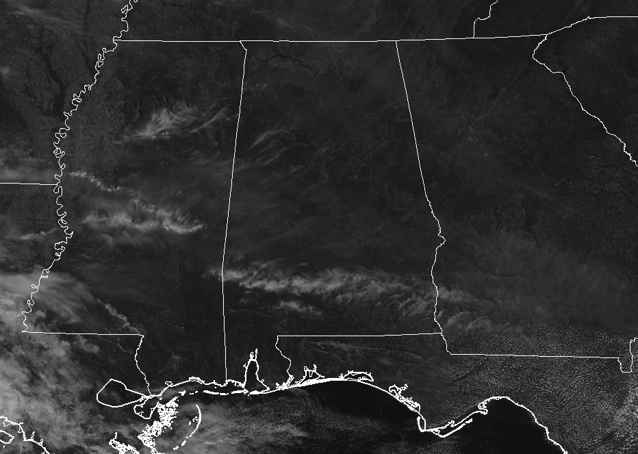
As we have really nice conditions across Central Alabama at this midday hour, we are now lees than 24-hours away from our next rain-making system. Other than those high and wispy cirrus clouds floating well up in the skies, we have a good bit of sunshine and temperatures running in the mid-60s to the lower 70s as of 12:30 PM. Birmingham was sitting at 72 degrees, just one degree behind the warm spot of Tuscaloosa at 73 degrees. Cullman is the cool spot at 65 degrees.
A non-tropical low is expected to move off of the coast and over the Gulf of Mexico later this evening, not associated with the remnants of Willa, that will bring showers to Central Alabama on Thursday and Friday. That low will not affect our weather for the remainder of today as we can expect to have mostly sunny skies through sunset, with highs topping out in the lower to mid-70s. Clouds will be on the increase later tonight and through the overnight hours, and a few showers may move into the southwestern parts of the area just before sunrise. Overnight lows will be in the upper 40s to the mid-50s.
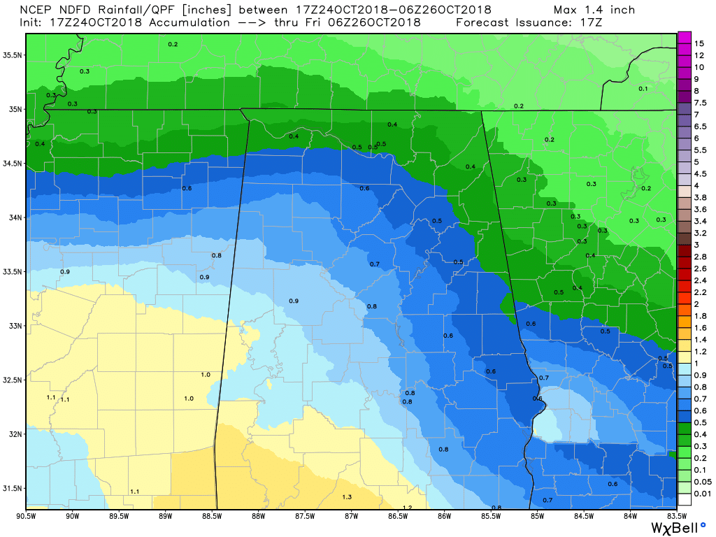
Thursday will be a cool and damp day, especially during the afternoon and into the evening hours, as that low will be stationed just along the Gulf Coast to our south sending moisture up in our direction. Rainfall amounts throughout the area will range from a little under 1/2-inch in the extreme northeastern parts to just around or slightly over 1 inch in the southwestern parts. There is the small possibility of a few claps of thunder, but no stronger storms are expected. Afternoon highs will be in the upper 50s for the most part, with a location or two briefly touching the lower 60s in the extreme southeastern parts of Central Alabama.
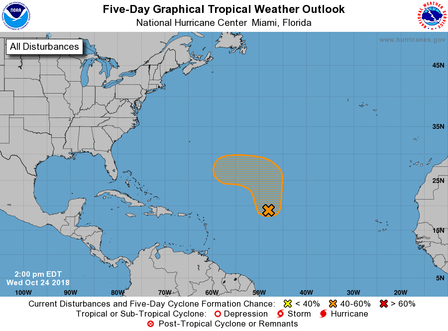
And just when we thought things would be quieting down in the tropics, we have a new disturbance out there in the Central Atlantic that the NHC is giving a 60% chance of developing into a tropical cyclone within the next 5 days. It is forecast to move northward for the next couple of days before moving into a more likely environment for development, then will make a turn to the west. It’s still too far out to be specific on details, but we’ll keep an eye on it. After all, hurricane season doesn’t end for another month.
Category: Alabama's Weather, ALL POSTS
About the Author (Author Profile)
Scott Martin is an operational meteorologist, professional graphic artist, musician, husband, and father. Not only is Scott a member of the National Weather Association, but he is also the Central Alabama Chapter of the NWA president. Scott is also the co-founder of Racecast Weather, which provides forecasts for many racing series across the USA. He also supplies forecasts for the BassMaster Elite Series events including the BassMaster Classic.Subscribe
If you enjoyed this article, subscribe to receive more just like it.


