Cloudy & Cool With Plenty Of Showers At Midday
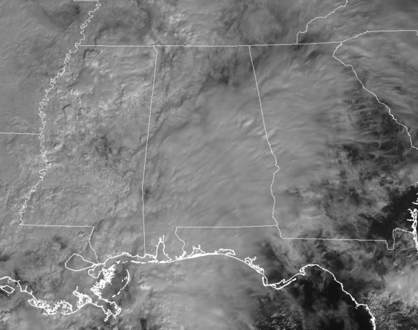
You are considered very lucky if you are seeing any breaks of sunshine at this point on your Thursday at midday, as nearly all of Central Alabama is covered completely in clouds.
Much of the shower activity at this point is located south of the I-20 and I-59/20 corridors, while some heavier showers are invading the northwestern parts of the area, especially in northern Lamar County and up into western Marion County. All of the activity is moving off to the east-northeast around 35-40 MPH. No lightning is showing on radar at this point.
Temperatures are running in the upper 50s to the lower 60s across Central Alabama, with Eufaula being classified as the warm spot at 62 degrees. Birmingham and Tuscaloosa are both reporting 61 degrees, and both Sylacauga and Alexander are tied at 54 degrees as the cool spots.
We’ll continue to have scattered to numerous showers throughout the area for the remainder of the afternoon and into the early evening hours. There may be a few claps of thunder, but there are no worries for any strong to severe storms in Central Alabama. Rainfall will be light to moderate at times, but you may catch a few breaks in the rain. Afternoon highs will top out in the upper 50s to the mid-60s from northwest to southeast. Those shower chances will continue through the overnight and into the early morning hours on Friday. A few claps of thunder may be possible prior to 10:00 PM, but there is no threat of strong or severe storms. Overnight lows dip into the upper 40s to the upper 50s from north to south. Rainfall amounts through the day will range from 1/4 inch in the southeast to around 1 inch close to the Mississippi state line. We should see around 1/2 inch of rainfall in Birmingham.
Friday will feature that shower activity beginning to move out of the area as the heavier amounts will be in the northeastern parts of the area. We may have a few spotty showers left over during the early evening and into the overnight hours, but those should be confined to the extreme northern parts of Central Alabama. Highs will top out in the upper 50s to the upper 60s from north to south, with lows falling into the mid-40s to the lower 50s.
THE TROPICS
We’ll have the likely formation of a tropical or subtropical storm within the next couple of days that will get the name of Oscar. It will drift westward before getting pushed back out to the northeast by a deep upper trough by this weekend. The rest of the Atlantic Basin is quiet at this point.
BEACH FORECAST CENTER
Get the latest weather and rip current forecasts for the beaches from Fort Morgan to Panama City on our Beach Forecast Center page. There, you can select the forecast of the region that you are interested in.
CONNECT ON SOCIAL MEDIA
You can find the AlabamaWx Weather Blog on the major social media networks:
Facebook
Twitter
WE’RE HAVING A RECORD-BREAKING YEAR… ADVERTISE WITH US TODAY!
Don’t miss out! We have enjoyed over 16.6 million page views on AlabamaWx.com since the start of 2018. We can customize a creative, flexible and affordable package that will suit your organization’s needs. Contact Bill Murray at (205) 687-0782.
E-FORECAST
Get the Alabama Wx Weather Blog’s Seven-Day Forecast delivered directly to your inbox by email twice daily. It is the most detailed weather forecast available in Central Alabama. Subscribe here… It’s free!
WEATHERBRAINS:
Don’t forget you can listen to our weekly 90 minute netcast anytime on the web at WeatherBrains.com or on iTunes, Stitcher, or Spotify. This is the show all about weather featuring many familiar voices, including the meteorologists at ABC 33/40.
Category: Alabama's Weather, ALL POSTS


