Nearly Perfect Weather For Your Sunday
October is known for some pretty fine weather in Alabama, and we will enjoy some examples of this over the next three days. Our first potential severe weather threat will occur Wednesday just in time for Halloween unfortunately.
PERFECT WEATHER WARNING FOR TODAY: We don’t get to issue them very often here in Central Alabama, although we have great weather all in all here. But today, mostly sunny skies, a few clouds, warm temperatures in the 70s, comfortable dewpoints in the 50s and a nice southwesterly breeze will make for a nice day. A dry cold front will come through tonight, pushing overnight lows back into the 40s.
MONDAY AND TUESDAY: Ridging will build over Alabama for Monday and Tuesday. This means warm and dry weather. Highs will warm well into the 70s to near 80F in spots over South Central Alabama. Lows Tuesday and Wednesday mornings will be in the 50s.
TRICK OR TREAT WEATHER: Wednesday will feature a moistening atmosphere across Central Alabama, with humidity levels rising ahead of a trough of low pressure moving out of the Plains states. The day should be mainly dry, although a few showers will show up by late afternoon. This could jeopardize trick or treating activities Wednesday night if the showers come in earlier and more widespread than expected. Highs on Wednesday will be In the upper 70s to near 80F.
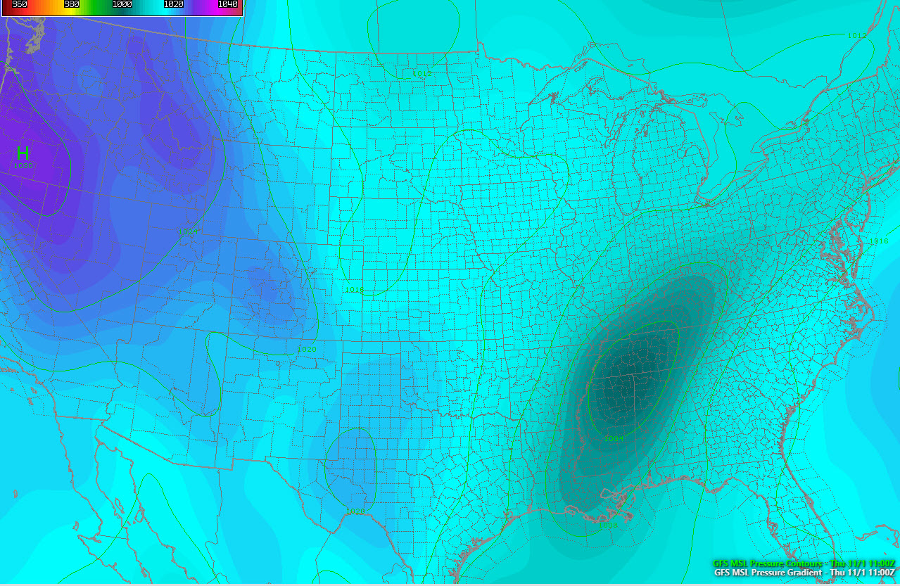
THURSDAY STORMS: Low pressure should form over the Deep South late Wednesday night into Thursday morning. As this low moves northeast to near Nashville, it will produce storms in the warm sector. It could be a low instability, high shear event that will be capable of severe weather, including the threat of tornadoes. It is too early to say whether this severe weather threat will be significant, but suffice to say, everyone should monitor later forecasts and severe weather risks. The rain should end by Thursday evening, although a few showers will remain in the forecast into Friday morning. Highs on Thursday will top out near 70F. Friday readings will be in the middle 60s, but the mercury will struggle to get out of the 50s on Saturday and Sunday. Lows will be in the 40s Friday morning and 30s Saturday and Sunday morning.
RAINFALL AMOUNTS: Rain amounts this week will range from 2 inches over the Tennessee Valley to between one half and one inch over Central Alabama.
VOODOO TERRITORY: Another storm system will bring a big wet weather system to Alabama and the Deep South by Sunday night the 11th and Monday the 12th.
TROPICAL STORM OSCAR: The 15th named storm of the North Atlantic Hurricane Season formed Friday evening as a subtropical storm. It made the transition today to a full-blown, warm core tropical storm and it will go on to become a hurricane Sunday night. It is turning to the west and will turn northwest on Monday before turning northeast out to sea by early Tuesday. It will accelerate northeastward over the open ocean Wednesday and Thursday. It is no threat to any land areas.
GULF COAST WEATHER: Nearly perfect weather along the beautiful beaches of Alabama and Northwest Florida this week as strong subtropical high pressure to the east holds sway until midweek. Then, the same front that will bring us rain and storms will do the same for the coast. The best chances for rain will come Wednesday evening until Thursday afternoon. Highs will be in the 70s to near 80F all week, but trending cooler at the end of the week and into the weekend. Lows will be in the 50s and 60s. The rip currents will be on the increase for Wednesday and Thursday. In fact, the risk will be extreme according to our modeling on Thursday. Not that you would want to go in anyway. Water temperatures have fallen to 68F at Dauphin Island.
Click here to see the Beach Forecast Center page.
WEATHERBRAINS: This week, the panel entertained the indefatigable Joe Bastardi. I think they asked him three questions, and he talked for an hour! It was great! Check out the show at www.WeatherBrains.com. You can also subscribe on iTunes. You can watch the show live at live.bigbrainsmedia.com You will be able to see the show on the James Spann 24×7 weather channel on cable or directly over the air on the dot 2 feed.
ON THIS DATE IN 1991: An extratropical low-pressure system formed on a cold front off the East Coast of the United States. The system would grow into a monster storm that would wreak havoc along the East Coast. It would bring record high tides, hurricane-force gusts and 30-foot waves from North Carolina to Maine. It is believed that the swordfishing boat Andrea Gail went down at some point on the 28th. The event was told by Sebastian Junger in his book The Perfect Storm, the name given to the huge cyclone. Follow my weather history tweets on Twitter. I am @wxhistorian at Twitter.com.
Category: Alabama's Weather, ALL POSTS
About the Author (Author Profile)
Bill Murray is the President of The Weather Factory. He is the site's official weather historian and a weekend forecaster. He also anchors the site's severe weather coverage. Bill Murray is the proud holder of National Weather Association Digital Seal #0001 @wxhistorianSubscribe
If you enjoyed this article, subscribe to receive more just like it.


