A Brief Check On The Weather Just Before 6:15 AM
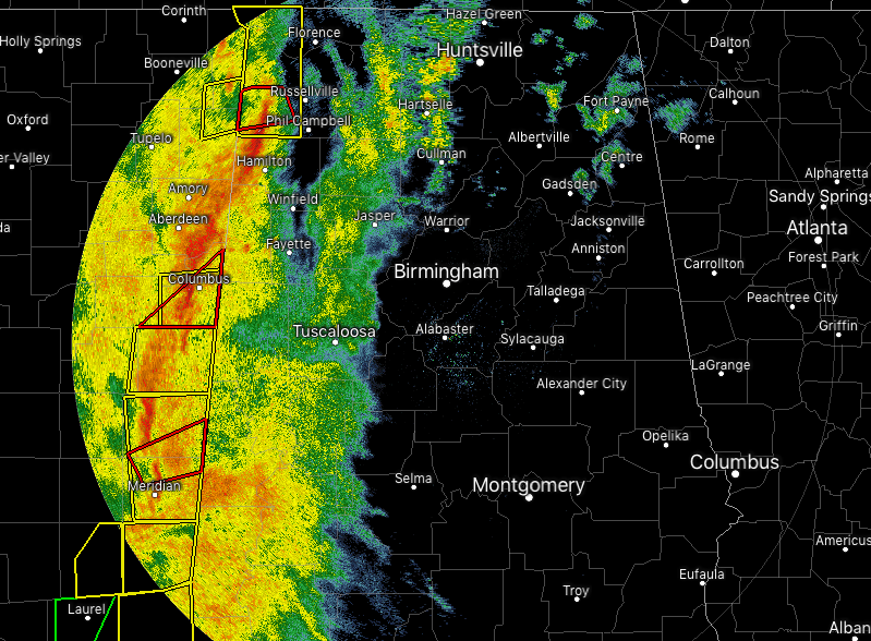
Radar at 6:02 AM shows a line of strong to severe thunderstorms about to move across the Mississippi state line into the western parts of North and Central Alabama.
A Tornado Warning is currently in effect for parts of Franklin County until 6:15 AM as a tornado has been confirmed located over Red Bay and moving east at 50 MPH. Locations in the path are Red Bay, Belgreen, Pleasant Site, Pogo, Cedar Creek Reservoir, Dempsey, Halltown, Little Bear Creek Reservoir.
A Severe Thunderstorm Warning is currently in effect for Colbert, Franklin, and Lauderdale counties until 7:00 AM.
We’ll have a threat of damaging winds and a couple of tornadoes throughout the morning hours and into the early afternoon hours. The western parts of the area will see strong to severe storms from now until around 10:00 AM, the central parts from 9:00 AM to 12:00 PM, and the eastern parts from 11:00 AM to 2:00 PM.
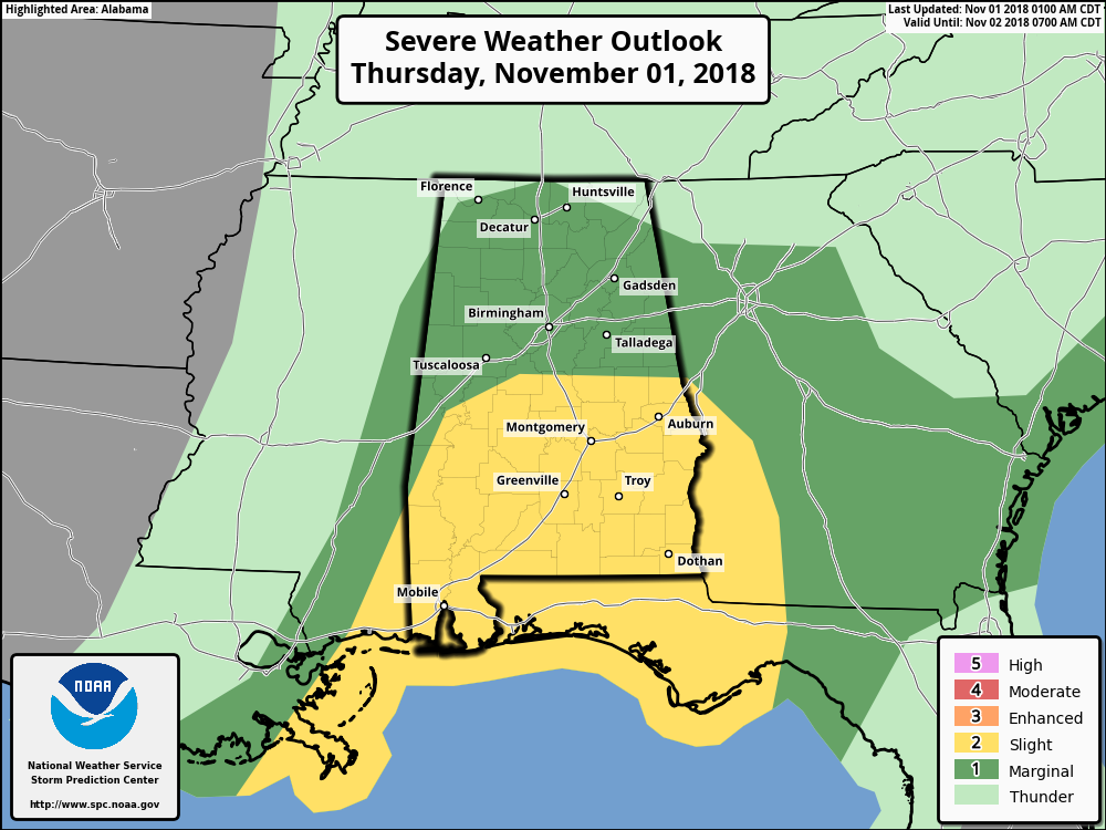
SPC continues to have the southern half of the state in a Slight Risk for severe storms through today, while the northern half is in a Marginal Risk. The greater threat for severe storms today will be over the southern half of the state where the instability will be greatest, but there is enough in the northern half that could warrant a few warnings as well.
Be sure to have your severe weather plan and supplies ready to go if your location goes under a warning. We’ll keep you posted throughout the day on the blog.
Category: Alabama's Weather, ALL POSTS
About the Author (Author Profile)
Scott Martin is an operational meteorologist, professional graphic artist, musician, husband, and father. Not only is Scott a member of the National Weather Association, but he is also the Central Alabama Chapter of the NWA president. Scott is also the co-founder of Racecast Weather, which provides forecasts for many racing series across the USA. He also supplies forecasts for the BassMaster Elite Series events including the BassMaster Classic.Subscribe
If you enjoyed this article, subscribe to receive more just like it.


