A Brief Check On Our Weather At 7:00 AM
As of 7:00 AM, we have no active warnings across North and Central Alabama. A Tornado Watch continues in effect for much of the area until 1:00 PM this afternoon.
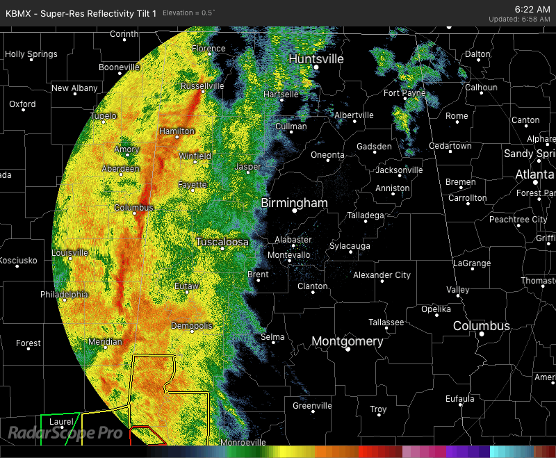
The system that we have moving through North and Central Alabama today is called a Pre-Frontal QLCS (Quasi-Linear Convective System). To put that in layman’s terms, it is a line of storms that is out ahead of a front. The QLCS has moved into the western parts of the area and will progress to the east and exit the eastern locations around 2:00 PM this afternoon.
The good news at this point is that the potential for stronger wind gusts may be lower at this time due to drier conditions in the eastern parts of the area.
This system should act like so many other fall severe weather systems… instability is expected to lessen and become more limited throughout the day, and become pinched into a more narrow zone as the line moves across the area. While instability will be limited in the northern parts of the area, instability values in the 400-700 J/kg range will be present south of a line from roughly Tuscaloosa to Jemison to Auburn. That environment will be highly sheared and convection will be low-topped, leading to the threat of a brief tornado or two and isolated damaging wind gusts. The threat is there for the northern half of the area, but will be much less than the south.
Category: Alabama's Weather, ALL POSTS
About the Author (Author Profile)
Scott Martin is an operational meteorologist, professional graphic artist, musician, husband, and father. Not only is Scott a member of the National Weather Association, but he is also the Central Alabama Chapter of the NWA president. Scott is also the co-founder of Racecast Weather, which provides forecasts for many racing series across the USA. He also supplies forecasts for the BassMaster Elite Series events including the BassMaster Classic.Subscribe
If you enjoyed this article, subscribe to receive more just like it.


