A Brief Check On Our Weather Just Before 8:00 AM
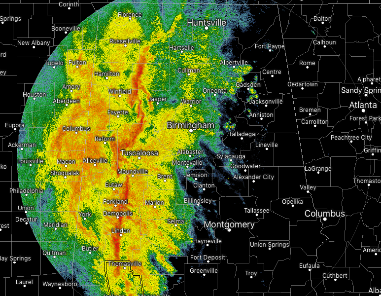
As of 7:50 AM, the QLCS continues to push eastward across the state, with the heaviest activity stretching from Moulton to Berry to Demopolis. Wind gusts up to 40 MPH are possible along the line, but we will continue to watch for any bowing segments and brief spin-up tornadoes embedded within the line.
There are no active warnings in North and Central Alabama at this point, but we still have the threat of strong to severe storms across the area. Damaging wind gusts will be the main threat, with an isolated spin-up tornado or two being a lesser threat.
So far, we have received just a few damage reports this morning across North and Central Alabama. One is for a tree down on AL 187 just northeast of the Hodges community in Franklin County. Another is for trees down around Red Bay, also in Franklin County. Also, a tree was reported down on CR 22 and Kasmeier Road in the Saint Florian community in Lauderdale County.
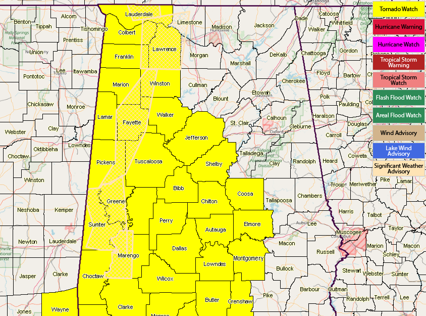
Both National Weather Service Offices in Huntsville and Birmingham are already considering cancelling a few counties from the tornado watch after the QLCS passes through. NWS Huntsville is actually talking about removing all of their counties from the watch (Lauderdale, Colbert, Franklin, Lawrence) as soon as the line passes through.
We’ll continue to keep you updated throughout the day on the blog.
Category: Alabama's Weather, ALL POSTS
About the Author (Author Profile)
Scott Martin is an operational meteorologist, professional graphic artist, musician, husband, and father. Not only is Scott a member of the National Weather Association, but he is also the Central Alabama Chapter of the NWA president. Scott is also the co-founder of Racecast Weather, which provides forecasts for many racing series across the USA. He also supplies forecasts for the BassMaster Elite Series events including the BassMaster Classic.Subscribe
If you enjoyed this article, subscribe to receive more just like it.


