Just Before 9:00 AM: Line Of Storms About To Push Into Western Jefferson County
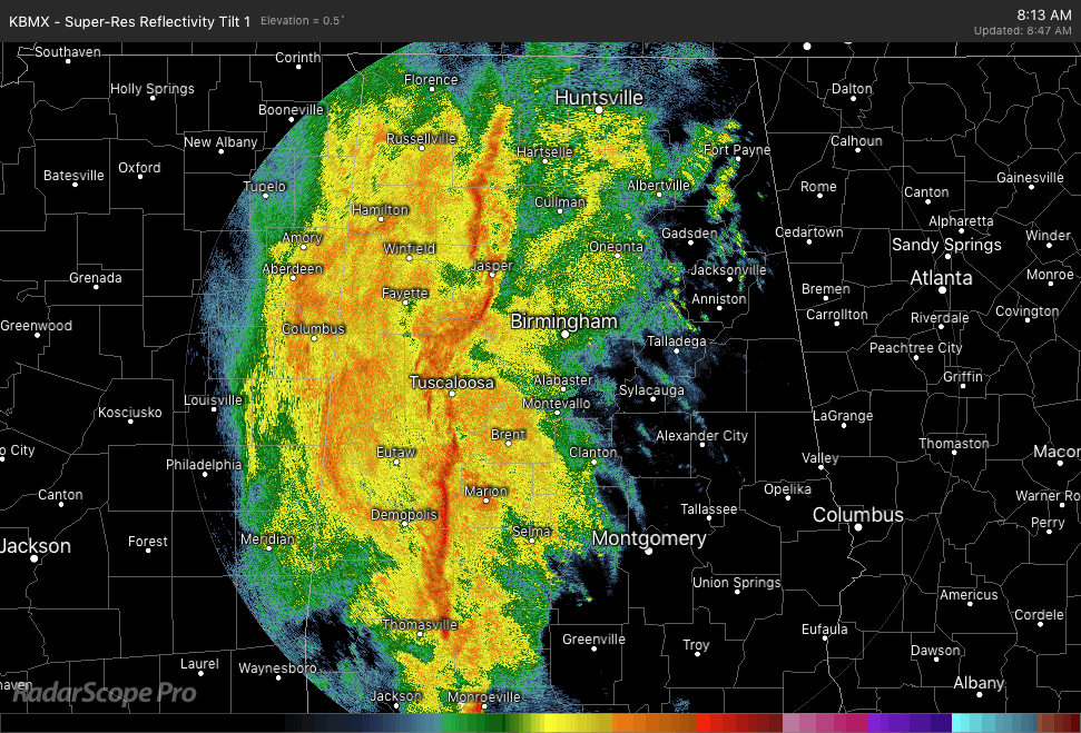
The QLCS continues to push across Central Alabama and will soon move into the western parts of Jefferson County. There is really no lightning showing up at this time, but you can expect some gusty winds and heavy rainfall as the line moves over your location.
The strongest part of the line is currently located from Lake View down to Brent and Marion and tapers off just south of Orrville. Wind gusts up to and possibly over 40 MPH can be expected with this segment of the QLCS.
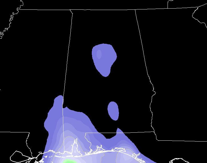
Instability (CAPE) Values
Instability values across North and Central Alabama are not all that impressive, with only 100-200 J/kg of CAPE showing in the central part of the area. Higher values are down to the south as expected, with values ranging from 100-800 J/kg (highest values along the Gulf Coast).
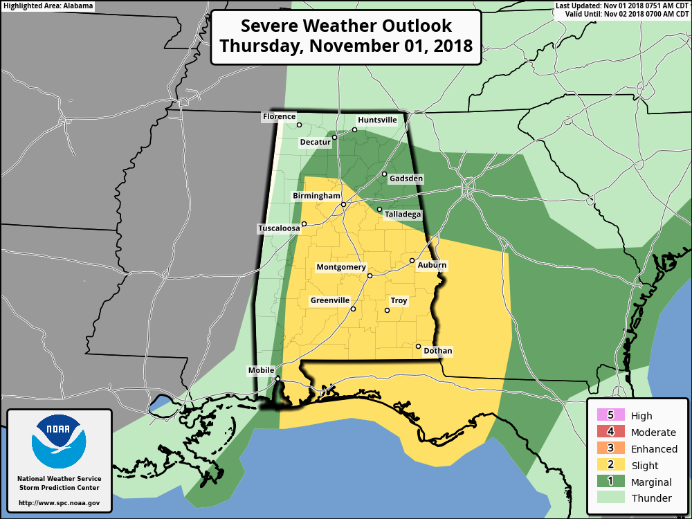
No severe weather warnings are currently in effect for North and Central Alabama at this time, but we still have a Slight Risk for severe storms throughout the remainder of the morning and into the afternoon hours for a good portion of Central Alabama, with a Marginal Risk immediately surrounding the Slight Risk.
As this is a high-shear/low-instability QLCS event, the potential for quick spin-up tornadoes and damaging gusts in embedded bowing segments remain possible in the Slight Risk area, with the highest potential for those in the extreme southern parts of the area (along and south of US 80 and I-85).
Just continue to have your severe weather safety plan and supplies ready to go just in case your locations goes under a warning. Have those batteries charged in your smartphones and new batteries in your flashlights and NOAA WeatherRadios.
We’ll continue to keep you posted throughout the day on the blog.
Category: Alabama's Weather, ALL POSTS
About the Author (Author Profile)
Scott Martin is an operational meteorologist, professional graphic artist, musician, husband, and father. Not only is Scott a member of the National Weather Association, but he is also the Central Alabama Chapter of the NWA president. Scott is also the co-founder of Racecast Weather, which provides forecasts for many racing series across the USA. He also supplies forecasts for the BassMaster Elite Series events including the BassMaster Classic.Subscribe
If you enjoyed this article, subscribe to receive more just like it.


