Severe Threat Over For Western Half Of North & Central Alabama
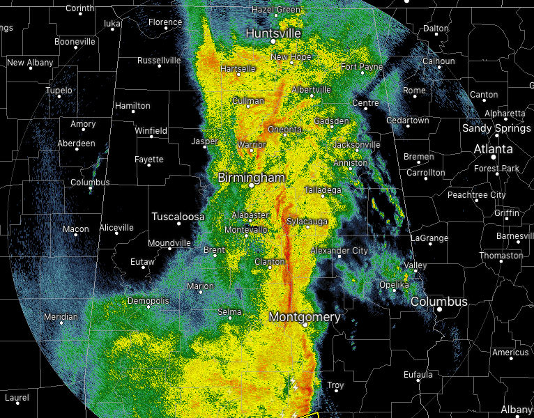
For most along and west of the I-65 corridor in North and much of Central Alabama, the severe weather threat is over for your location. East of that the window for stronger storms will be from now until roughly 2:00 PM this afternoon.
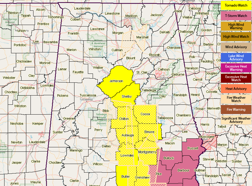
NWS Birmingham continues to shave counties off from the western side of the Tornado Watch that expires at 1:00 PM, as the next batch of counties will be coming off shortly. A Severe Thunderstorm Watch continues for the southeastern parts of the area until 2:00 PM.
There is still a threat of a few isolated damaging wind gust along the line of storms, with a smaller threat of a brief spin-up tornado. Instability is continuing to slowly increase over the east-central and southeastern parts of the area, and with the high-shear environment in place, those threats will continue until the main part of the QLCS pushes out of the state and into Georgia.
Category: Alabama's Weather, ALL POSTS
About the Author (Author Profile)
Scott Martin is an operational meteorologist, professional graphic artist, musician, husband, and father. Not only is Scott a member of the National Weather Association, but he is also the Central Alabama Chapter of the NWA president. Scott is also the co-founder of Racecast Weather, which provides forecasts for many racing series across the USA. He also supplies forecasts for the BassMaster Elite Series events including the BassMaster Classic.Subscribe
If you enjoyed this article, subscribe to receive more just like it.


