Moderate Rainfall Continues Over Central Alabama, Severe Storms Possible In South Alabama
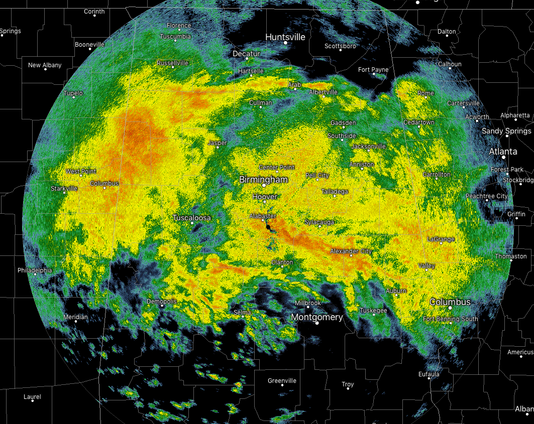
Plenty of moderate to heavy rain continues to fall across Central Alabama as of 9:00 am on this Monday morning, and that trend looks to continue through much of the day. The latest run of the HRRR is showing that the heavier rain activity should be out of the Tuscaloosa area by the 5:00-7:00 pm window, out of the Birmingham metropolitan area by the 7:00-9:00 pm time frame, and out of the state by the 10:00 pm-12:00 am window.
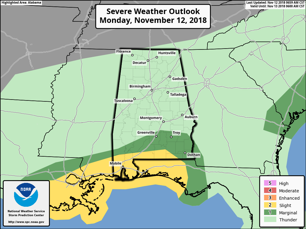
The good news is that there is no threat of organized severe weather across nearly the entire Central Alabama area, with the exception of the extreme southeastern corner. Much of Pike and Bullock counties, along with a small sliver of extreme southern Lowndes and Montgomery counties have been included in a Marginal Risk (level 1 out of 5) along with a large portion of South Alabama. A Slight Risk (level 2 of 5) has been defined for the extreme south and southwestern parts of the state. The main threat in these areas will be from the formation of supercells that may include isolated damaging wind gusts, but an isolated tornado or two cannot be ruled out. For that reason, a Tornado Watch is currently in effect for Mobile and Baldwin counties, along with the extreme southern parts of Louisiana and Mississippi, and the extreme western counties of the Florida panhandle, until 12:00 pm CST.
With that being said, don’t be surprised if you hear a few claps of thunder out there across Central Alabama throughout the day, especially over the southeastern portions of the area.
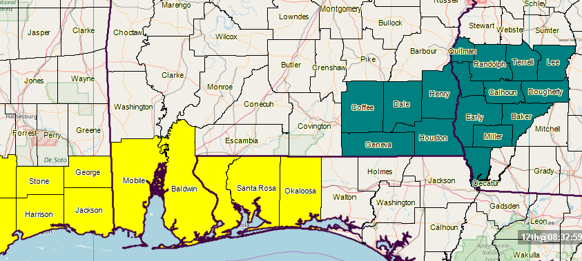
Also with the threat of continuous heavy rainfall over the southern parts of the state, NWS Tallahassee has issued a Flash Flood Watch for Coffee, Dale, Henry, Houston, and Geneva counties in the southeastern corner of the state until 6:00 pm CST this evening.
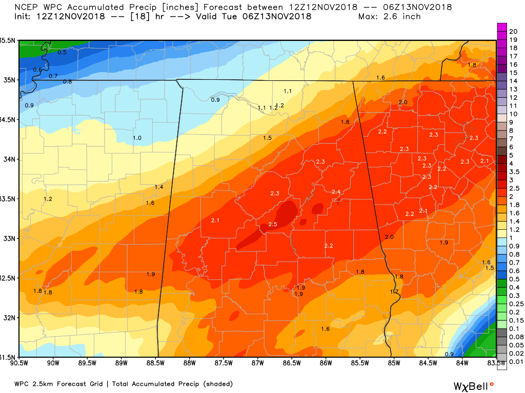
With the amount of rain that is expected to fall over Central Alabama, we could see some localized flooding issues. The WPC is still painting rainfall totals from 1.50-2.50 inches across the area through midnight tonight.
Category: Alabama's Weather, ALL POSTS
About the Author (Author Profile)
Scott Martin is an operational meteorologist, professional graphic artist, musician, husband, and father. Not only is Scott a member of the National Weather Association, but he is also the Central Alabama Chapter of the NWA president. Scott is also the co-founder of Racecast Weather, which provides forecasts for many racing series across the USA. He also supplies forecasts for the BassMaster Elite Series events including the BassMaster Classic.Subscribe
If you enjoyed this article, subscribe to receive more just like it.


