Slight Risk For Severe Storms For Extreme Southeastern Parts Of Central Alabama
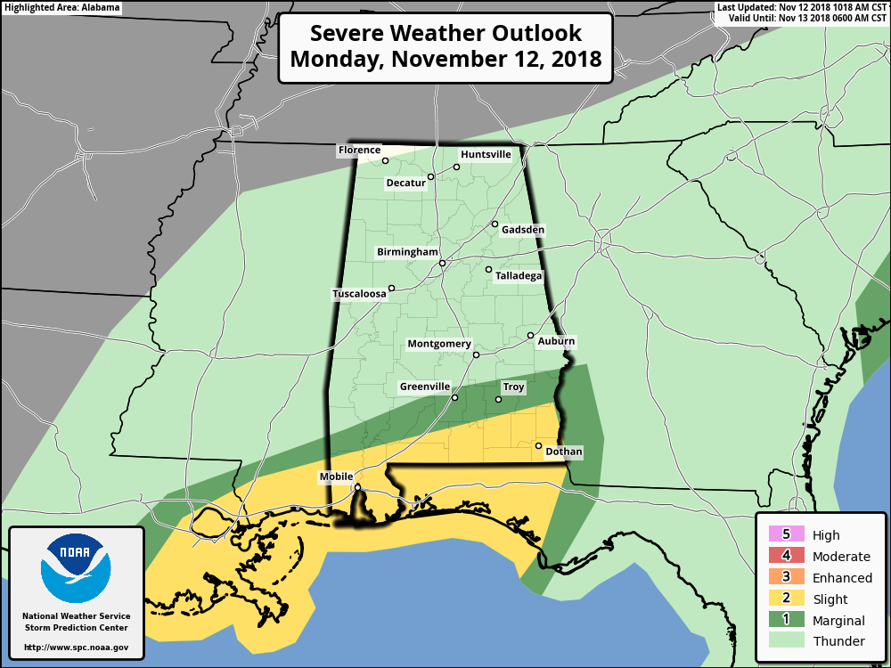
The latest update of the Day 1 Severe Weather Outlook graphic from the Storm Prediction Center was just released, and the Slight Risk (level 2 of 5) has been expanded farther to the north to now include the extreme southern portion of Barbour County (including Blue Springs), and the extreme southeastern corner of Pike County. The Slight Risk now includes locations south of a line from Citronelle to Dozier to Blue Springs.
The Marginal Risk (level 1 of 5) has been expanded northward as well, and now includes the area north of the slight risk stretching as far as Jackson (Greene Co.) to Pine Apple (Wilcox Co.) to Fort Deposit (Lowndes Co.) to just south of Hurtsboro (Russell Co.).
A warm front is moving slowly to the north along the Gulf Coast and the possibility of supercellular thunderstorm development continues through the remainder of the daylight hours and into the evening. A few of those supercells will have the possibility of rotating, especially those that form along and south of the warm front. Isolated damaging winds and a brief tornado or two may be possible.
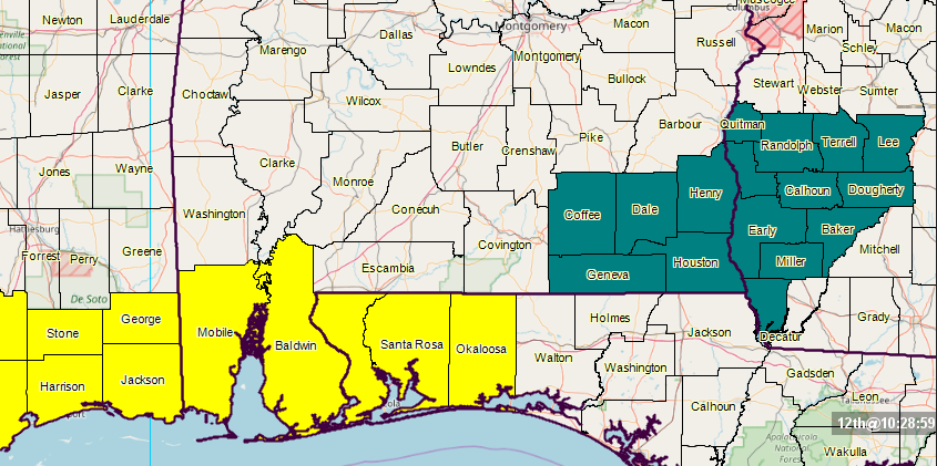
A Tornado Watch continues for Mobile and Baldwin counties until 12:00 pm CST today. A Flash Flood Watch continues for Coffee, Dale, Henry, Houston, and Geneva counties until 6:00 pm CST Tuesday.
Category: Alabama's Weather, ALL POSTS
About the Author (Author Profile)
Scott Martin is an operational meteorologist, professional graphic artist, musician, husband, and father. Not only is Scott a member of the National Weather Association, but he is also the Central Alabama Chapter of the NWA president. Scott is also the co-founder of Racecast Weather, which provides forecasts for many racing series across the USA. He also supplies forecasts for the BassMaster Elite Series events including the BassMaster Classic.Subscribe
If you enjoyed this article, subscribe to receive more just like it.


