A Picture Tells a Thousand Words
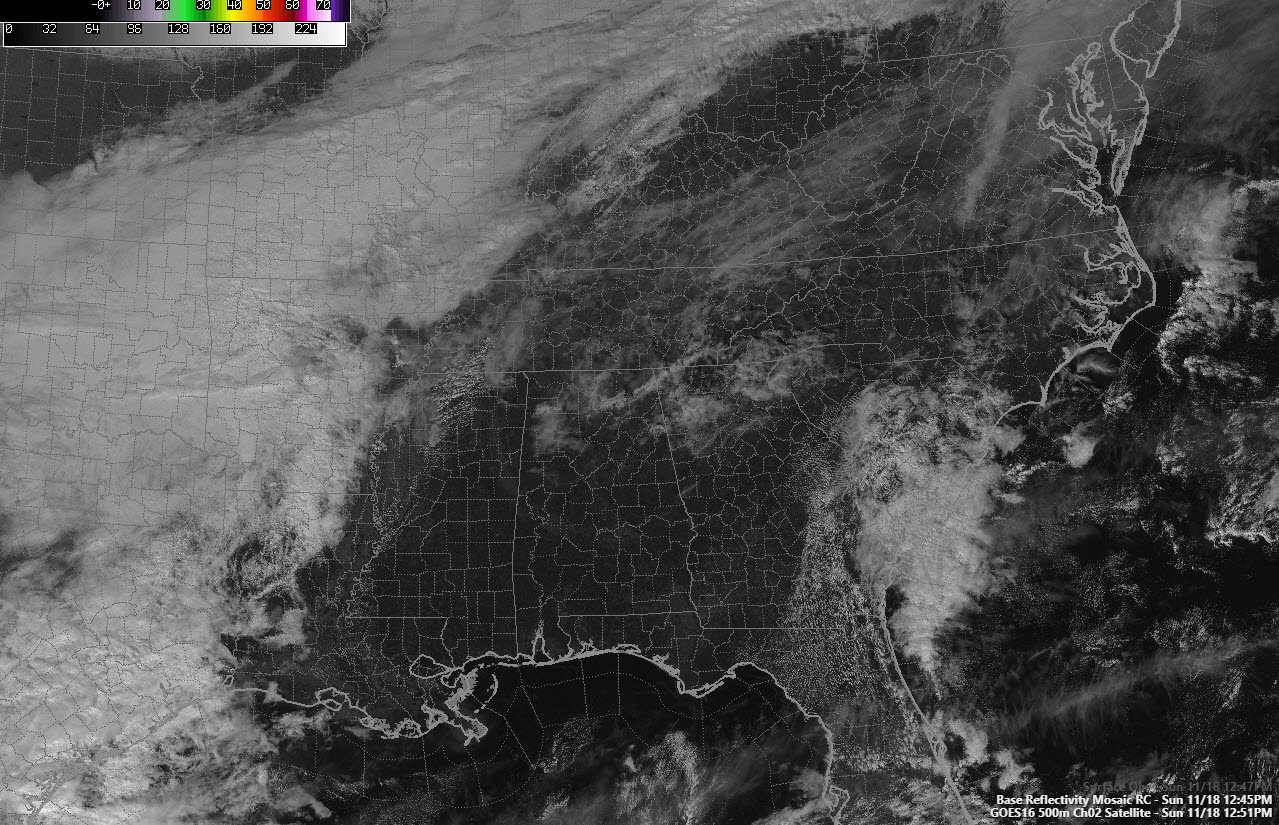
Here is the visible satellite image from this afternoon over the eastern half of the United States. Lots of interesting features that we can pick out.
Alabama is mostly sunny except for high clouds over the northern part of the state. Those clouds are associated with the southern flank of an upper trough sliding through the Ohio Valley to the north.
You can see moisture increasing to west over western Tennessee and northwestern Mississippi in the flow ahead of the trough.
To the west, thicker clouds well back into Texas and Oklahoma. Showers are present over Arkansas, evident in the textured clouds showing up there. Additional showers are showing up over southeastern Texas.
You can see moisture surging northward over northern Florida and southeastern Georgia in the flow on the back side of a little ridge of high pressure off Jacksonville.
Temperatures are in the 60s across Alabama.
Lows tonight will be in the 40s.
Showers will approach Northwest Alabama sometime between late morning and mid-afternoon. They will spread into West Central Alabama by late afternoon. They will overspread the rest of Central Alabama during the evening.
A cold front will push through the area Monday night, setting up clearing skies and slightly cooler conditions for Tuesday. Wednesday and Thursday will be fair and cool. Rain will return on Friday.
Category: Alabama's Weather, ALL POSTS
About the Author (Author Profile)
Bill Murray is the President of The Weather Factory. He is the site's official weather historian and a weekend forecaster. He also anchors the site's severe weather coverage. Bill Murray is the proud holder of National Weather Association Digital Seal #0001 @wxhistorianSubscribe
If you enjoyed this article, subscribe to receive more just like it.


