A Quick Look at the Alabama Weather Situation Early This Morning: Severe Storms Possible Today
Scott will have the video shortly, but here is a quick look at current conditions across Alabama early on this Saturday morning.
A large mass of rain is moving across the state at this hour. Heavy rain covers much of the Greater Birmingham area, extending up I-59 toward Fort Payne down through Etowah, Calhoun, and Cleburne Counties. Moderate to heavy rain extends back southwest to the Selma area.
The only lightning in the state is over far South Alabama.
A large mass of storms is over the northern Gulf south of the Florida Panhandle affecting areas from Panama City to the east.
To the northwest, a strong low-pressure system is over the Oklahoma/Texas border. A cold front is pushing through Arkansas and Louisiana. Strong storms are occurring ahead of the front over southeastern Arkansas.
Over Central Mississippi, a weakening storm is passing between Jackson and Columbus.
The surface low is being powered by an unusually potent upper-level trough over the Plains. A strong low-level jet is pumping warm, moist Gulf air northward this morning. It is also providing strong speed shear as well. That surface low is providing southeasterly winds over Alabama and Mississippi, which sets up favorable directional shear. The SPC recently mentioned that a tornado watch might be possible for parts of southeastern Mississippi and southern Alabama as well as the Florida Panhandle.
For later today, rain and storms will continue to move across much of the state into early afternoon. There should be a break in the early afternoon when dwpoints will climb into the upper 60s to near 70F from Tuscaloosa/Birmingham to Mongomery and Dothan as the maritime warm front moves northward.
Instability values will be high in the area south of the martime warm front. Look for the temperature to warm into the lower 70s with a dewpoint around 69F at Tuscaloosa by 3-4 p.m. with some filtered sunshine. The main low level wind shear will be lifting out to the northeast by then, but there will still be sufficient shear to produce a tornado threat along and south of the warm front.
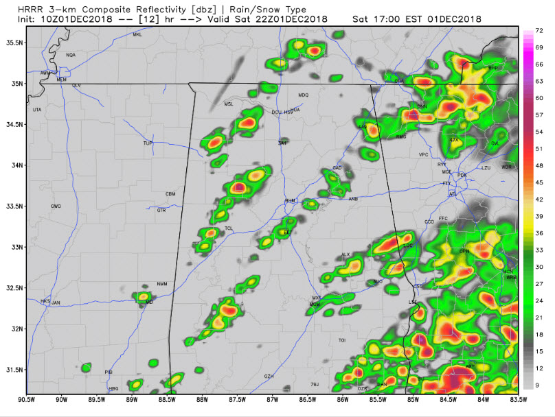
The question is whether storms will be able to form. Here is the HRRR at 4 p.m. showing scattered storms over West Alabama.
These storms have the potential to be severe with a tornado threat. Here is the significant tornado parameter showing the highest tornado threat at the same time.
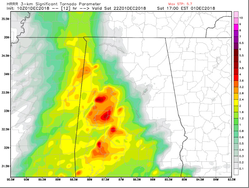
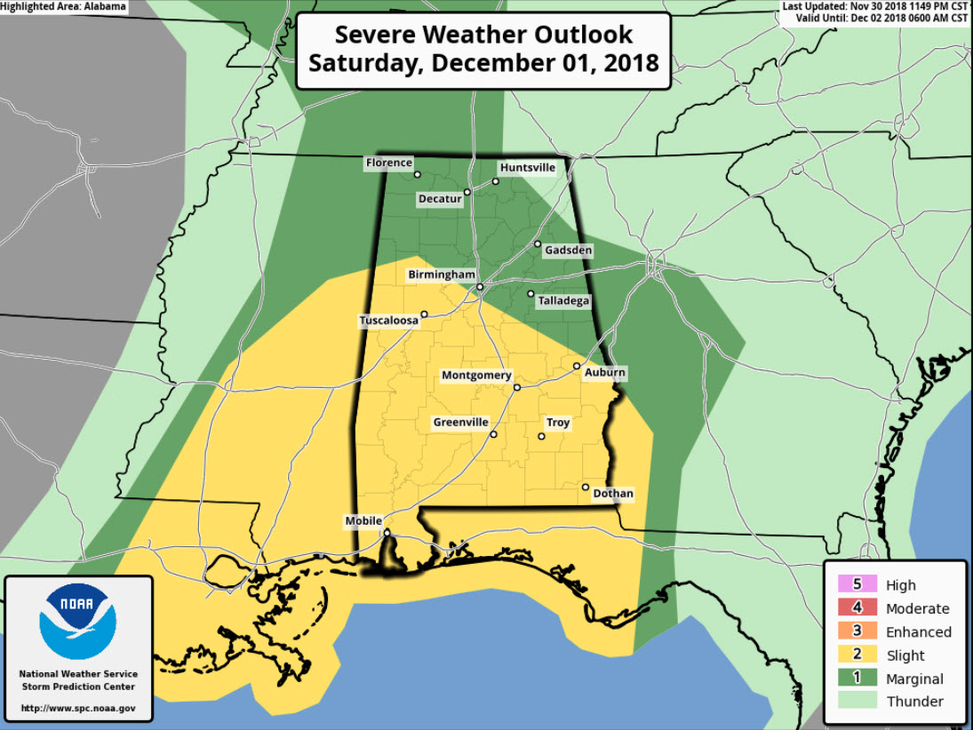
So it is not certain that storms will be able to form, but if they do form this afternoon, they may become severe and could produce tornadoes. Areas from Lamar through Fayette, Walker, Jefferson, Shelby, Chilton and Autauga Counties and points south will have the greatest chance of a tornado. This lines up well with the SPC Slight Risk area.
The main threat will come from 2 p.m.-9 p.m.
There are lots of activities and distractions going on across Alabama today, so it is imperative that you keep an eye on the weather while going about your day. Hopefully, the threat will be isolated, but it will be real if storms form.
Category: Alabama's Weather, ALL POSTS
About the Author (Author Profile)
Bill Murray is the President of The Weather Factory. He is the site's official weather historian and a weekend forecaster. He also anchors the site's severe weather coverage. Bill Murray is the proud holder of National Weather Association Digital Seal #0001 @wxhistorianSubscribe
If you enjoyed this article, subscribe to receive more just like it.


