SPC Expands Slight Risk Area, Severe Threat Now Extends Past Midnight Tonight
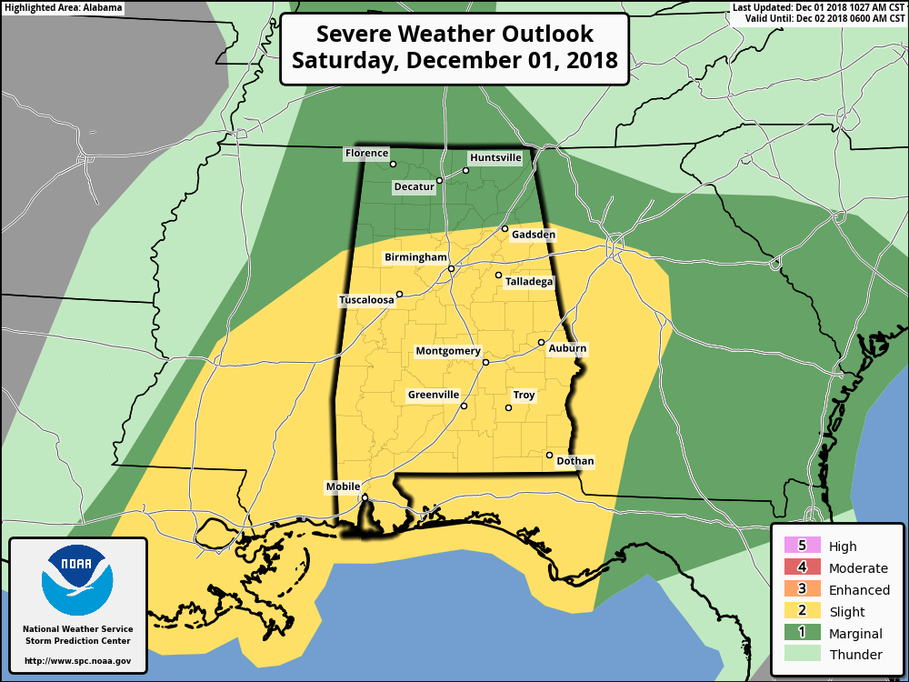
The latest updated Day 1 Severe Weather Outlook graphic is out from the Storm Prediction Center, and they have included even more of Central Alabama in the standard Slight Risk for severe storms for this afternoon and into the overnight hours. The slight risk now stretches as far north as Vernon to Carbon Hill to Gadsden to just south of Centre. A Marginal Risk of severe storm extends north of that line and includes all of North Alabama.
Along with the latest updated graphic, the Storm Prediction Center has now included text in their Convective Outlook that the unstable airmass that is conducive for severe thunderstorm development is expected to move across Central Alabama and the potential for supercells and the threat of a few tornadoes could linger farther into the evening and overnight hours for the eastern parts of Alabama and into western Georgia.
While some clearing is starting to take place over parts of Mississippi ahead of the cold front which usually would lead to further destabilization of the atmosphere, but with the weakening low-level winds in place along with weak veering of winds, there is very limited convective initiation occurring at this point.
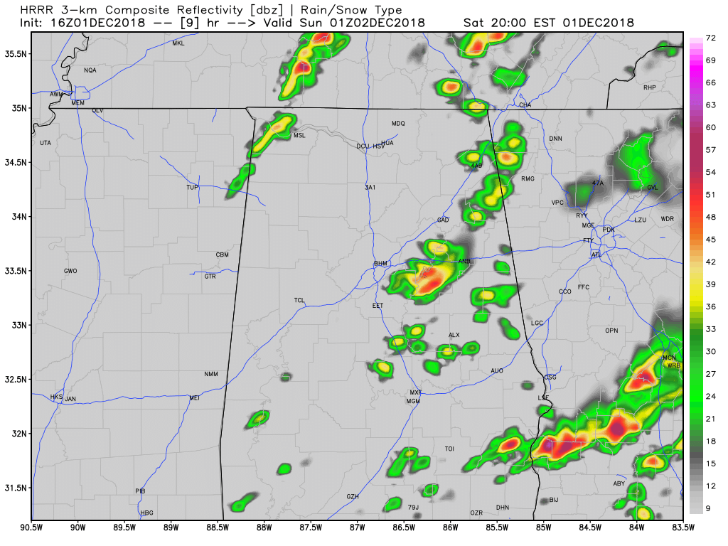
HRRR Simulated Radar 7:00pm tonight.
The latest HRRR is now starting to show the development of thunderstorms during the evening and into the late night hours. Lapse rates will begin to steepen, and along with height falls and cooling aloft, should be enough to force thunderstorm development.
The potential of all modes of severe weather are still in the forecast… damaging winds of 60 MPH, quarter-size hail, and a few tornadoes. The main window of the possibility of strong to severe storms now extends from 2:00 pm this afternoon through at least 4:00 am Sunday.
We are still seeing robust numbers with the Significant Tornado Parameter, especially later tonight as values top out at 6.4 over the northeastern parts of the area around 11:00 pm. Instability values look to continue to be high, ranging up to 2,500 J/kg. The higher shear values will be located over the northern parts of Georgia, but we’ll continue to have more than sufficient shear to support rotating updrafts. Dewpoints will also be well up into the mid to upper 60s throughout the area.
So, the ingredients will be there for the potential of severe thunderstorm development. If storms do develop, they could become supercellular in nature and become strong to severe rather quickly. If we have any sunshine to break through the cloud cover across the area before sunset, that will only add more fuel to the fire.
Bottom Line: Be prepared. Have your severe weather action plan ready to go. Keep your smart phones fully charged and download the ABC 33/40 app so you can have live tornado coverage if you have to seek shelter in your place of safety.
We’ll continue to have updates throughout the day on the AlabamaWx Weather Blog.
Category: Alabama's Weather, ALL POSTS
About the Author (Author Profile)
Scott Martin is an operational meteorologist, professional graphic artist, musician, husband, and father. Not only is Scott a member of the National Weather Association, but he is also the Central Alabama Chapter of the NWA president. Scott is also the co-founder of Racecast Weather, which provides forecasts for many racing series across the USA. He also supplies forecasts for the BassMaster Elite Series events including the BassMaster Classic.Subscribe
If you enjoyed this article, subscribe to receive more just like it.


