Partly Cloudy & Still Rather Cold At Midday, Rain Returns Tomorrow
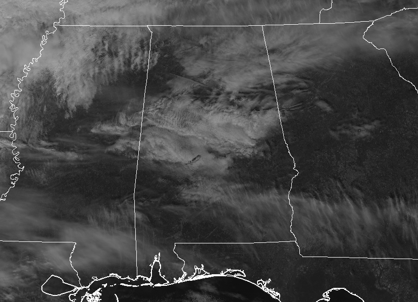
At 12:00 PM: As we have just hit the midday hour on Thursday, skies are partly cloudy across much of Central Alabama. Temperatures are still rather cold (in my book) only in the 40s across the area. The warm spots were Eufaula and Demopolis at 48 degrees, while the cool spot is Alabaster at 41 degrees. Birmingham was at 46 degrees.
WEATHER FOR THE REST OF YOUR THURSDAY: Skies will continue to be partly cloudy through the remainder of the afternoon and into the early evening hours while temperatures only climb a little. Afternoon highs will top out in the upper 40s to the lower 50s. For tonight, clouds will be on the increase and a few showers may move into the northwest corner of Central Alabama before we reach sunrise on Friday morning. Overnight lows will be in the mid to the upper 30s.
RAIN AT TIMES AND REMAINING RATHER COOL ON FRIDAY: Showers will begin moving into the northwestern parts of the area to start the day and move across the northern half of Central Alabama throughout the daylight hours. While a few showers are possible along and south of I-20, most of the shower activity will be located north of the corridor. Afternoon highs will be in the mid-40s to the upper 50s. Rain chances increase across the area on Friday night and through the overnight hours, with rain likely north of a line from Demopolis to Alexander. South of that line, shower chances will be in the 20-50% from south to north. Lows will be in the lower to the mid-40s.
BEACH FORECAST CENTER: Get the latest weather and rip current forecasts for the beaches from Fort Morgan to Panama City on our Beach Forecast Center page. There, you can select the forecast of the region that you are interested in.
WE’RE HAVING A RECORD-BREAKING YEAR… ADVERTISE WITH US TODAY!: Don’t miss out! We have enjoyed over 18.7 MILLION page views on AlabamaWx.com so far in 2018. We can customize a creative, flexible and affordable package that will suit your organization’s needs. Contact Bill Murray at (205) 687-0782.
E-FORECAST: Get the Alabama Wx Weather Blog’s Seven-Day Forecast delivered directly to your inbox by email twice daily. It is the most detailed weather forecast available in Central Alabama. Subscribe here… It’s free!
CONNECT ON SOCIAL MEDIA: You can find the AlabamaWx Weather Blog on the major social media networks: Facebook & Twitter.
WEATHERBRAINS: Don’t forget you can listen to our weekly 90 minute netcast anytime on the web at WeatherBrains.com or on iTunes, Stitcher, or Spotify. This is the show all about weather featuring many familiar voices, including the meteorologists at ABC 33/40.
ON THIS DAY IN WEATHER HISTORY: 1989 – Heavy snow blanketed the Central Rocky Mountain Region. Totals in the southern foothills of Colorado ranged up to 17 inches at Rye. Arctic air invaded the north central U.S. Lincoln NE, which reported a record high of 69 degrees the previous afternoon, was 35 degrees colder. International Falls MN was the cold spot in the nation with a morning low of 9 degrees below zero, and temperatures in northern Minnesota hovered near zero through the daylight hours.
Category: Alabama's Weather, ALL POSTS
About the Author (Author Profile)
Scott Martin is an operational meteorologist, professional graphic artist, musician, husband, and father. Not only is Scott a member of the National Weather Association, but he is also the Central Alabama Chapter of the NWA president. Scott is also the co-founder of Racecast Weather, which provides forecasts for many racing series across the USA. He also supplies forecasts for the BassMaster Elite Series events including the BassMaster Classic.Subscribe
If you enjoyed this article, subscribe to receive more just like it.


