Socked in Across Alabama
There could be a few peeks of sunshine breaking through over parts of Pickens County in West Central Alabama. If you’re seeing some of those, consider yourself lucky.
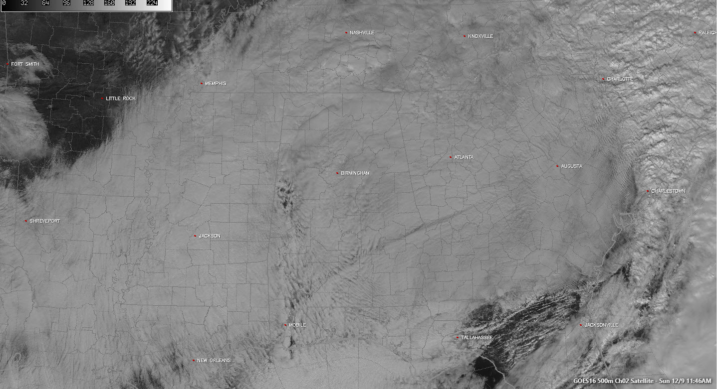
Alabama is socked in completely with clouds early on this Sunday afternoon. In fact, you could fly from Austin, Texas to Atlantic City this afternoon and never get a glimpse of the ground.
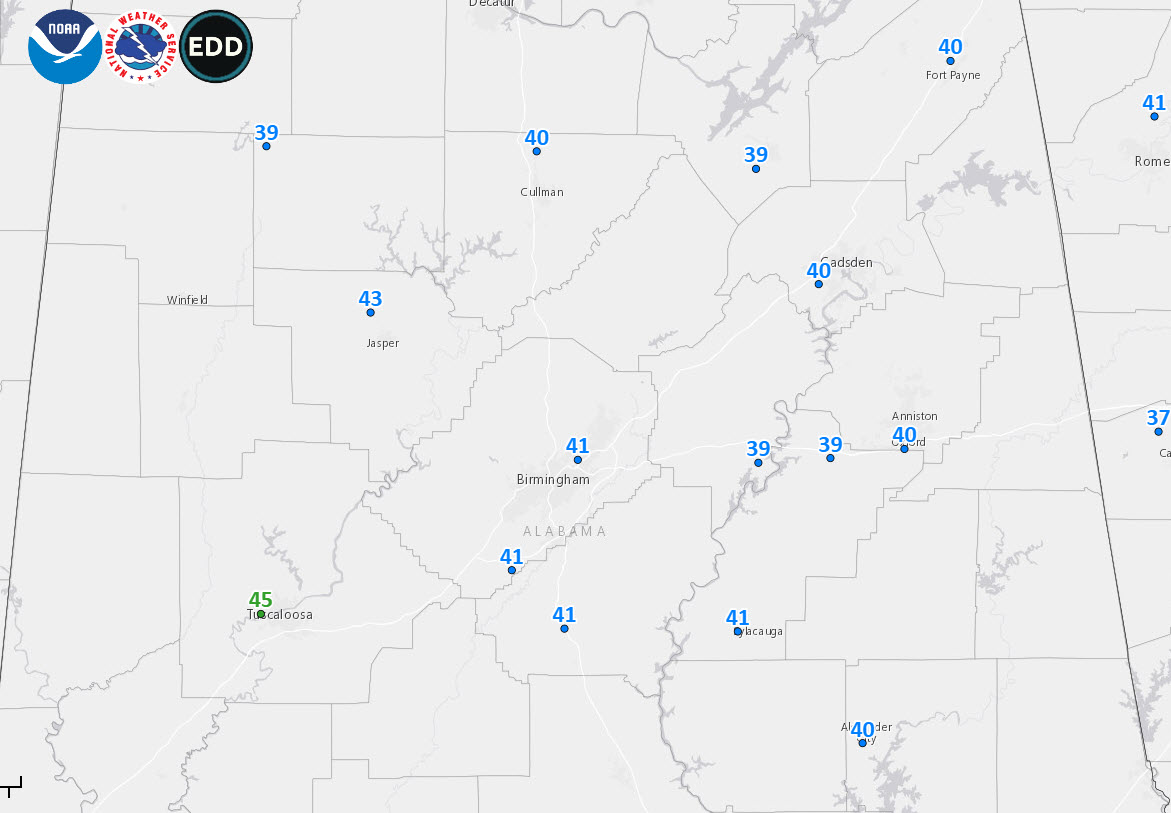
It is a raw, blustery, cold day, with temperatures hovering in the upper 30s and lower 40s across the area. They range from 39F at several stations along and north of US-278 from Halyeville to Cullman to Albertville and Gadsden. Upper 30s are common across East Alabama including places like Anniston and Pell City where northeasterly winds are funneling in cold air from Georgia.
That cold air is producing significant snows across the Carolinas this morning. 17 inches of snow is now on the ground at Swannanoa in Buncombe County, NC. 11.1 inches of snow is on the ground at the Asheville Airport. There was significant accumulation early this morning in the Raleigh/Durham area. At RDU Airport, temperatures have edged above freezing.
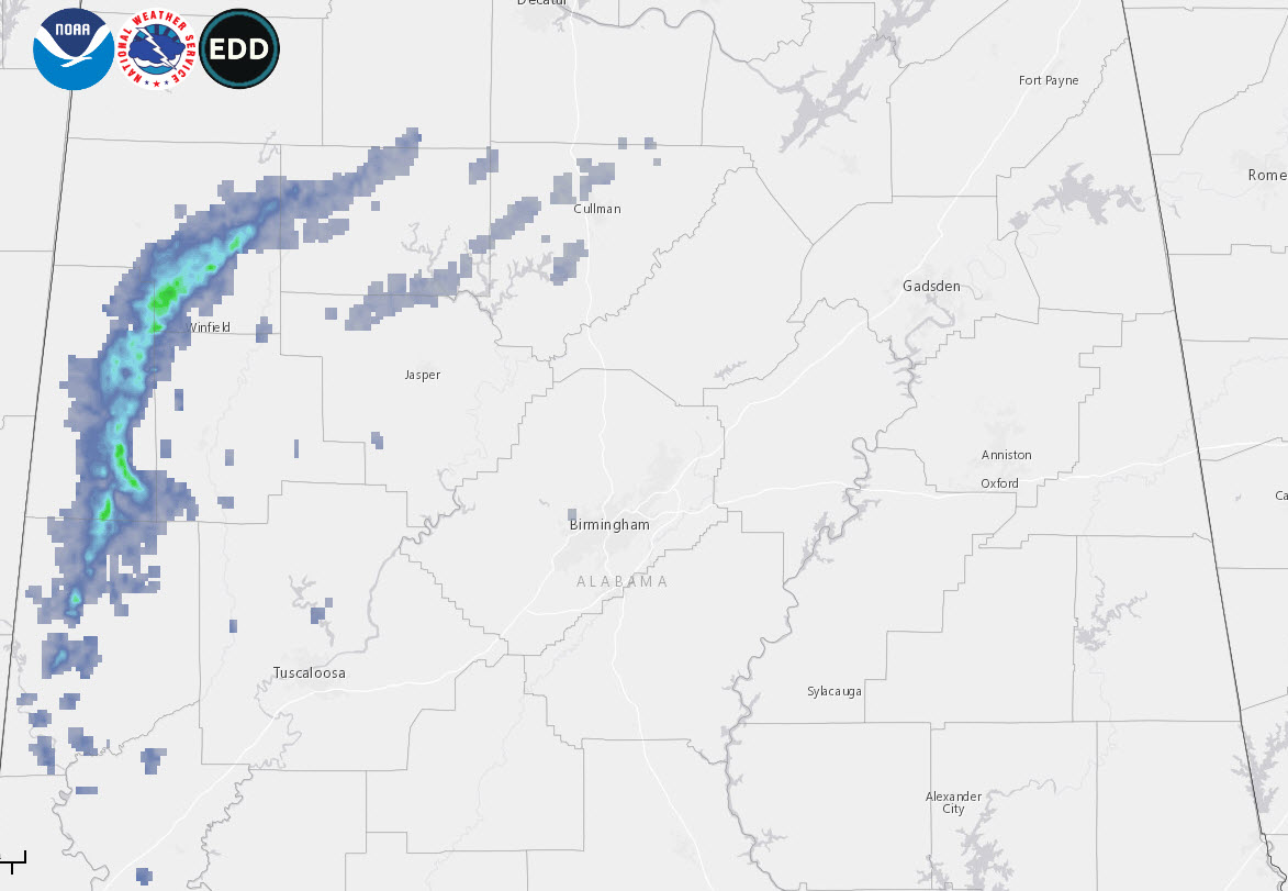
Light rain and drizzle is falling across West Central Alabama.
Not much change will happen through the afternoon hours with a little elight rain and drizzle from time to time, temperatures holding about where they are, cloudy skies and a cool northeasterly breeze.
The main upper trough will get ready to swing through the Southeast tomorrow night. Until it does, there could be more light rain and drizzle. As temperatures fall to near freezing tonight, there could be a few snowflakes mixed in over portion of Northeast Alabama late tonight and early Monday morning.
Tomorrow looks like it will be another cloudy, cold and blustery day again with light rain and drizzle as the main trough gets ready to move through. Temperatures won’t get out of the 40s.
Things change for a short while Tuesday and Wednesday as ridging builds in and sunshine returns. We will be back in the 50s Tuesday, WEdnesday and Thursday. Rain will return on Thursday as another trough mvoves our way. Rain will become likley by Thursday night into the afternoon hours on Friday. There could be some thunder involved, but no severe weather is expected.
This wil set the stage for a seasonally cool weekend, with some lingering light rain on Saturday but some sunshine returning by Sunday.
Category: Alabama's Weather, ALL POSTS
About the Author (Author Profile)
Bill Murray is the President of The Weather Factory. He is the site's official weather historian and a weekend forecaster. He also anchors the site's severe weather coverage. Bill Murray is the proud holder of National Weather Association Digital Seal #0001 @wxhistorianSubscribe
If you enjoyed this article, subscribe to receive more just like it.


