Heavy Rain & A Few Storms Expected Through Friday Afternoon, Some Could Be Strong
LOCALLY HEAVY RAIN IS A GOOD BET AFTER MIDNIGHT
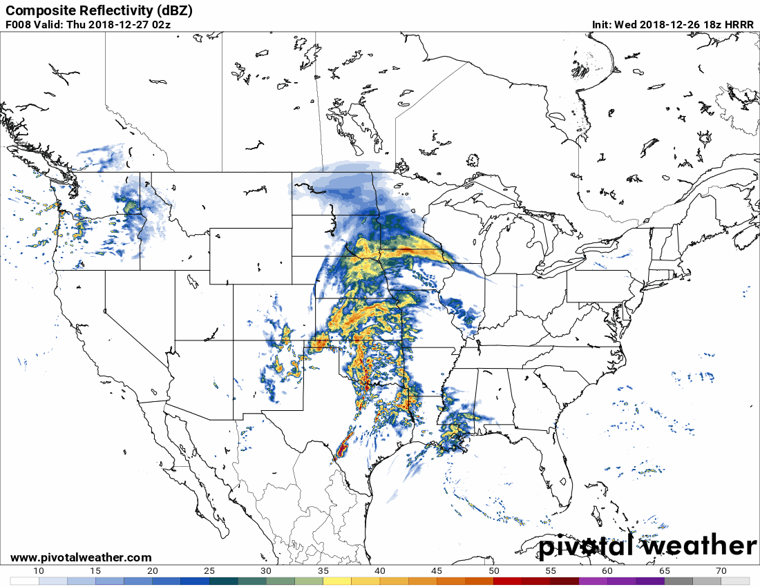
A vigorous center of low pressure will start off at midnight tonight on the border of Oklahoma and Kansas and will begin to make its trek to the northeast and ending up by the Great Lakes by morning rush hour on Friday. That means for us that we’ll have scattered to numerous showers and a few elevated thunderstorms begin to move into the area during the overnight hours tonight, mainly after 1:00 am. The above animation is from the HRRR valid from 2:00 am Thursday through 12:00 am Friday. Some of these showers and storms may put down a decent amount of rain, but the heavier stuff will make it into the area during Thursday evening and through the overnight and early morning hours on Friday.
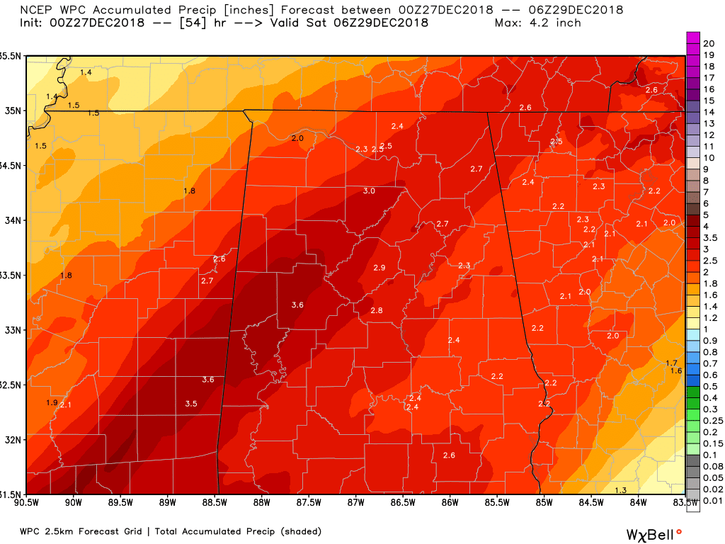
The heavier showers and storms associated with the front will be slow moving in forward motion as the low will be moving more north than eastward, so training of heavier cells may occur, and rainfall amounts through the end of the day on Friday could total as high as 2.00 to 3.00 inches, with some localized amounts as high as 4.00 inches. The above image is the forecasted amounts throughout the area valid through 12:00 am Saturday from unsecured Prediction Center of the National Weather Service. Therefore, flash flood watches have already been issued for nearly all of North/Central Alabama (details listed below).
Along with the possibility of flash flooding, we also have the threat of some gusty winds throughout the day on Thursday. The NWS has issued a wind advisory for much of North/Central Alabama for all of Thursday (details listed below). Winds could reach as high as 20-25 MPH at times with stronger gusts up to 35 MPH possible. Any unsecured objects (lawn & patio furniture, etc.) will be blown around, tree limbs could be blown down, and a few power outages may occur.
WATCHES, WARNINGS, & ADVISORIES
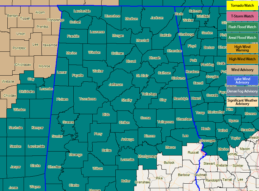
NORTH ALABAMA
Flash Flood Watch (6:00 pm CST Thursday through 9:00 am CST Friday)
Colbert, Cullman, DeKalb, Franklin, Jackson, Lauderdale, Lawrence, Limestone, Madison, Marshall, and Morgan counties.
Wind Advisory (12:00 am CST Thursday through 12:00 am Friday)
Colbert, Cullman, DeKalb, Franklin, Jackson, Lauderdale, Lawrence, Limestone, Madison, Marshall, and Morgan counties.
CENTRAL ALABAMA
Flash Flood Watch (12:00 pm CST Thursday through 6:00 pm CST Friday)
Autauga, Bibb, Blount, Calhoun, Chambers, Cherokee, Chilton, Clay, Cleburne, Coosa, Dallas, Elmore, Etowah, Fayette, Greene, Hale, Jefferson, Lamar, Lee, Lowndes, Macon, Marengo, Marion, Montgomery, Perry, Pickens, Randolph, Shelby, St. Clair, Sumter, Talladega, Tallapoosa, Tuscaloosa, Walker, and Winston counties.
Wind Advisory (12:00 am CST Thursday through 12:00 am Friday)
Autauga, Bibb, Blount, Calhoun, Chambers, Cherokee, Chilton, Clay, Cleburne, Coosa, Dallas, Elmore, Etowah, Fayette, Greene, Hale, Jefferson, Lamar, Lee, Lowndes, Macon, Marengo, Marion, Montgomery, Perry, Pickens, Randolph, Shelby, St. Clair, Sumter, Talladega, Tallapoosa, Tuscaloosa, Walker, and Winston counties.
MARGINAL SEVERE WEATHER THREAT AT BEST FOR PARTS OF THE AREA
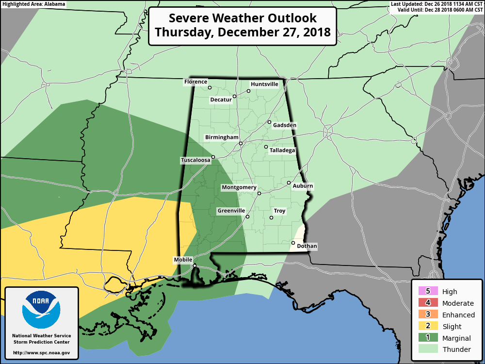
While there may be a bit of unstable energy to move in with the heavier storms on Thursday evening and through the beginning of the overnight hours, much of our area will see general thunderstorms. There may be just enough shear to support some isolated damaging wind gusts in the Marginal Risk areas, but as time goes on, the dynamic support will continue to be pulled north of the area and storms will lose the ability to rotate. While the tornado threat is not a complete zero, the risk for one will be very, very small. The window for any stronger to marginally severe storms will be from 6:00 pm CST Thursday through 2:00 am CST Friday.
WET PATTERN CONTINUES THROUGH NEW YEARS
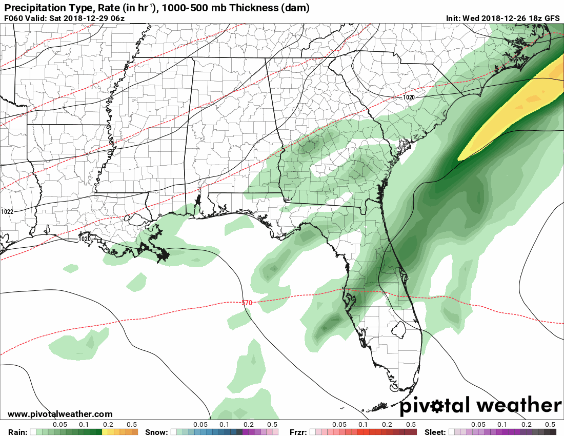
While much of Saturday will be mainly dry with only a slight risk of showers, rain remains in the forecast through midday on Tuesday, January 1st, 2019. The above image is from the GFS valid from 12:00 am Saturday through 12:00 pm Tuesday. Rainfall totals from now through 12:00 pm Tuesday could be as high as 3.50 to 5.50 inches. That also means that it will be wet as we ring in the New Year at 12:00 am Tuesday.
We’ll keep you posted with any updates, including watches, warnings, and advisories that are issued, from now through the event. Have a great evening.
Category: Alabama's Weather, ALL POSTS
About the Author (Author Profile)
Scott Martin is an operational meteorologist, professional graphic artist, musician, husband, and father. Not only is Scott a member of the National Weather Association, but he is also the Central Alabama Chapter of the NWA president. Scott is also the co-founder of Racecast Weather, which provides forecasts for many racing series across the USA. He also supplies forecasts for the BassMaster Elite Series events including the BassMaster Classic.Subscribe
If you enjoyed this article, subscribe to receive more just like it.


