Heavy Rain For Alabama Over Next Seven Days; Some Strong Storms Tonight, Friday Morning
Heavy rain, strong winds and the potential for severe weather. Now if we only had some snow thrown in. That couldn’t happen, could it? Nahhh…. Oh wait…
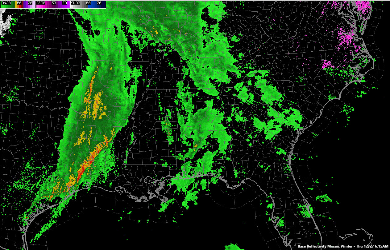
TODAY: Rain moved in overnight and winds picked up. This morning, they are averaging some 20-25 mph with occasional gusts as high as 35 mph. That wind will be able to fell some weakened trees and bring down some tree limbs, so be careful out there. Wind advisories are in effect.
BRIEF LULL IN THE RAIN, BUT HEAVIER RAIN THIS AFTERNOON/TONIGHT: There may be a lull in the rain late this morning into the afternoon, but another round of heavier rain and thunderstorms will move in this afternoon and last through the night, into Friday. Rainfall amounts will total 2-3 inches across the area through Friday afternoon and flash flood watches are in effect.
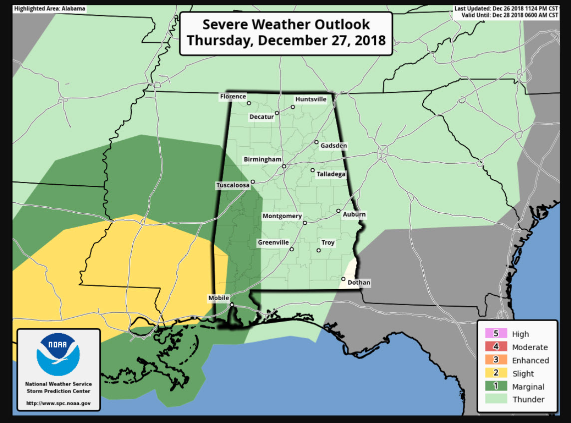
SEVERE WEATHER POSSIBLE THIS EVENING AND EARLY FRIDAY: There could be some thunder involved at times today, but the best chance of strong to severe storms will come late this evening and early Friday morning when instabilities are at their greatest. The best chance in Alabama will be from Tuscaloosa and Lamar Counties southward through southwestern portions of our state. The overall best chance will be to the west of Alabama.
RAIN MOVES OUT FRIDAY: A cold front will spell a brief end to the rain on Friday afternoon, and Friday night and much of Saturday *MAY* be dry. But rain will return Saturday night, and when it does, it could stay through New Years Day.
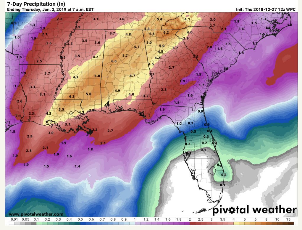
RAINFALL AMOUNTS: Amounts of 3-7 inches will be common across Alabama before the rain comes to an end next week. This could cause flooding issues.
THE RAIN DOESN’T END: Despite a brief respite forecast for Friday night into early Saturday, rain will return during the day on Saturday as another disturbance passes through the flow. Rain could end again for a while on Sunday but should resume on Monday. Monday night looks wet unfortunately for New Year’s Eve celebrations. The European hints that there could be additional rain events Wednesday and Friday of next week! The Euro places 15-day rainfall amounts at around 6 inches, according to its ensemble mean.
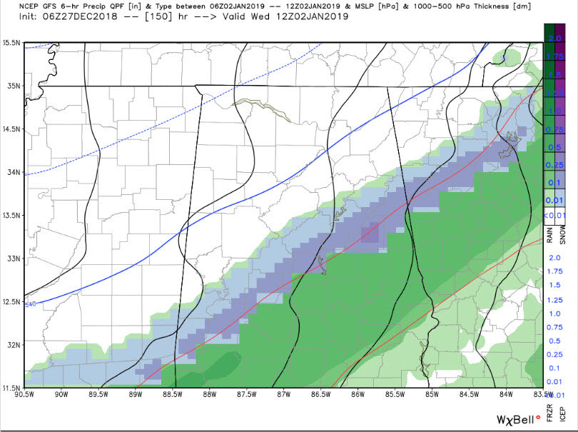
VOODOO TERRITORY: The overnight run of the GFS was hinting at some snow on the back side of the cold front over South Alabama next Wednesday or Thursday. Not out of the realm of possibility, but too early to talk about impacts.
GULF COAST WEATHER: An extended period of wet weather setting up for the beautiful beaches of Alabama and Northwest Florida as we head towards the New Year. Rain will be a staple in the forecast right on through New Year’s Day. It won’t rain the whole of course, but there will be several bouts with showers and storms. Highs will touch 70F on Friday, but otherwise be in the mild 60s. Lows will be generally in the 50s and 60s.
Click here to see the Beach Forecast Center page.
WEATHERBRAINS: Go back and review the weather of 2018 with Greg Carbin from the Weather Prediction Center. Check out the show at www.WeatherBrains.com. You can also subscribe on iTunes. You can watch the show live at http://live.bigbrainsmedia.com/. You will be able to see the show on the James Spann 24×7 weather channel on cable or directly over the air on the dot 2 feed.
ON THIS DATE IN 1996: Dense fog in the Tampa Bay area caused a series of chain-reaction accidents on the soaring Sunshine Skyway Bridge, involving 50 vehicles. One person was killed and 24 injured. The 1,280-foot span across the mouth of Tampa Bay was closed in both directions. Follow my weather history tweets on Twitter. I am @wxhistorian at Twitter.com.
FREQUENT UPDATES: Scott Martin and I will have frequent updates here throughout the event. Warnings will post automatically. Stay tuned to AlabamaWX for the latest on Central Alabama weather.
Category: Alabama's Weather, ALL POSTS
About the Author (Author Profile)
Bill Murray is the President of The Weather Factory. He is the site's official weather historian and a weekend forecaster. He also anchors the site's severe weather coverage. Bill Murray is the proud holder of National Weather Association Digital Seal #0001 @wxhistorianSubscribe
If you enjoyed this article, subscribe to receive more just like it.


