Early Morning Thoughts on Today’s Severe Weather Threat
Everything seems to be on track with the forecast for severe weather for today for parts of Alabama.
A warm front has pushed into North Alabama this morning. Dewpoints > 60F now reach as far north as Muscle Shoals, Decatur, Huntsville International Airport, Jasper, Birmingham, and Talladega. A surface low is near Vicksburg, Mississippi.
Southerly winds are now being reported all across Alabama, averaging 8-15 mph with occasional gusts to 20 mph. Those winds will become a little brisker this morning, continuing to pull more warm, moist Gulf air northward.
But clouds will hang thick all day, and instability values will be fairly low, around 500 joules/kg by this afternoon. But the wind fields will be strong and any lop topped storms that form will have the potential to produce damaging winds. The timing of the damaging wind threat will be from 1 to 9 p.m.
In addition, the proximity of the surface low will allow surface winds to “back” counterclockwise to the south-southeast just enough to produce a small threat of tornadoes. The main window for potential tornadoes will be between 1-4 p.m.
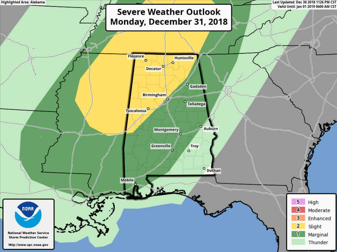
The greatest threat for severe weather will be generally near and northwest of I-59, including places like Tuscaloosa, Birmingham, Jasper, Hamilton, Fayette, Decatur, Florence, and Huntsville. This is the “slight” risk area outlooked by the Storm Prediction Center. This is their standard risk forecast and is a 2 out of 5 on their scale. It indicates that there is a chance of severe weather. They have much of the rest of the state in their “marginal” risk area (1/5) indicating isolated severe weather is possible.
The activity will congeal into a line of storms that will push southeastward into the I-59 corridor between 3 and 7 p.m. It should weaken the further southeast it goes as instability wanes and the upper-level dynamics move off to the northeast.
There will be rain showers through the evening however putting a bit of a damper on New Year’s Eve celebrations.
The threat for severe weather, including damaging winds and even a couple of tornadoes, continues for Alabama on this New Year’s Eve 2018. Everyone should pay attention to the weather today, review their safety plan for where they will be this afternoon and evening, and have a way to receive warnings. We will have constant updates here on AlabamaWX.
Category: Alabama's Weather, ALL POSTS
About the Author (Author Profile)
Bill Murray is the President of The Weather Factory. He is the site's official weather historian and a weekend forecaster. He also anchors the site's severe weather coverage. Bill Murray is the proud holder of National Weather Association Digital Seal #0001 @wxhistorianSubscribe
If you enjoyed this article, subscribe to receive more just like it.


