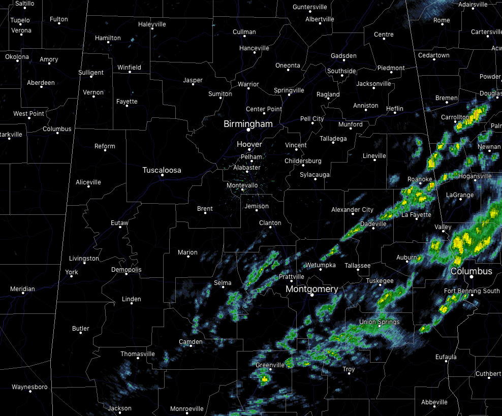
A Few Lingering Showers Over The Southeastern Parts Of Central Alabama At Midday
CONDITIONS ACROSS CENTRAL ALABAMA AT 11:45 AM
We continue to have some scattered shower activity over the southeastern quarter of Central Alabama along the cold front that moved through much of the area on Monday but staled out over the southern parts. North of the I-20 corridor, all is dry at this point with mostly cloudy skies. There are a few breaks that are allowing for some sun to shine for a few minutes, but we should stay mainly gray throughout the day. Temperatures are currently in the mid-50s to the mid-60s across much of the area, but much warmer down ahead of the front in Eufaula at 74 degrees. The cool spot is Haleyville at 55 degrees, while Birmingham is at 63 degrees.
WEATHER FOR THE REST OF YOUR NEW YEAR’S DAY 2019
While much of the area will be considerably drier than Monday, we’ll still continue to have a chance of showers mainly south of the I-20 corridor through the rest of the afternoon and into the early evening hours. Those showers will be associated with the front that moved through much of the area but stalled out over the southern parts of the area. Skies will continue to be mainly cloudy, but a few breaks will allow for some sun to make it down to the surface at times. Afternoon highs will top out in the upper 50s to the lower 70s. Showers chances do drop during the late evening and through the overnight hours, but a small chance of scattered showers will remain south of the I-20 corridor. Overnight lows will be in the lower 40s to the upper 50s.
RAIN RETURNS FOR THE ENTIRE AREA ON WEDNESDAY
Another system will start to build out to our west and more moisture will begin to flow up into the area. While we start off dry at daybreak, some light to moderate showers will start to move into the area before midday. Skies will be cloudy and highs will top out in the upper 40s to the upper 60s across the area from northwest to southeast. Chance of rain throughout the day will be around 60%.
WEATHER STATS FROM THE FINAL DAY OF 2018
The warmest high temperature readings from across the state were Dothan and Tuscaloosa, both topping out at 78 degrees. The coolest low was recorded in Decatur at 51 degrees. The highest rainfall total with Monday’s storm system was reported at the Birmingham International Airport at 1.09 inches.
BEACH FORECAST CENTER
Get the latest weather and rip current forecasts for the beaches from Fort Morgan to Panama City on our Beach Forecast Center page. There, you can select the forecast of the region that you are interested in.
WE’RE HAVING A RECORD-BREAKING YEAR ON THE ALABAMAWX WEATHER BLOG… ADVERTISE WITH US TODAY!
Don’t miss out! We have enjoyed nearly 20 MILLION page views on AlabamaWx.com in 2018. We can customize a creative, flexible and affordable package that will suit your organization’s needs. Contact Bill Murray at (205) 687-0782.
E-FORECAST
Get the Alabama Wx Weather Blog’s Seven-Day Forecast delivered directly to your inbox by email twice daily. It is the most detailed weather forecast available in Central Alabama. Subscribe here… It’s free!
CONNECT WITH THE ALABAMAWX WEATHER BLOG ON SOCIAL MEDIA
You can find the AlabamaWx Weather Blog on the major social media networks:
Facebook
Twitter
WEATHERBRAINS
Don’t forget you can listen to our weekly 90 minute netcast anytime on the web at WeatherBrains.com or on iTunes, Stitcher, or Spotify. This is the show all about weather featuring many familiar voices, including the meteorologists at ABC 33/40.
ON THIS DAY IN WEATHER HISTORY
1934 – Heavy rain which began on December 30th led to flooding in the Los Angeles Basin area of California. Flooding claimed the lives of at least 45 persons. Walls of water and debris up to ten feet high were noted in some canyon areas. Rainfall totals ranged up to 16.29 inches at Azusa, with 8.26 inches reported in Downtown Los Angeles.
Category: Alabama's Weather, ALL POSTS
About the Author (Author Profile)
Scott Martin is an operational meteorologist, professional graphic artist, musician, husband, and father. Not only is Scott a member of the National Weather Association, but he is also the Central Alabama Chapter of the NWA president. Scott is also the co-founder of Racecast Weather, which provides forecasts for many racing series across the USA. He also supplies forecasts for the BassMaster Elite Series events including the BassMaster Classic.Subscribe
If you enjoyed this article, subscribe to receive more just like it.


