Showers Pushing Out Of The Area For Now; More Rain Expected Later Today
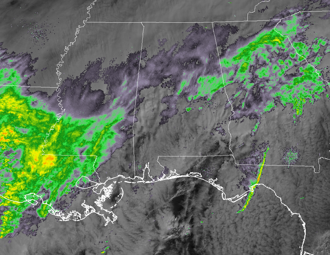
While much of Central Alabama is getting a much-needed break from the rain at the moment, more rain and a few rumbles of thunder are located back to our west and southwest. Currently, we still have showers mainly over the eastern half of Central Alabama, with the heaviest activity over the Heflin and Dadeville areas. All of the activity is pushing off to the east-northeast.
Once those showers move out, there is a good chance that much of the area could see a few hours of dry weather before we see showers and heavier rain move into the area during the late afternoon and evening hours. We may have some drizzle or very light showers form in between the main shower activity.
The latest HRRR has the more organized rain activity moving into the western parts of Central Alabama starting around 3:00-4:00 pm this afternoon and begin the trek across the area. The heaviest of the activity looks to reach the western portions by 8:00-10:00 pm tonight, making it to the I-65 corridor by 11:00 pm to 1:00 am, and into the eastern portions by 12:00-2:00 am.
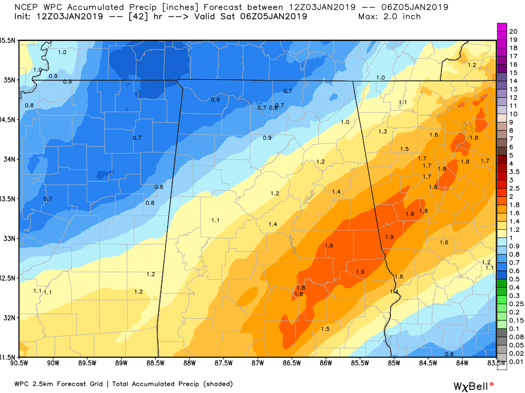
Rainfall amounts across the area through the end of the evening on Friday is forecast to be from 0.75 inches in the northwestern parts of Central Alabama to as high as nearly 2.00 inches in the southeastern locations. With the ground as saturated as it is, that amount of rainfall could lead to some localized flash flooding issues, especially in poor drainage areas and in low-lying areas.
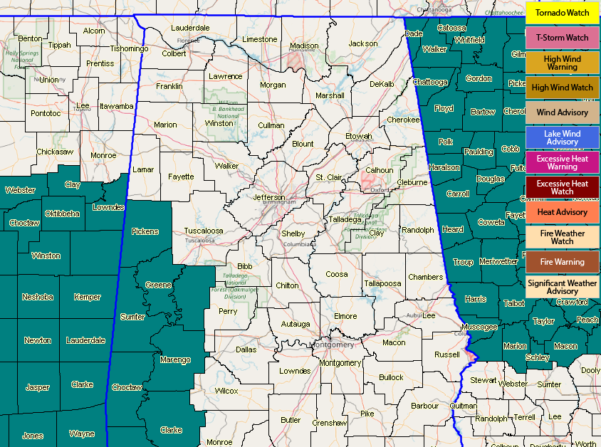
At this point, a Flash Flood Watch is in effect for Greene, Hale, Marengo, Pickens, and Sumter counties in Central Alabama until 6:00 am Friday morning. That watch may need to be expanded farther to the north and to the east later today.
The good news is that once Friday is finished, we will get a good stretch of dry weather across Central Alabama for several days. There is a small chance of showers during the overnight hours of Monday night and into Tuesday morning, but the latest model runs have come in drier than the previous runs.
We’ll keep you updated throughout the day with any updates.
Category: Alabama's Weather, ALL POSTS
About the Author (Author Profile)
Scott Martin is an operational meteorologist, professional graphic artist, musician, husband, and father. Not only is Scott a member of the National Weather Association, but he is also the Central Alabama Chapter of the NWA president. Scott is also the co-founder of Racecast Weather, which provides forecasts for many racing series across the USA. He also supplies forecasts for the BassMaster Elite Series events including the BassMaster Classic.Subscribe
If you enjoyed this article, subscribe to receive more just like it.


