Sunny Skies But Chilly Across Central Alabama At Midday
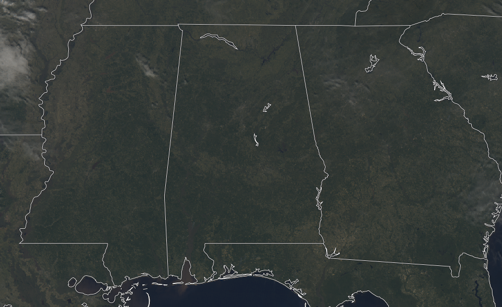
At 11:30 AM, skies are nearly 100 percent clear across Central Alabama (you’ll have to zoom in really close to see the very small stray clouds floating over the northern half of the state). It would be a really nice day if we had warmer temperatures. Unfortunately, we are rather chilly at the moment with readings in the upper 30s to right at 50 degrees across the area. The cool spot is Haleyville at 37 degrees, while the warm spot is Eufaula at 50 degrees. It is only 43 degrees at Birmingham.
WEATHER FOR THE REST OF YOUR THURSDAY
We’ll continue to have mainly clear skies and cold temperatures for the remainder of the daylight hours across Central Alabama, with a little bit of a breeze out of the northwest around 5-10 MPH. Afternoon highs will top out in the mid-40s to the lower 50s across the area from northwest to southeast. For this evening and through the overnight hours, skies will be clear and we’ll lose a good deal of the radiational heating that we received during the day. Overnight lows will be in the mid to upper 20s.
ANOTHER NICE AND COOL DAY FOR YOUR FRIDAY
Much of the daylight hours will feature mostly sunny skies and cooler temperatures for the last workday of the week. Unfortunately, clouds will start to move in late in the day and throughout the night as our next rain-making system approaches from the west. We should stay dry through the night with rain moving in early on Saturday. Friday’s highs will be in the upper 40s to the mid-50s with overnight lows in the mid to upper 30s.
BEACH FORECAST CENTER
Get the latest weather and rip current forecasts for the beaches from Fort Morgan to Panama City on our Beach Forecast Center page. There, you can select the forecast of the region that you are interested in.
WE HAD A RECORD-BREAKING YEAR IN 2018! ADVERTISE WITH US TODAY ON THE ALABAMAWX WEATHER BLOG!
We have enjoyed over 19.9 MILLION page views on AlabamaWx.com for 2018… breaking our previous record by over 3 million page views. Don’t miss out! We can customize a creative, flexible and affordable package that will suit your organization’s needs. Contact Bill Murray at (205) 687-0782.
E-FORECAST
Get the Alabama Wx Weather Blog’s Seven-Day Forecast delivered directly to your inbox by email twice daily. It is the most detailed weather forecast available in Central Alabama. Subscribe here… It’s free!
CONNECT WITH THE ALABAMAWX WEATHER BLOG ON SOCIAL MEDIA
You can find the AlabamaWx Weather Blog on the major social media networks:
Facebook
Twitter
WEATHERBRAINS
Don’t forget you can listen to our weekly 90 minute netcast anytime on the web at WeatherBrains.com or on iTunes, Stitcher, or Spotify. This is the show all about weather featuring many familiar voices, including the meteorologists at ABC 33/40.
ON THIS DAY IN WEATHER HISTORY
2011 – On the morning of Sunday, January 9th, a low pressure system formed in the Gulf of Mexico just off the Texas coast. This low pressure system traveled parallel to the Gulf Coast throughout the day on Sunday and into the day on Monday before moving over the Florida Panhandle and off the Atlantic Seaboard Monday night. Even though the system weakened as it moved eastward, it brought moisture across Central Alabama, where cold temperatures were already in place from a cold front that had moved through Friday and Saturday, the 7th and 8th of January.
By noon on Sunday, weak reflectivities were already on the radar, though, it wasn’t until about 2 PM that afternoon when Tuscaloosa began reporting unknown precipitation. The bulk of the activity started later that evening, but because of an elevated warm layer of air that moved inland as the low pressure system passed to the south of Alabama, the southern half of the county warning area didn’t receive any snow — just ice and sleet. By daybreak Monday morning, areas north of Interstate 20 were reporting anywhere from 1 to 14 inches of snow with the heaviest totals near the Alabama-Tennessee state line. Ice reports were as high as 0.50 inches in multiple counties south of Interstate 20.
The ice and snow from Sunday night and Monday morning created havoc across most of the state. By Sunday evening, businesses and schools had already declared they would be closed on Monday and for good reason. Road conditions around central Alabama caused many counties to declare that roads would be closed overnight Sunday night. Unfortunately, this winter weather event caused the loss of at least 2 lives on area roadways because of slick conditions.
Though the majority of the activity was over by Monday night, the effects of the system were felt for the next couple of days. Areas that saw excessive amounts of snow were plagued with melting and refreezing on area roadways for the next couple of days, creating slick conditions through Wednesday, January 12th. – NWS Birmingham
Category: Alabama's Weather, ALL POSTS
About the Author (Author Profile)
Scott Martin is an operational meteorologist, professional graphic artist, musician, husband, and father. Not only is Scott a member of the National Weather Association, but he is also the Central Alabama Chapter of the NWA president. Scott is also the co-founder of Racecast Weather, which provides forecasts for many racing series across the USA. He also supplies forecasts for the BassMaster Elite Series events including the BassMaster Classic.Subscribe
If you enjoyed this article, subscribe to receive more just like it.


