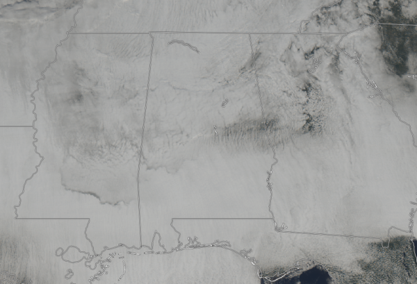
Cloudy & Cold At Midday
AS OF 12:15 PM: Skies across Central Alabama are cloudy, and with the surface winds out of the northwest at 5-10 MPH, it is just too cold to even want to be outside at the moment. Temperatures are only in the mid-30s to the mid-40s across the area from northwest to southeast. As usual, Eufaula is the warm spot at 46 degrees while Haleyville is the cool spot at 36 degrees. Birmingham is only up to 41 degrees at this time.
WEATHER FOR THE REST OF YOUR MONDAY: We’re going to stay mainly cloudy across Central Alabama throughout the rest of the afternoon and into the early evening hours. Afternoon highs will only make it up into the upper 30s to the upper 40s across the area from northwest to southeast. Winds of 5-15 MPH out of the northwest will make those highs feel even cooler. For tonight, skies will start to slowly clear, but we’ll be partly to mostly cloudy at best before sunrise. Overnight lows will be in the upper 20s to the mid-30s.
IMPROVING WEATHER ON TUESDAY: Skies will continue to slowly clear throughout the day on Tuesday and will finally be mostly sunny by the late afternoon hours. Along with the sunshine, warmer temperatures will make Tuesday better than what we are seeing today. Afternoon highs will be in the mid-40s to the mid-50s. Skies will be mostly clear throughout the evening and overnight hours, and lows will be in the lower to mid-30s.
ON THIS DAY IN WEATHER HISTORY: 1989 – A winter storm spread snow and sleet and freezing rain from the Middle Mississippi Valley to the northeastern U.S. Freezing rain in West Virginia caused fifteen traffic accidents in just a few minutes west of Charleston. Tennessee was deluged with up to 7.5 inches of rain. Two inches of rain near Clarksville TN left water in the streets as high as car doors.
BEACH FORECAST CENTER: Get the latest weather and rip current forecasts for the beaches from Fort Morgan to Panama City on our Beach Forecast Center page. There, you can select the forecast of the region that you are interested in.
WE HAD A RECORD-BREAKING YEAR IN 2018! ADVERTISE WITH THE BLOG!: We have enjoyed over 19.9 MILLION page views on AlabamaWx.com for 2018… breaking our previous record by over 3 million page views. Don’t miss out! We can customize a creative, flexible and affordable package that will suit your organization’s needs. Contact Bill Murray at (205) 687-0782.
E-FORECAST: Get the Alabama Wx Weather Blog’s Seven-Day Forecast delivered directly to your inbox by email twice daily. It is the most detailed weather forecast available in Central Alabama. Subscribe here… It’s free!
CONNECT WITH THE BLOG ON SOCIAL MEDIA: You can find the AlabamaWx Weather Blog on the major social media networks:
Facebook
Twitter
WEATHERBRAINS: Don’t forget you can listen to our weekly 90 minute netcast anytime on the web at WeatherBrains.com or on iTunes, Stitcher, or Spotify. This is the show all about weather featuring many familiar voices, including the meteorologists at ABC 33/40.
Category: Alabama's Weather, ALL POSTS


