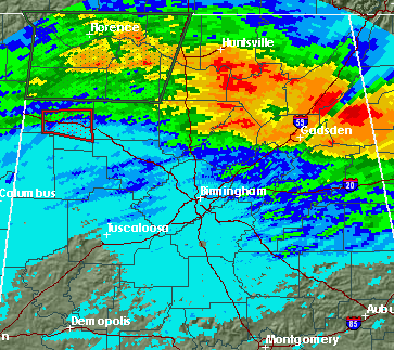
Severe weather analysis 430 pm
Supercell storms continue in NE MS/NW AL this afternoon in warm, unstable air mass. Normally, storms in a summerlike air mass would not generally rotate, but these storms have two factors allowing some rotation.
1. A leftover mesoscale circulation, 50-100 miles across (called an MCV), sometimes forms when areas of thunderstorms persist for several hours. Air converges toward them, and eventually the earth’s rotation (Coriolis force) produces rotation. This has happened today, and produces some helicity.
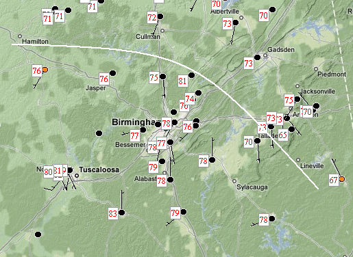
2. The wet ground caused by last night’s storms, and clouds, are holding temperatures down in north Alabama to the lower 70s, while temperatures are in the upper 70s further south, where the ground is drier. Check out radar-estimated precipitation from overnight and current temperatures:
Storms near this boundary will tap into the sea-breeze type circulation (warm air rising, cold air sinking) produced, and some of this rotation may be tilted upward into thunderstorms near the boundary, causing tornadoes.
Keep an eye on the weather this afternoon. I may go storm chasing soon.
For your meteorological consulting needs, Coleman and Peters, LLC can provide you with accurate information on past hailstorms, lightning, flooding, and wind damage. We work primarily for people involved in insurance cases and for attorneys. Please call us at (205) 568-4401.
Category: Uncategorized


