Early Afternoon Update: and Notes on the Winter Weather Threat for Tuesday for Alabama
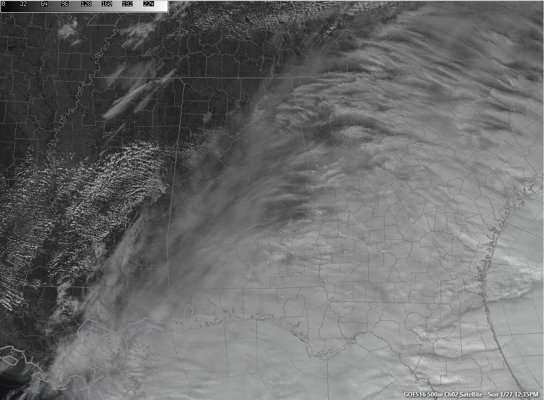
Just after noon, high clouds are moving across much of Central and South Alabama in an extremely fast upper-level flow. Jet stream levels winds are running over 150 mph south of the southwest as a shortwave trough swings towards Alabama. For us, other than those clouds, the system will be a non-factor as the rain has stayed out of the state. It is bringing soaking rains to the Florida Peninsula though.
You can see that a few cumulus clouds have developed across Central Mississippi in an area of slightly higher moisture. Moisture location will become very important as we watch our next weather maker develop.
Temperatures are in the 40s under the cloudiness across Central Alabama. North Alabama and South Alabama stations have managed to reach 50F. Lows tonight will drop into the 30s, but most places will stay above freezing.
Monday will be a partly to mostly cloudy day with a breezy southwesterly wind occasionally gusting to 20 mph. Readings will warm into the upper 50s to near 60F.
WINTER STORM TO IMPACT ALABAMA TUESDAY
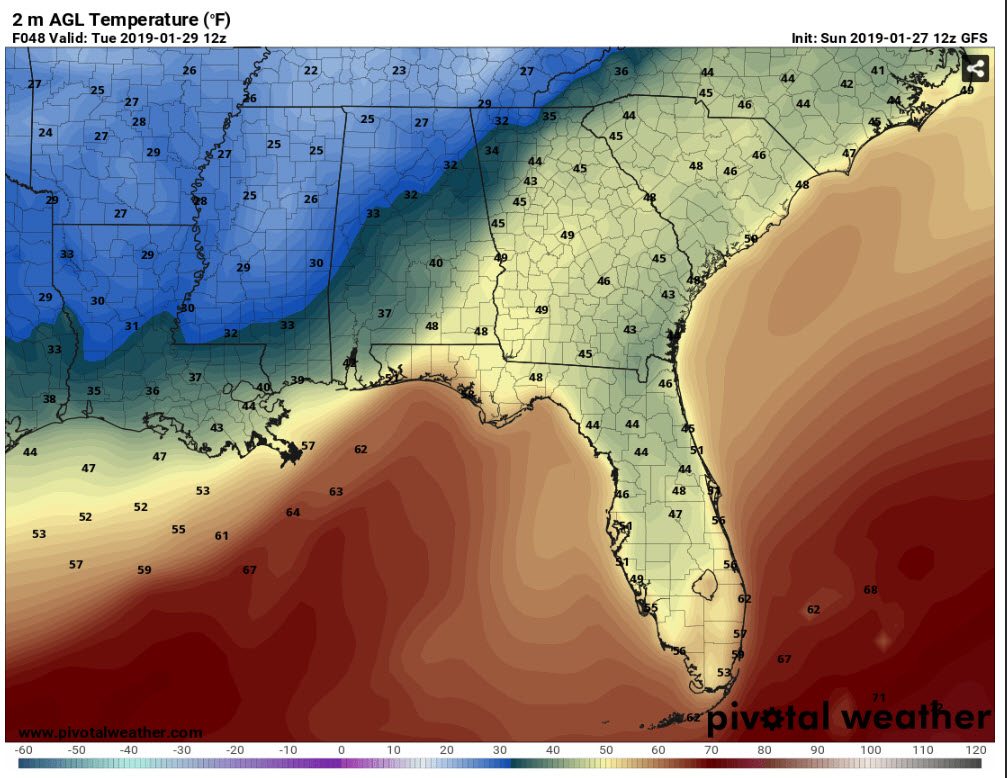
An arctic cold front will push through Alabama Tuesday, reaching northwestern Alabama late tomorrow evening. By midnight, temperatures will still be in the upper 40s in the I-59 Corridor but will be dropping into the middle 30s over northwestern Alabama.
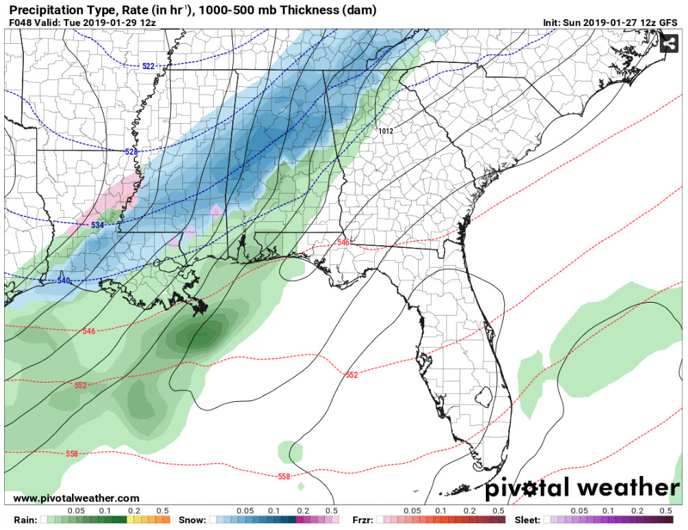
By then, rain will be increasing along the front and will be changing to snow over northwestern Alabama in places like Hamilton and Russellville.
By 3 a.m., rain will be changing to snow as far southeast as I-59
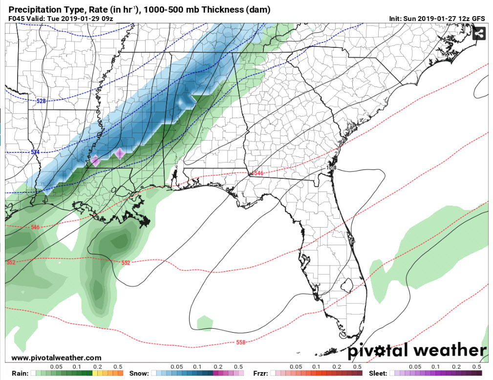
And temperatures will be quickly dropping toward freezing.
We think now that roads will be mainly wet by that time, but if snowfall rates are high enough, roads will become snowpacked and slippery quickly.
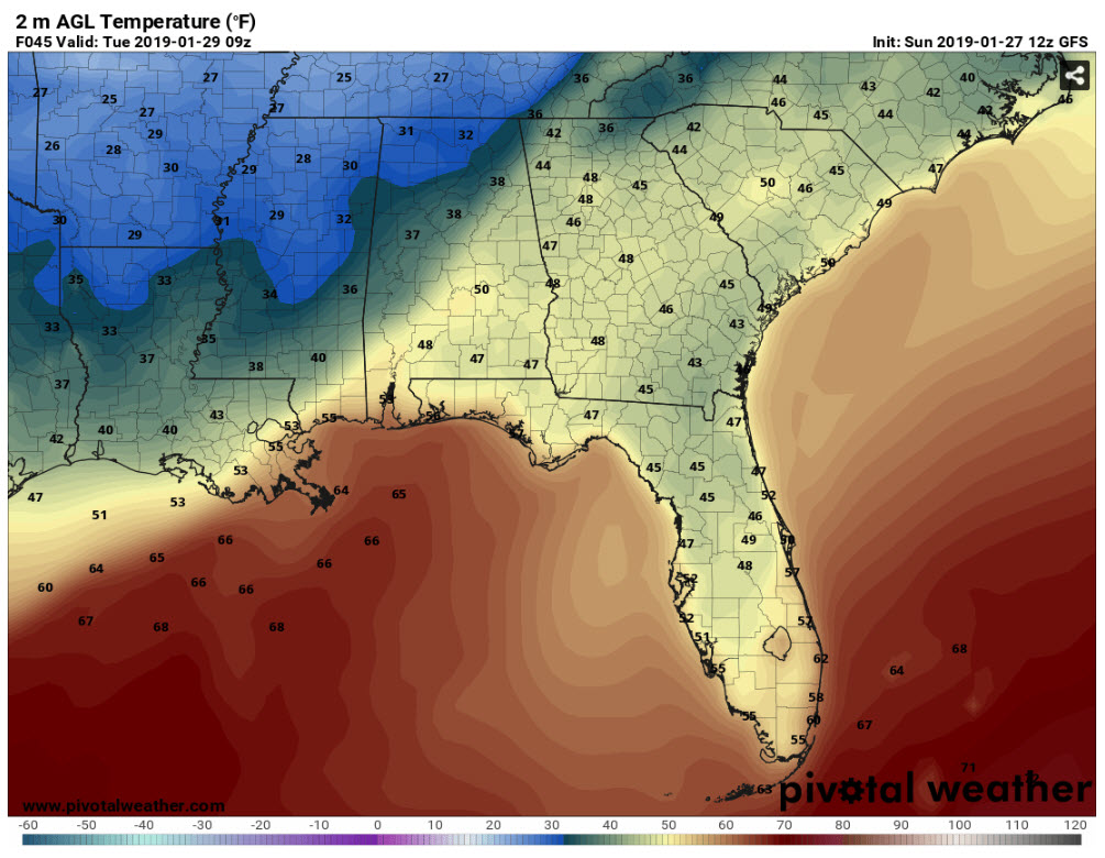
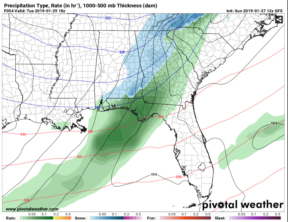
By 6 a.m., snowfall could be fairly widespread across much of North and Central Alabama.
And temperatures will be near freezing along I-59 by then. Bridges will begin to freeze and roads will start to become snowcovered.
The snow will quickly taper off from west to east during the late morning.
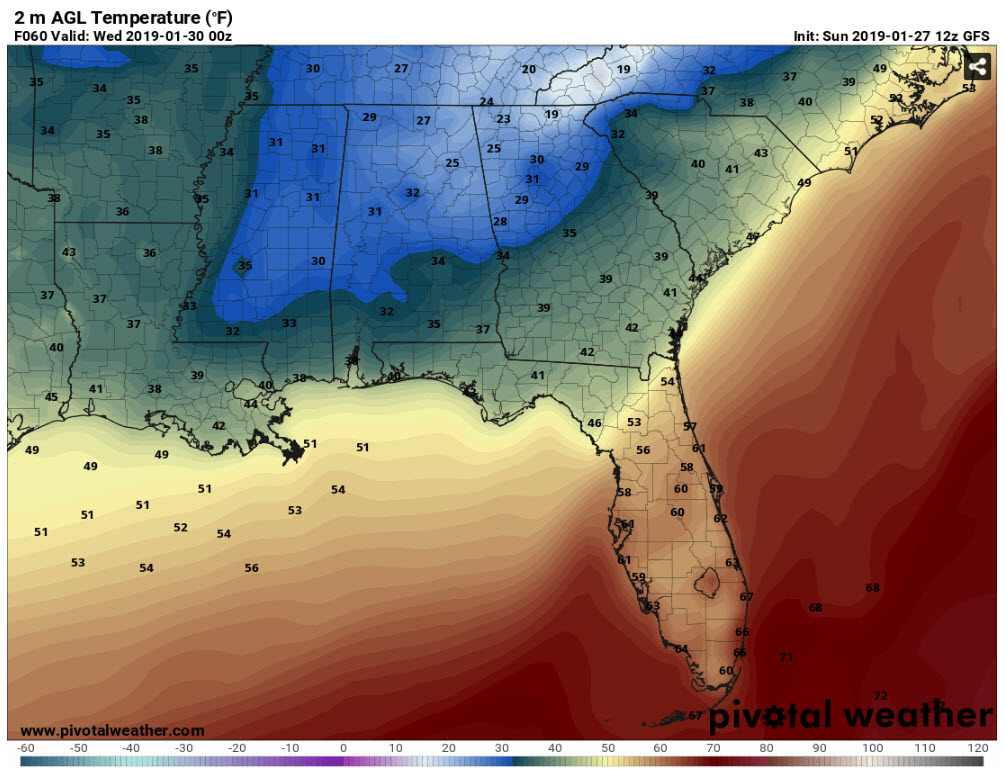
The GFS hints at some slight warming over West Alabama but keeps temperatures below freezing over the northeastern quarter of the state from Birmingham northeast. I frankly think that readings will probably stay below freezing in places like Tuscaloosa, Birmingham, Anniston, and Gadsden, as well as points to the north.
There are still differences between the models as to exactly where the heaviest snow may fall. It will be impossible to predict until we see where the heaviest areas of snow are setting up early Tuesday.
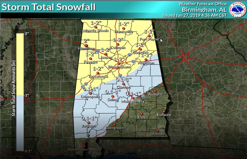
But for now, it appears that 1-2 inches of snow may fall as far south as Sumter, Greene, northern Hale, Bibb, Shelby, northern Talladega, Calhoun and Cleburne Counties. 1/2 to 1 inch may fall as far south as Evergreen, Montgomery, and Auburn.
Here is the expected snowfall map from the NWS Birmingham:
By nightfall, temperatures will be below freezing over the northern two-thirds of the area and roads will quickly become sheets of ice. The ground is saturated from recent abundant rainfall, and there will be significant runoff from hillsides onto streets, which will freeze. Travel will become impossible as wet roads freeze, even in places where snowfall is not as heavy.
It will be very cold Tuesday night, with lows dropping into the teens and lower 20s across North and Central Alabama.
So, a significant snowfall is in store for parts of North and Central Alabama. Hazardous roads will be the impact for Tuesday, Tuesday night and Wednesday. Hopefully, some melting will occur on Wednesday as the sun comes out and temperatures warm to the upper 30s. But roads could refreeze Wednesday night and more significant travel issues could occur. Readings Wednesday night will again fall into the teens and upper 20s.
It may be Thursday before we thaw out enough to get back to safe driving across the area.
Winter storm watches may be issued this afternoon for parts of Alabama. We will have frequest updates throughout the event here on the blog.
Category: Alabama's Weather, ALL POSTS
About the Author (Author Profile)
Bill Murray is the President of The Weather Factory. He is the site's official weather historian and a weekend forecaster. He also anchors the site's severe weather coverage. Bill Murray is the proud holder of National Weather Association Digital Seal #0001 @wxhistorianSubscribe
If you enjoyed this article, subscribe to receive more just like it.


