Here Comes the Front
The initial cold front is located near Memphis this evening, with the arctic front following closely on its heels.
Rain has now entered northwest Alabama and extends back through northern Mississippi, western Tennessee, northern Louisiana, and southern Arkansas.
The rain will be changing to snow as the colder air infiltrates the region tonight.
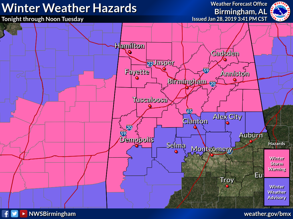
Forecasts are still on track for 2-3 inches of snow across the winter storm warning area, including Jasper, Fayette, Cullman, Tuscaloosa, Birmingham, Gadsden, and Anniston. 1-2 inches of snow will fall on either side of the heaviest band, including places like Demopolis, Clanton and Hamilton.
A dusting to 1 inch will fall as far south as Montgomery and Selma.
Rain should begin changing to snow after midnight over Northwest Alabama with the rain/snow line sliding southeastward during the pre-dawn hours, reaching I-59 around 4-5 a.m.
Category: Alabama's Weather, ALL POSTS, Winter Weather
About the Author (Author Profile)
Bill Murray is the President of The Weather Factory. He is the site's official weather historian and a weekend forecaster. He also anchors the site's severe weather coverage. Bill Murray is the proud holder of National Weather Association Digital Seal #0001 @wxhistorianSubscribe
If you enjoyed this article, subscribe to receive more just like it.


