Rain & Snow Continuing In The East, Already Drying Out In The West
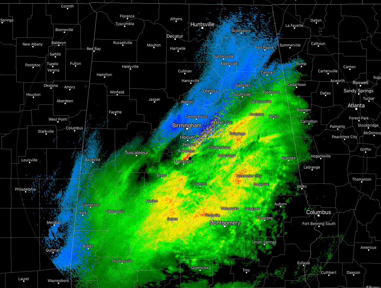
We continue to have snow falling on the north and western parts of the precipitation shield that is moving through North and Central Alabama right before the 6:00 am hour. Snow has already ended for Hamilton, Haleyville, Fayette, and Jasper. The good news is that there have been no reports of icing or snow accumulations on roadways to cause any travel issues. It appears at this time that the temperatures are not dropping below freezing until after the snow comes to an end.
Temperatures across the area are in the upper 20s to the upper 40s across Central Alabama from the northwest to the southeast. Haleyville is at 27 degrees, Birmingham is at 34 degrees, and Eufaula is at 49 degrees.
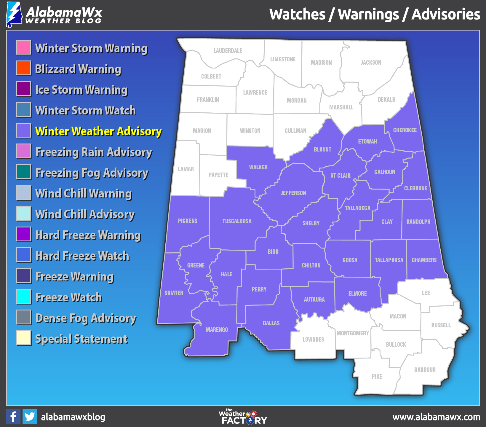
A Winter Weather Advisory continues in effect for much of Central Alabama until 12:00 pm today. There is the potential for some accumulations of up to 1 inch in the advisory locations. All precipitation should be out of the area prior to noon.
Skies will begin to clear and we’ll have sun across much of the area by noon and temperatures will eventually make it up into the mid-30s to the mid-40s across the area from northwest to southeast. The good news is that with the warmer surface temperatures grouped with the above freezing temperatures this afternoon and the wind, much of the moisture out on the roadways and bridges should evaporate. However, what remains after we lose the sunshine after sunset could quickly become ice as temperatures will quickly retreat below freezing and drop into the lower to mid-20s across the area from north to south.
We’ll continue to have updates through the morning. Keep checking back often.
Category: Alabama's Weather, ALL POSTS, Winter Weather
About the Author (Author Profile)
Scott Martin is an operational meteorologist, professional graphic artist, musician, husband, and father. Not only is Scott a member of the National Weather Association, but he is also the Central Alabama Chapter of the NWA president. Scott is also the co-founder of Racecast Weather, which provides forecasts for many racing series across the USA. He also supplies forecasts for the BassMaster Elite Series events including the BassMaster Classic.Subscribe
If you enjoyed this article, subscribe to receive more just like it.


