Showers Moving Out At Midday; More Possible Later Today
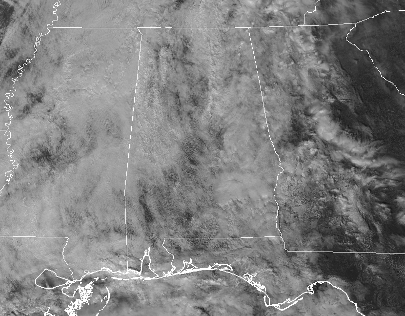
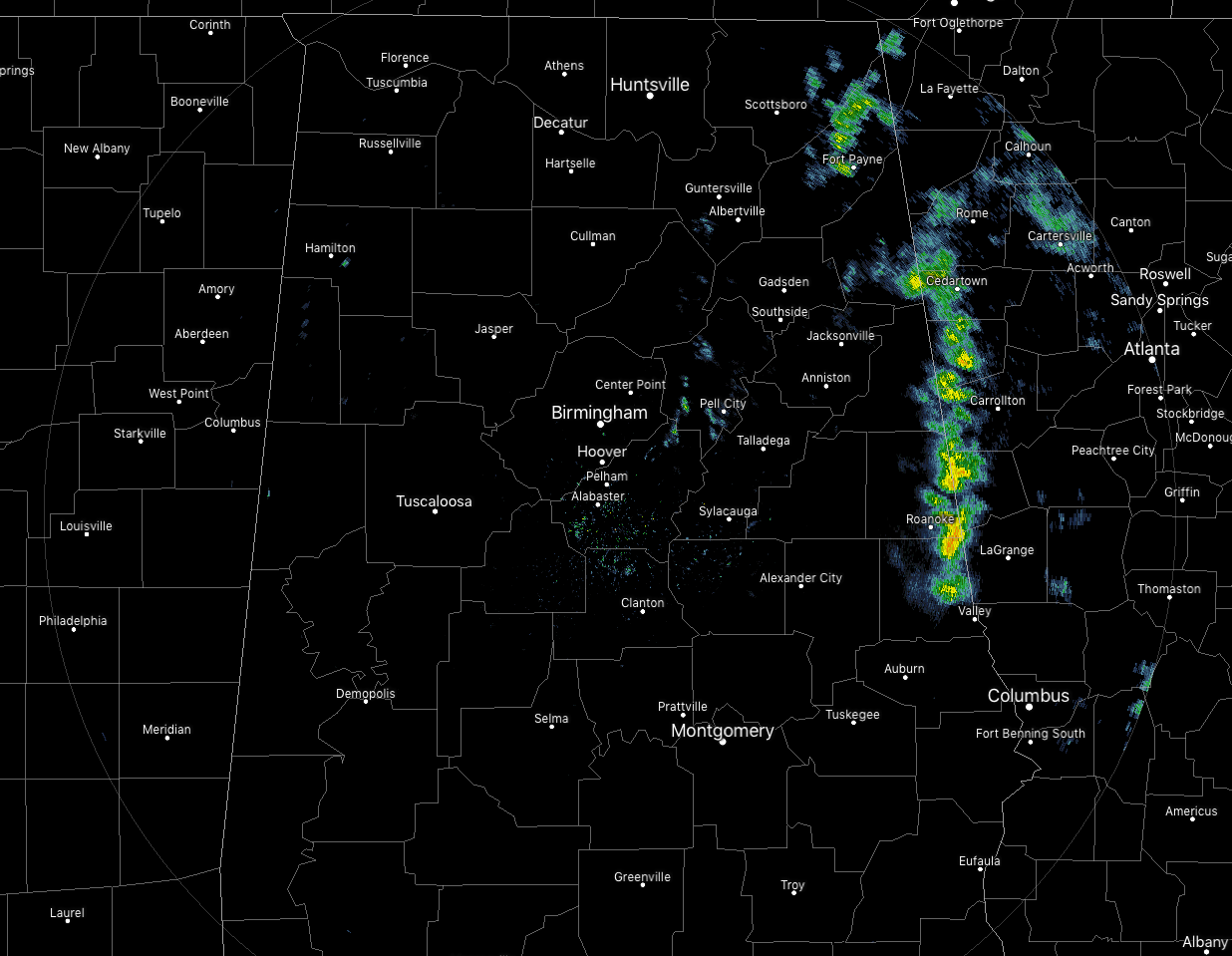
We have some shower activity moving out of North and Central Alabama and into the west and northwestern parts of Georgia, with a few light showers and drizzle behind those over the east-central parts of the area. There are a few breaks in the cloud cover over North and Central Alabama allowing for some rays to reach the surface, but skies are mostly cloudy for the most part. Temperatures as of 12:20 pm are in the upper 50s to the mid-60s across Central Alabama, with Birmingham sitting at 61 degrees. The warm spot is Eufaula at 66 degrees while the cool spot is Gadsden at 57 degrees.
WEATHER FOR THE REST OF YOUR MONDAY
We’ll continue to have mostly cloudy skies across Central Alabama with a few passing showers moving across. The latest high-resolution models continue to show scattered showers forming and moving across mainly the northern half of the area (north of a line from Aliceville to Alabaster to Wedowee), but the potential is there for a few to move across the southern portions of the area. Afternoon highs will top out in the mid-60s to the lower 70s. The potential for passing scattered showers continue for the late night and through the overnight hours with lows dropping into the mid-50s to the lower 60s.
MUCH OF THE SAME FOR TUESDAY
Nearly a “wash and repeat” forecast as we’ll continue to have mainly cloudy skies with a very small chance of a few isolated to scattered light showers or sprinkles throughout the entire day. Afternoon highs will be in the lower to mid-70s across the area. A nice day to sit outside and get some warm fresh air while recovering from the flu when there are no raindrops falling. Rain chances decrease somewhat for Tuesday night and through the overnight hours, but a very small chance of an isolated shower or two remains possible. Lows will be in the lower to mid-60s.
ON THIS DAY IN WEATHER HISTORY
2004 – 7.15 inches of rain deluges Pinson, AL, setting an all-time record rainfall over 24 hours for the town.
BEACH FORECAST CENTER
Get the latest weather and rip current forecasts for the beaches from Fort Morgan to Panama City on our Beach Forecast Center page. There, you can select the forecast of the region that you are interested in.
ALREADY OFF TO A HOT START IN 2019! ADVERTISE WITH THE BLOG!
We have enjoyed over 2.4 MILLION page views on AlabamaWx.com so far in 2019! Don’t miss out! We can customize a creative, flexible and affordable package that will suit your organization’s needs. Contact Bill Murray at (205) 687-0782.
E-FORECAST
Get the Alabama Wx Weather Blog’s Seven-Day Forecast delivered directly to your inbox by email twice daily. It is the most detailed weather forecast available in Central Alabama. Subscribe here… It’s free!
CONNECT WITH THE BLOG ON SOCIAL MEDIA
You can find the AlabamaWx Weather Blog on the major social media networks:
Facebook
Twitter
WEATHERBRAINS
Don’t forget you can listen to our weekly 90 minute netcast anytime on the web at WeatherBrains.com or on iTunes, Stitcher, or Spotify. This is the show all about weather featuring many familiar voices, including the meteorologists at ABC 33/40.
Category: Alabama's Weather, ALL POSTS
About the Author (Author Profile)
Scott Martin is an operational meteorologist, professional graphic artist, musician, husband, and father. Not only is Scott a member of the National Weather Association, but he is also the Central Alabama Chapter of the NWA president. Scott is also the co-founder of Racecast Weather, which provides forecasts for many racing series across the USA. He also supplies forecasts for the BassMaster Elite Series events including the BassMaster Classic.Subscribe
If you enjoyed this article, subscribe to receive more just like it.


