

Breezy But Already Quite Warm Out There At Midday
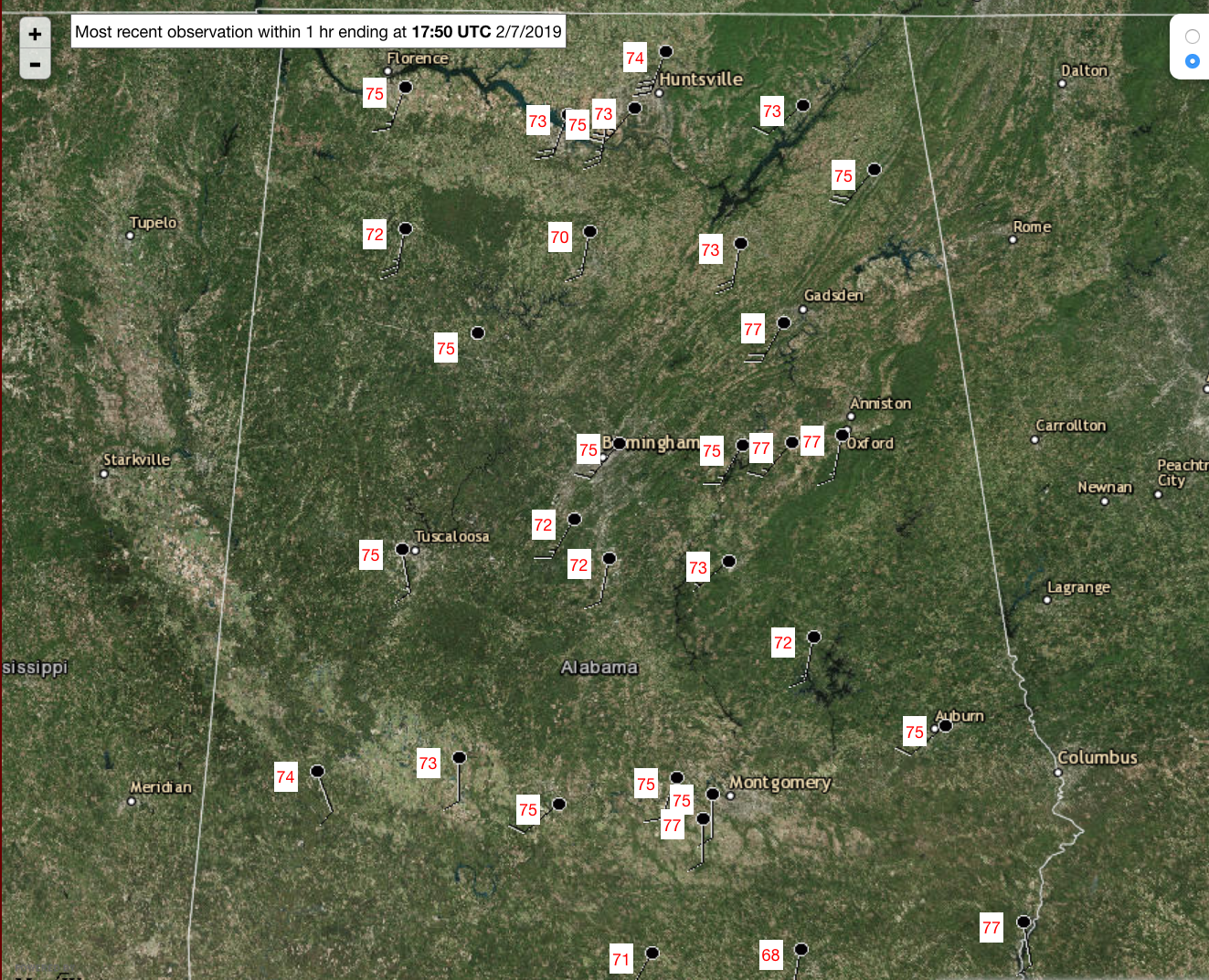
CONDITIONS AT 11:50 AM
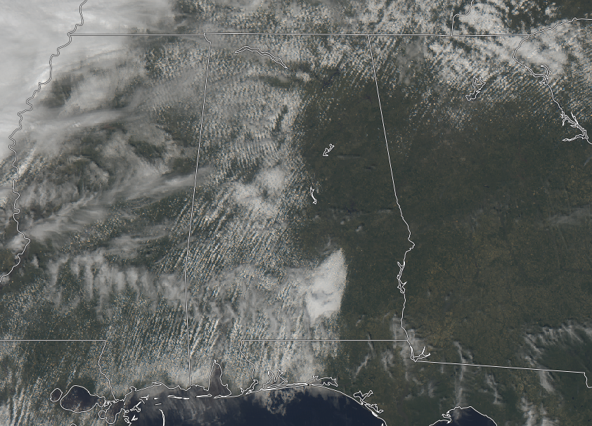
While much of the western half of Central Alabama has a mix of sun and clouds as we are approaching the noon hour, much of the eastern half of the area has sunny skies. No rain in the area at the moment and should stay that way until we start to cross into the early evening hours. Temperatures are quite mild at this point, ranging from the upper 60s to the upper 70s already. Birmingham is already near record-tying warmth at 75 degrees, while several locations are tied at 77 degrees as the warm spots. The only location in the 60s is Troy at 68 degrees.
WEATHER FOR THE REST OF YOUR THURSDAY
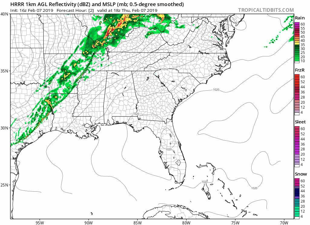
While we’ll have some clouds to deal with through the remainder of the afternoon hours, the latest HRRR model run shows that an unorganized line of showers will begin to enter the northwestern parts of the state around 4-5 pm and progressing through the area for the remainder of your evening and into the late night hours. The above-simulated radar simulations show that the line will become a little better organized as it reaches the central parts of the area around 7-8 pm when approaching the city of Birmingham. After that, the line will start to lose its organization and rainfall will begin to diminish, with not much left out there at midnight. With a tightening pressure gradient as the cold front moves closer to the area, winds will be a little breezy today out of the south-southwest at 10-15 MPH with a few gusts possibly reaching 25 MPH. The good news is that rainfall will not last all that long with this line of showers and no thunder or severe weather is expected. With the strong flow out of the south, afternoon highs will be up at or near record-breaking territory in the upper 70s to the lower 80s. Looks like I’ll be bringing the Donna Reed animated GIF back out this evening as I’ll most likely be posting broken high-temperature records. Here is a list of record highs that are in jeopardy…
Birmingham
Forecasted high: 79 degrees
Previous record: 76 degrees (1999 & 1957)
Anniston
Forecasted high: 79 degrees
Previous record: 78 degrees (1957)
Montgomery
Forecasted high: 81 degrees
Previous record: 81 degrees (1957)
Tuscaloosa
Forecasted high: 80 degrees
Previous record: 79 degrees (1999)
The cold front will move through beginning later tonight and through the overnight hours with temperatures quickly dropping into the lower 30s to the mid-50s across the area from northwest to southeast. As mentioned earlier, rainfall will begin to diminish as the line moves through the east-central and eastern parts of the area. Rain chances are highest in the northwest, at 80%, and drop as you move southeastward, ending up around 50% in the southeastern parts of the area (south of I-85).
MUCH COOLER ON FRIDAY
After the passage of the cold front during the late night and overnight hours, you’ll feel like Mother Nature is playing a cruel trick on you. After record-breaking warmth today, we’ll be back in the refrigerator on Friday. We’ll be dry with decreasing clouds throughout the day with afternoon highs only reaching the mid-40s to the lower 60 across the area from northwest to southeast. We’ll continue to have some clouds for Friday evening and through the overnight hours with lows down into the upper 20s to the mid-30s.
ON THIS DAY IN WEATHER HISTORY
1861 – The temperature at Gouverneur, NY, bottomed out at -40 degrees, a drop of 70 degrees in one day. Two days later the mercury hit 55 degrees.
Category: Alabama's Weather, ALL POSTS
About the Author (Author Profile)
Scott Martin is an operational meteorologist, professional graphic artist, musician, husband, and father. Not only is Scott a member of the National Weather Association, but he is also the Central Alabama Chapter of the NWA president. Scott is also the co-founder of Racecast Weather, which provides forecasts for many racing series across the USA. He also supplies forecasts for the BassMaster Elite Series events including the BassMaster Classic.Subscribe
If you enjoyed this article, subscribe to receive more just like it.


