Here Comes the Wedge
High pressure centered over the Mid-Atlantic states is doing what East Coast highs often do, it is sending easterly winds down the lee of the Appalachian Mountains.
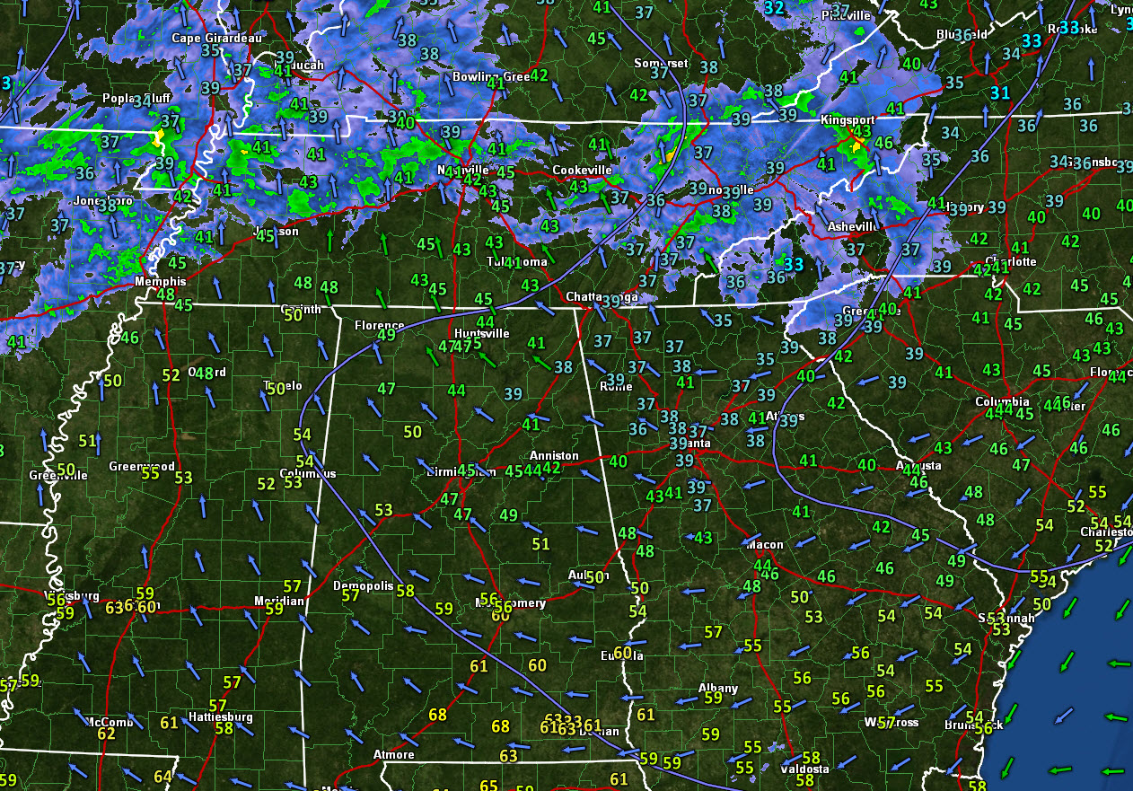
Those winds are driving cool, drier air across Georgia and into eastern Alabama.
Temperatures at Anniston have fallen from 46F to 41F, and have rebounded slightly to 42F. At Fort Payne, the mercury has dropped from 42F to 38F. Al Albertville, they have dropped from 43F to 39F.
They are now dropping at Birmingham. The temperature has fallen to 45F at the Airport.
At Atlanta, it is 39F. At Griffin GA it is 36F.
Ahead of the wedge, it is 53F at Tuscaloosa and 54F at Columbus, MS.
So, the wedge will continue oozing westward for some distance this afternoon, wrecking hopes of afternoon highs in the 50s for folks along and east of I-65.
A few showers will show up this afternoon adding to the slightly miserable conditions.
Rain could become fairly widespread tonight across Central Alabama, with lows staying pretty steady where they are in east and dropping into the middle 40s in the west.
Showers will be possible on Monday, with rain becoming likely Monday night. Rain and thunderstorms will move across the state late Monday night and Tuesday morning ahead of a cold front.
There is a small risk of damaging winds and an isolated tornado with this activity.
Clearing will come Tuesday with fair weather for midweek, and more showers by late Thursday and heavier rain Thursday night into Friday.
Category: Alabama's Weather, ALL POSTS
About the Author (Author Profile)
Bill Murray is the President of The Weather Factory. He is the site's official weather historian and a weekend forecaster. He also anchors the site's severe weather coverage. Bill Murray is the proud holder of National Weather Association Digital Seal #0001 @wxhistorianSubscribe
If you enjoyed this article, subscribe to receive more just like it.


