

Marginal Severe Weather Threat Continues Through Early Afternoon

AT 8:15 AM: The stronger part of the squall line is now beginning to approach or has already made it to some of the larger cities in Central Alabama. By the time this post is out, the gusty winds will be moving into the Birmingham Metropolitan Area. So far, we have had no severe weather warnings and the latest from the Storm Prediction Center states that a watch is unlikely as the threat for organized severe weather is not likely.
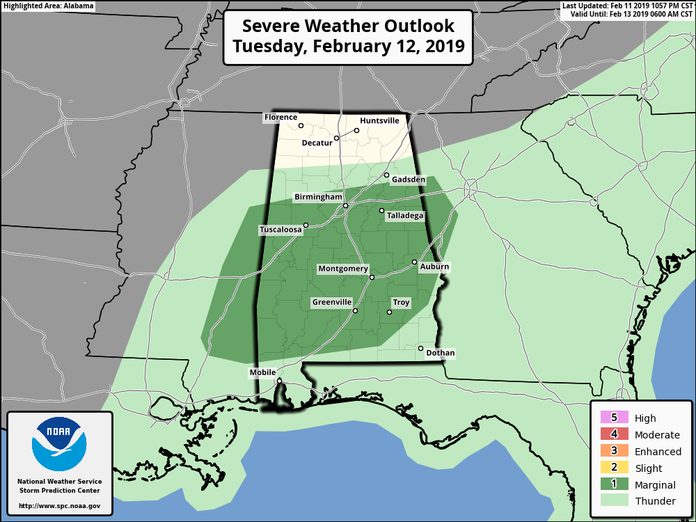
However, SPC continues to have a good bit of Central Alabama defined in a Marginal Risk of severe weather throughout the remainder of the morning and into the early afternoon hours. The potential for stronger to marginally severe storms will be along and south of a line from Demopolis to Clanton to Alexander, while the threat will be much less north of that up to Tuscaloosa to Birmingham to Gadsden.
The main threat will be from isolated damaging wind gusts, but a brief spin-up tornado can’t be ruled out. We will have some limiting factors in place as there is a good bit of moisture ahead of the line of storms along with clouds that will keep the effects of daytime heating lower. Instability values should remain very low, but we do have strong low-level shear in place. The window for stronger to marginally severe storms will be from around 9:00 am to 2:00 pm.
We’ll keep you posted throughout the day on the blog if there are any changes or if any watches or warnings are posted.
Category: Alabama's Weather, ALL POSTS, Severe Weather
About the Author (Author Profile)
Scott Martin is an operational meteorologist, professional graphic artist, musician, husband, and father. Not only is Scott a member of the National Weather Association, but he is also the Central Alabama Chapter of the NWA president. Scott is also the co-founder of Racecast Weather, which provides forecasts for many racing series across the USA. He also supplies forecasts for the BassMaster Elite Series events including the BassMaster Classic.Subscribe
If you enjoyed this article, subscribe to receive more just like it.


